Key Takeaways
- It’s an hour from Vernal and easy to add to any trip. Flaming Gorge sits just north up US-191 through Ashley National Forest — close enough for a day trip, big enough to hold you for a weekend.
- The fishing is genuinely world-class. The reservoir has produced record-class lake trout and enormous brown trout, and the Green River tailwater below the dam is one of the most celebrated fly-fishing stretches in the country.
- The scenery rivals Utah’s famous parks. Powell named it “Flaming Gorge” for a reason — red sandstone cliffs drop straight into deep blue-green water, and the overlooks are the equal of far more crowded destinations.
- It’s a four-season place with a strong summer peak. Summer is for boating and swimming; fall brings color and quiet; winter and early spring are for ice fishing and solitude, with some facilities and roads seasonally limited.
- Verify the details that change. Fees, fishing limits, marina hours, boat rentals, and campground availability all shift year to year — this guide flags what to confirm with official sources before you go.
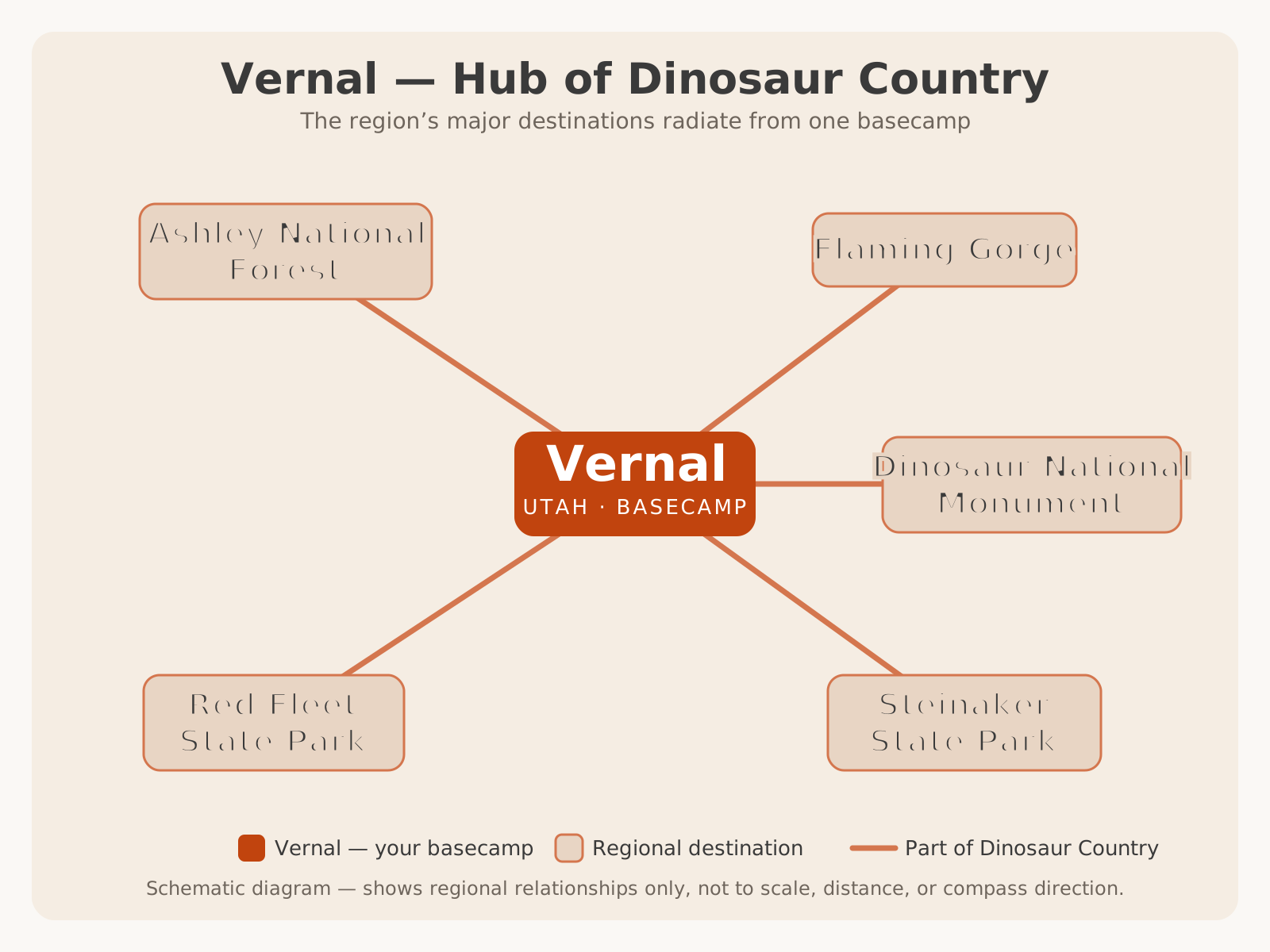
It helps to picture where Flaming Gorge sits before diving into the details. It is the farthest of the five destinations that radiate from Vernal — the basecamp town roughly an hour south — which is why most visitors fold it into a wider Dinosaur Country trip rather than treating it as a standalone stop.
Why Visit Flaming Gorge
Most people who make it to Vernal for the dinosaurs have no idea that one of the West’s most spectacular reservoirs sits an hour up the road. Flaming Gorge is the kind of place that would be swarmed if it were within an hour of a big city — instead, it’s tucked into the far northeast corner of Utah, spilling over into Wyoming, quietly holding some of the best fishing, boating, and canyon scenery in the region.
The pitch is simple. You get red-rock canyon walls that light up at sunrise and sunset, deep blue-green water that stretches for miles, trophy fishing that draws anglers from across the country, and a network of scenic drives and overlooks that deliver postcard views without the entrance-gate lines. It’s big enough to feel like a real adventure and compact enough that a family can see the highlights in a single day. And because it’s managed as a national recreation area rather than a national park, it’s built for active use — boats, fishing rods, campfires, and paddleboards — rather than for looking at from behind a fence.
For travelers already planning a Dinosaur Country trip, Flaming Gorge is the natural third act: fossils at Dinosaur National Monument to the east, backcountry adventure and things to do around Vernal, and big water and big scenery to the north. Few regions pack this much variety into an hour’s radius.
History and Geology
Flaming Gorge got its name in 1869, when the explorer John Wesley Powell led his first expedition down the Green River. As his boats approached the mouth of a deep red canyon, the sandstone cliffs glowed so intensely in the sun that Powell recorded the name “Flaming Gorge” — a description that still fits the moment the light hits the rock at either end of the day. The red comes from iron-rich sandstone laid down over hundreds of millions of years, then lifted and tilted by the same forces that built the Uinta Mountains, one of the few major ranges in North America that runs east–west.
The reservoir itself is far younger than the canyon. In 1964, the Bureau of Reclamation completed Flaming Gorge Dam across the Green River, part of the larger Colorado River Storage Project that reshaped water and power across the interior West. The dam stands more than 500 feet tall (VERIFY WITH OFFICIAL SOURCE for the exact height and construction figures) and backs the Green River up into a reservoir roughly 91 miles long, drowning the lower canyons and creating the recreation area visitors know today. The small town of Dutch John, Utah was built to house dam workers and remains the closest community to the dam.
The geology is worth understanding because it shapes the whole experience. The southern, Utah end near the dam is classic red-rock canyon country — steep, dramatic, and deep. As you move north toward Manila and into Wyoming, the walls open into broader high-desert bays and gentler shoreline. That’s why the north end suits big open-water boating while the southern canyons feel more intimate and sheltered. Human history in the area runs deeper still: the surrounding country holds evidence of long Indigenous presence, and the nearby Fremont and Ute rock art around Vernal is part of the same cultural landscape.
Reservoir Overview
Flaming Gorge Reservoir is the centerpiece, and its shape defines how you use it. Running roughly 91 miles from the dam in Utah north into Wyoming, it winds through deep canyon in the south and opens into wide bays in the north, giving it two distinct characters in one body of water.
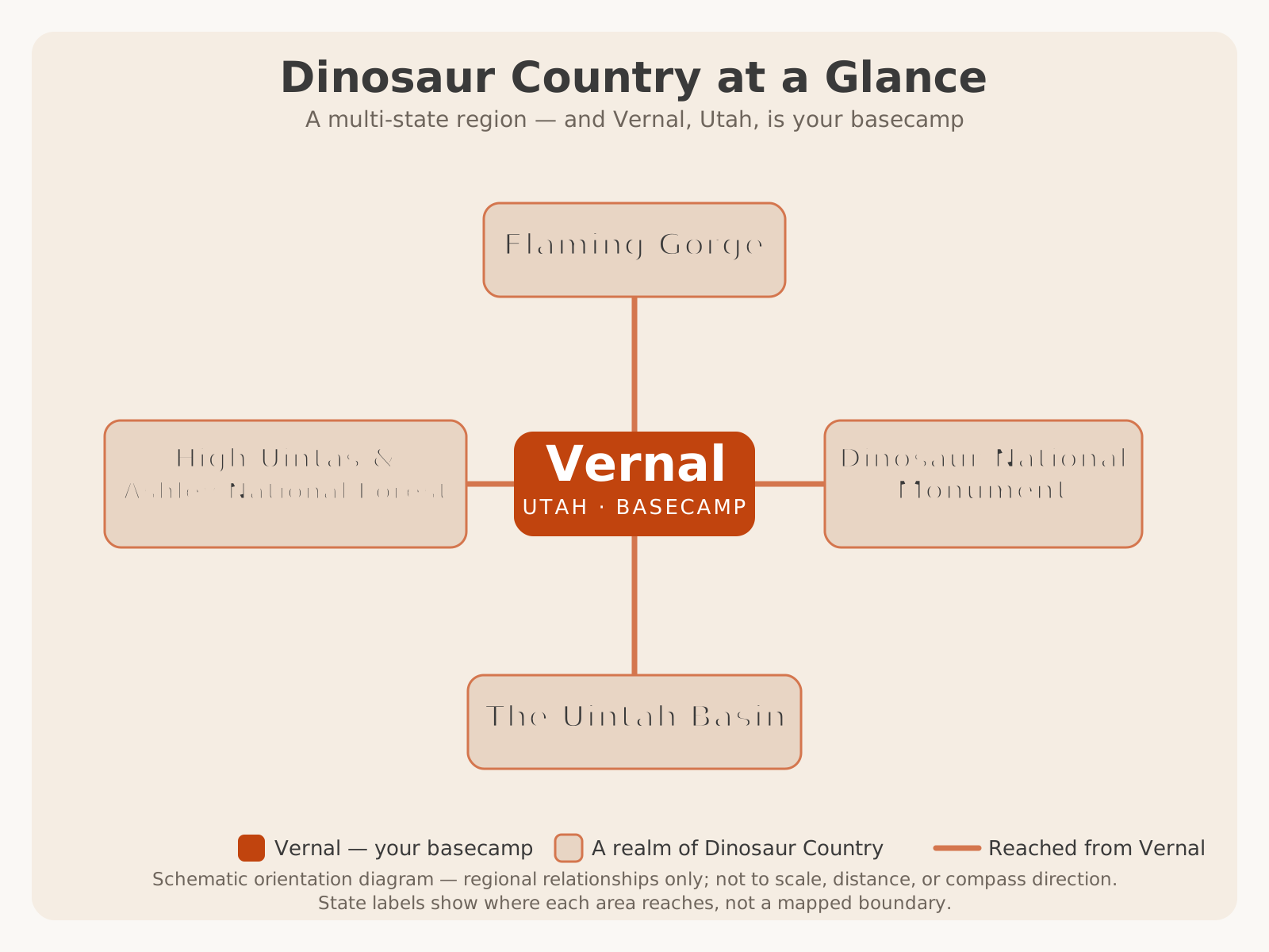
That two-state reach is part of a bigger pattern. Flaming Gorge is one realm of a Dinosaur Country region that crosses state lines — much as the monument does to the east — and the whole of it is reachable from Vernal, the basecamp town an hour to the south.
The reservoir is administered by the USDA Forest Service as part of Ashley National Forest, and because it crosses a state line, both Utah and Wyoming manage recreation and fishing on it under a reciprocal arrangement. Two main gateway communities frame it: Manila, Utah, a small town on the northwest side near the Sheep Creek area, and Dutch John, Utah, near the dam on the southeast side. On the Wyoming end, the reservoir is served from the Green River and Rock Springs area.
| Feature | Detail |
|---|---|
| Managing agency | USDA Forest Service — Ashley National Forest |
| Location | Utah–Wyoming border, northeast Utah |
| Approx. reservoir length | ~91 miles |
| Created by | Flaming Gorge Dam (completed 1964) |
| River | Green River |
| Gateway towns | Manila, UT (north) · Dutch John, UT (south) |
| Drive from Vernal | Approx. 1 hour north via US-191 |
Scenic Viewpoints
The overlooks are where Flaming Gorge earns its name, and several are reachable with only a short walk from a parking area — which makes them the easiest high-reward stops for families, photographers, and anyone short on time.
- Red Canyon Overlook. The signature view: sheer red cliffs plunging more than a thousand feet to the blue-green water below. It’s near the Red Canyon Visitor Center off UT-44 and is the single most photographed spot in the recreation area. VERIFY WITH OFFICIAL SOURCE for the exact cliff height and current visitor-center hours.
- Sheep Creek Overlook & the Sheep Creek Geological Loop. A side road (the Sheep Creek Bay area) climbs through dramatically folded and upturned rock layers — one of the best places to actually see the tilting of the Uinta uplift. The loop is a scenic drive in its own right and is typically a seasonal road.
- Dowd Mountain Overlook. A high, sweeping panorama over the western arm of the reservoir, usually quieter than Red Canyon.
- Flaming Gorge Dam Overlook. Views down onto the dam and the start of the Green River tailwater, with the visitor center nearby.
Best Recreation Areas
Flaming Gorge is really a collection of distinct areas, each with its own access points, ramps, and services. Knowing which is which saves a lot of driving.
- Red Canyon (Utah, south). The scenic heart near the dam — overlooks, the visitor center, trails along the rim, and some of the most dramatic canyon shoreline.
- Cedar Springs (Utah, near the dam). A marina area close to Dutch John and the dam, convenient for boat access to the southern canyon water. VERIFY WITH OFFICIAL SOURCE for current marina services and boat rentals.
- Lucerne Valley (Utah, near Manila). A large recreation and marina area on the northwest side, with open-water access, camping, and a boat ramp. Popular with families and larger boats. VERIFY WITH OFFICIAL SOURCE for services.
- Sheep Creek Bay & the Geological Loop (Utah). Scenic driving, geology, and quieter shoreline west of Manila.
- Dutch John & the Green River below the dam (Utah). The base for tailwater fly fishing and float trips downstream toward Little Hole.
- Buckboard & the Wyoming end. Open high-desert bays and big-water boating on the northern reaches.
| Area | Side | Best for |
|---|---|---|
| Red Canyon | Utah, south | Overlooks, scenery, rim trails |
| Cedar Springs | Utah, near dam | Boat access to southern canyon |
| Lucerne Valley | Utah, near Manila | Open-water boating, family camping |
| Sheep Creek | Utah, west of Manila | Geology, scenic driving, quiet shore |
| Dutch John / Green River | Utah, below dam | Fly fishing, float trips |
| Buckboard | Wyoming, north | Big open-water boating |
Boating
Flaming Gorge is a boater’s reservoir. The sheer size means there’s room for everything from bass boats and pontoons to kayaks and paddleboards, and the two-part geography lets you match the water to your craft: sheltered southern canyons for smaller boats and paddlers, wide northern bays for bigger boats that can handle open water and wind.
Boat ramps and marinas are concentrated at Cedar Springs and Lucerne Valley on the Utah side and Buckboard on the Wyoming side. Some marinas historically offer boat rentals, fuel, slips, and supplies, but services, rental fleets, and hours change — VERIFY WITH OFFICIAL SOURCE (the specific marina) before counting on a rental or a fuel stop.
A few practical realities to plan around:
- Wind. The open northern water can build a serious chop in the afternoon. Morning is usually calmer — a good reason to launch early.
- Distances are real. With 91 miles of water, it’s easy to travel farther than you realize. Watch fuel and daylight.
- Invasive-species inspection. Reservoirs across the West require boat inspection and decontamination to stop quagga mussels and other invasives. Expect to be checked, and clean, drain, and dry your boat between waters. VERIFY WITH OFFICIAL SOURCE for current inspection requirements and any fees.
- Life jackets and cold water. Even in summer, water below the surface stays cold. Wear life jackets, especially with children aboard.
Fishing Overview
Fishing is what puts Flaming Gorge on the national map — it’s the flagship water in our overview of fishing across Dinosaur Country. The reservoir is famous for its lake trout (mackinaw), which grow to enormous sizes here and have produced record-class fish, and for trophy brown trout — Flaming Gorge has a long-standing reputation for giant browns. Anglers also target rainbow trout, kokanee salmon, and smallmouth bass, giving the reservoir genuine variety across seasons and techniques.
Below the dam, the Green River tailwater is a separate world: a cold, clear, blue-ribbon fly-fishing stretch that’s regularly ranked among the best trout rivers in the United States. The classic experience is a float trip from just below the dam down through Little Hole, casting to wild rainbows and browns in gin-clear water. Guided float trips and wade fishing are both popular, and the river fishes well much of the year.
Because the reservoir straddles two states, licensing is unusual: Utah and Wyoming maintain a reciprocal arrangement so a license from either state generally covers the reservoir water — but the specifics, along with limits and regulations, differ from the Green River below the dam and change over time.
For a broad-strokes idea of what’s caught where:
| Species | Where | Notes |
|---|---|---|
| Lake trout (mackinaw) | Reservoir, deeper water | Grows very large; record-class fish caught here |
| Brown trout | Reservoir & river | Trophy reputation; big fish possible |
| Rainbow trout | Reservoir & Green River | Backbone of the tailwater fly fishery |
| Kokanee salmon | Reservoir | Seasonal; special regulations often apply |
| Smallmouth bass | Reservoir, rocky shoreline | Fun warm-season action |
Camping Overview
Flaming Gorge has a wide range of camping, from developed Forest Service campgrounds with amenities to primitive and dispersed sites in the surrounding Ashley National Forest, plus lodging in Dutch John and Manila for those who’d rather not sleep outside. Campgrounds are clustered near the recreation areas — around Red Canyon, Lucerne Valley, the dam, and along the scenic byways — so you can usually camp close to whatever you came to do.
Because campground availability, reservation windows, fees, seasons, and amenities change every year, this guide won’t publish a site-by-site list that could go stale. Instead:
- Many developed campgrounds take reservations and fill on summer weekends — book ahead for peak season.
- Some sites are first-come, first-served, which can work midweek or in shoulder season.
- Dispersed camping is possible in parts of Ashley National Forest under Forest Service rules, but comes with no services and its own regulations.
- Higher-elevation campgrounds have short seasons and may not open until late spring or may close early in fall.
Hiking Overview
Hiking isn’t the headline at Flaming Gorge the way fishing and boating are, but there’s a solid range of trails, and several deliver big scenery for modest effort. Options run from short rim walks at the overlooks to longer routes down into the canyon and along the Green River.
- Red Canyon Rim trails. Relatively flat walking along the canyon edge near the visitor center, with continuous overlook views — the best payoff-per-effort hiking in the area and family-friendly.
- Little Hole National Recreation Trail. Follows the Green River below the dam through prime fly-fishing water — popular with anglers and walkers alike, and gorgeous along the river.
- Canyon Rim Trail. Connects points along the Red Canyon rim.
- Backcountry and forest trails. Longer, less-developed routes climb into the surrounding high country of Ashley National Forest, the mountain forest that administers Flaming Gorge.
Wildlife
The country around Flaming Gorge is genuinely rich with wildlife, and the mix of water, canyon, sagebrush, and forest supports a wide range of species. Along the scenic drives and quieter shoreline, keep an eye out for bighorn sheep on the rocky slopes, mule deer, elk, pronghorn on the open flats, and moose in the wetter drainages of the surrounding forest. Overhead, osprey and bald eagles hunt the reservoir, and the tailwater below the dam is a good place to see birds working the water.
Wildlife is most active — and most visible — at dawn and dusk, the same golden hours that make the cliffs glow. Drive slowly on the byways at those times both to spot animals and to avoid them on the road. Give every animal room; never approach or feed wildlife, and keep a safe distance from moose in particular, which can be unpredictable.
Photography Tips
Flaming Gorge is a photographer’s reservoir, and a little planning turns a good trip into a great portfolio.
- Chase the ends of the day. The red cliffs only “flame” in low, warm light. Red Canyon Overlook at sunrise or the late-afternoon light on the canyon walls is the classic shot; midday washes the color out.
- Bring range. A wide lens captures the canyon-and-water panoramas; a longer lens isolates cliff detail, distant boats, and wildlife without disturbing it.
- Use the water. Calm morning water gives you mirror reflections of the red walls — get to the overlooks or the shoreline before the wind picks up.
- Watch the weather for drama. Summer afternoon thunderstorms build spectacular skies, but they also bring lightning to exposed overlooks — get off high, open points when storms approach.
- Include scale. A boat, a kayak, or a person on the rim gives a sense of just how big the canyon walls really are.
Seasonal Advice
Flaming Gorge is a four-season destination, but each season is a different trip.
- Summer (peak). Warm, fully open, and the best time for boating, swimming, and water sports. It’s also the busiest — weekends around the ramps and campgrounds fill up. Expect hot afternoons and reliable thunderstorm risk.
- Fall. One of the best times to visit: cooler air, thinning crowds, fine fishing, and color in the surrounding forest. Higher-elevation facilities begin closing.
- Winter. Quiet and stark, with ice fishing on the reservoir when conditions allow and solitude everywhere. Some roads, campgrounds, and services are closed or limited, and mountain access can be snowbound.
- Spring. A transition season — the water is cold, the crowds are thin, and the fishing can be excellent, but higher facilities may not have opened yet and weather is changeable.
Family Tips
Flaming Gorge is an easy win with kids, in part because the best scenery requires so little effort. The overlooks near Red Canyon deliver enormous payoff for a short walk from the car, the swim beaches and sheltered bays give younger kids a place to splash, and a pontoon or a half-day of fishing turns the reservoir into a whole day of entertainment.
A few things that make family trips go smoothly:
- Life jackets, always. The water is cold below the surface and there are no lifeguards. Kids in life jackets, near the water or on a boat.
- Sun and water. High-desert sun is deceptive. Hats, sunscreen, and more water than you think you need.
- Keep back from the rim. The overlook drop-offs are real and mostly unfenced — hold little hands near the edge.
- Break the drive. The overlooks and the dam visitor center make natural stops that keep the hour-long drive from Vernal from wearing thin.
For a broader kid-focused plan built around Vernal, see fun things to do in Vernal with kids.
Accessibility Notes
Many of Flaming Gorge’s headline experiences are car-accessible or reachable by short, relatively level paths — the overlooks near Red Canyon, the dam overlook, and the scenic byways deliver much of the best scenery without a demanding hike. Visitor centers and developed recreation areas generally provide accessible parking and facilities, though provisions vary by site.
Boat ramps, backcountry trails, unpaved roads, and primitive campgrounds vary widely in surface and grade and are not uniformly accessible. Because specific accessibility services — accessible sites, fishing access, shuttle or dock provisions — change seasonally and by location, VERIFY WITH OFFICIAL SOURCE (Ashley National Forest and the individual visitor centers or marinas) for current accessibility provisions before a visit if you have specific needs.
Suggested One-Day Itinerary
A single day is enough to see why Flaming Gorge is special, especially if you’re basing out of Vernal. This route focuses on scenery and the dam rather than a full day on the water.
- Morning: Leave Vernal early and drive north on US-191 into Ashley National Forest, gaining elevation as you go. Stop at pullouts along the byway.
- Late morning: Red Canyon Overlook and the visitor center — the signature view, best before midday. Walk a stretch of the rim trail.
- Lunch: Picnic at Red Canyon or head into Manila or Dutch John for a bite.
- Afternoon: Drive the Sheep Creek Geological Loop (seasonal) for geology and quiet scenery, or visit Flaming Gorge Dam and its overlook and, if open, the visitor center.
- Late afternoon: Catch the low light back on the red cliffs before the drive home, watching for wildlife on the byway at dusk.
Suggested Weekend Itinerary
With two to three days you can add the water and a night under the stars.
- Day 1 — Scenery & orientation. Drive up from Vernal, hit the overlooks (Red Canyon, Dowd Mountain), tour the dam, and settle into a campground or lodging near Lucerne Valley or Dutch John. Sunset at an overlook.
- Day 2 — On the water. A full day boating, paddling, swimming, or fishing the reservoir — or book a guided fly-fishing float on the Green River below the dam through Little Hole. Evening campfire.
- Day 3 — Choose your finish. A rim or riverside hike (Little Hole trail), a slow scenic-drive morning, or a return south to fold in Dinosaur National Monument and the rest of a Vernal-based trip on the way home.
Planning Tips
A handful of things separate a smooth Flaming Gorge trip from a frustrating one:
- Fuel and supplies in Vernal or the gateway towns. Services thin out fast. Top off the tank and stock the cooler before you head up, and don’t count on a specific marina store being open — VERIFY WITH OFFICIAL SOURCE.
- Cell service is spotty. Download offline maps and tell someone your plan, especially if you’re boating or heading into the backcountry.
- Book ahead for summer. Campgrounds, boat rentals, and guided trips fill on peak weekends — reserve your anchor plans first, then build the trip around them.
- Respect the water. Cold below the surface, wind in the afternoon, and real distances. Life jackets on, launch early, and watch the weather.
- Clean, drain, dry. Follow invasive-species rules and expect inspection stations.
- Give it the right amount of time. A day for the scenery, a weekend for the water. Either way, pair it with the rest of a Vernal trip.
Flaming Gorge is one of those places that rewards the traveler who commits to the detour — an hour north of Vernal, up through the forest, to a canyon of flaming cliffs and deep water that most people driving through Utah never realize is there. Base out of Vernal, give it at least a full day, confirm the details that change, and you’ll come away understanding why locals have quietly guarded this corner of Dinosaur Country for generations. When you’re ready to round out the trip with a guided backcountry adventure closer to town, book a UTV tour with Adventure Tours Vernal and let a local show you the country behind the postcards.