Key Takeaways
- It’s the region’s high country — and its air conditioning. When the desert around Vernal bakes, the forest is thousands of feet higher and markedly cooler, with alpine lakes, meadows, and shade.
- It holds Utah’s tallest mountains. The Uintas are one of the few major ranges in the Lower 48 that run east–west, and Kings Peak (13,528 ft) — the state’s highest point — sits inside the forest’s High Uintas Wilderness.
- There’s a version for every ability. Drive-up lakes, easy nature walks, and developed campgrounds for families; long trails, remote basins, and Kings Peak for seasoned backcountry travelers.
- The season is short up high. The best high-country window is roughly July through September; snow closes much of the mountains the rest of the year, though it opens them for snow sports.
- Plan for altitude and weather. Thin air, fast-building afternoon thunderstorms, and long distances from services make preparation the difference between a great day and a dangerous one.
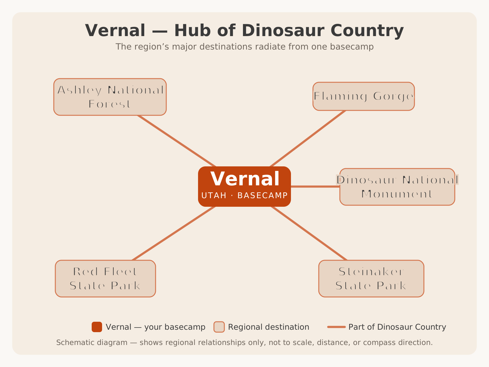
It helps to see where the forest sits in the region before the details. Ashley National Forest is the high-country side of a wheel that centers on Vernal — the basecamp at its foot — with the desert destinations spinning off in the other directions.
Why Visit Ashley National Forest
If Dinosaur National Monument is the region’s deep past and Flaming Gorge is its big water, Ashley National Forest is its high, green ceiling — the mountains you see on the northern horizon from almost anywhere in Vernal. It’s where the region goes to cool off, spread out, and get genuinely remote. On a hot July afternoon in the basin, you can drive an hour and be standing beside a cold alpine lake ringed by pines, with snow still tucked in the shadows of the peaks above.
The appeal is range. Ashley is enormous and varied, and it meets you at whatever level you want to engage. You can drive a paved scenic byway to an overlook and be back for dinner. You can pitch a tent at a developed campground beside a mountain reservoir and fish in the evening. Or you can shoulder a pack and walk for days into the High Uintas Wilderness, camping under some of the darkest skies in Utah and climbing the highest peak in the state. Few public lands offer that full spectrum — casual to expeditionary — inside a single forest.
For a Vernal-based trip, the forest is the natural counterweight to the desert. Spend your first days low — fossils, canyons, red rock, the reservoir — then go high for a day or two of cool air, water, and mountains. It’s the piece that makes the region feel complete, and it’s the reason locals never run out of country to explore. For the wider picture of how it all fits together, start with our Ultimate Guide to Vernal.
History and Naming
The forest carries the name of William Henry Ashley, a fur trader and explorer who pushed into this country in the 1820s and famously navigated part of the Green River — the same river that later filled Flaming Gorge. His name stuck to the mountains and, eventually, to the national forest established here in the early twentieth century (VERIFY WITH OFFICIAL SOURCE for the exact establishment year and the details of Ashley’s expeditions). The fur-trade era was the first chapter of Euro-American history in these mountains, but people had used this high country for far longer: Ute and earlier peoples traveled and hunted the Uintas for generations, following the same drainages and passes that hikers use today.
The Forest Service era brought the mission the land still serves — protecting the watershed, timber, and range while providing for recreation. Much of the highest country was given its strongest protection in 1984, when Congress designated the High Uintas Wilderness, preserving the alpine core of the range as roadless, motor-free backcountry. The forest also took on stewardship of the Flaming Gorge National Recreation Area after the dam created the reservoir in the 1960s, which is why a single agency — Ashley National Forest — manages both the highest peaks and the big reservoir today.
Understanding that history helps a visitor read the landscape: the working forest of roads, campgrounds, and reservoirs on the outside, and the protected wilderness heart on the inside, all named for a trapper who came looking for beaver two centuries ago.
Geography and the Uinta Mountains
The heart of Ashley National Forest is the Uinta Mountains, and they’re geologically unusual in a way that shapes the whole experience. Unlike almost every other major range in the Lower 48 — which run roughly north–south — the Uintas run east–west, a broad, high spine stretching across northeastern Utah. They’re a massive uplift of ancient rock, and their high, relatively gentle crest is dotted with glacially carved basins, each holding a scatter of alpine lakes.
Elevations in the forest span an enormous range, from around 6,000 feet in the lower canyons near Vernal to more than 13,000 feet at the summits. That vertical spread is why the forest feels like several places at once: sagebrush and juniper low down, then aspen and pine, then spruce and fir, then open alpine tundra above treeline where only hardy, ground-hugging plants survive. Crowning it all is Kings Peak at 13,528 feet, the highest point in Utah, set deep in the High Uintas Wilderness.
The glacial history is written everywhere up high: U-shaped valleys, rock basins, and hundreds of lakes left behind when the ice retreated. For visitors, the practical takeaway is that the Uintas are a true alpine environment — high, cold at night even in summer, prone to sudden storms, and shortened to a brief warm season by their elevation.
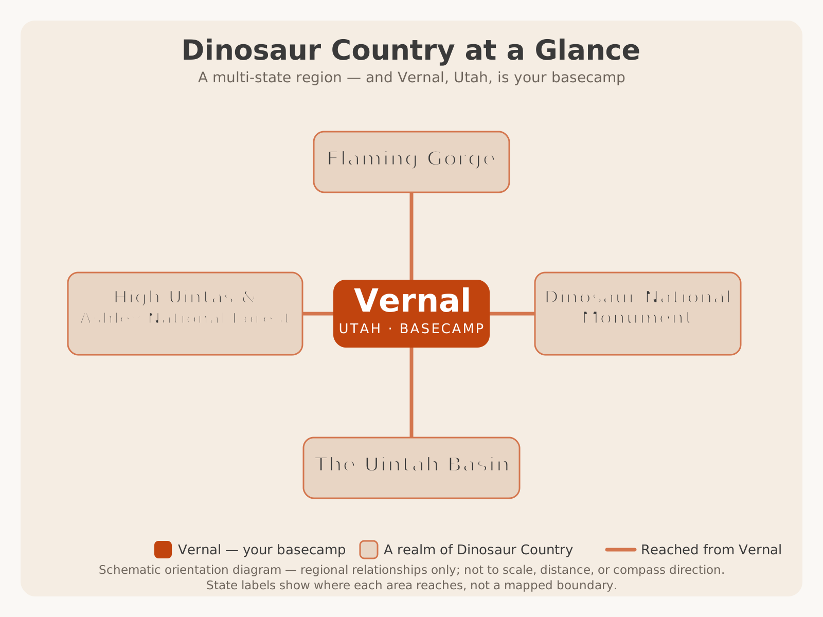
Seen from the region as a whole, this high country is one of Dinosaur Country’s distinct realms — the alpine counterweight to the desert monument and the reservoirs — anchored by Vernal at the mountains’ southern foot.
| Feature | Detail |
|---|---|
| Managing agency | USDA Forest Service |
| Location | Northeastern Utah (and a corner of Wyoming) |
| Approx. size | ~1.3 million acres |
| Mountain range | Uinta Mountains (run east–west) |
| Highest point | Kings Peak — 13,528 ft (highest in Utah) |
| Protected core | High Uintas Wilderness (designated 1984) |
| Also administers | Flaming Gorge National Recreation Area |
| Headquarters | Vernal, Utah |
What’s Inside the Forest
Ashley National Forest is big enough that it helps to think of it in parts:
- The High Uintas Wilderness. The protected alpine core — Utah’s tallest peaks, hundreds of lakes, and long trails, with no roads or motors. This is backpacking, horse-packing, and serious day-hiking country.
- The developed mountain zone. Below and around the wilderness: paved and gravel roads, campgrounds, mountain reservoirs like Moon Lake, trailheads, and picnic areas — the family-friendly, drive-to forest.
- Flaming Gorge National Recreation Area. The reservoir and its red canyons, administered as part of Ashley NF but with its own full guide — see the Ultimate Guide to Flaming Gorge.
- The canyon and foothill country near Vernal. Lower-elevation forest along drainages like Dry Fork and Ashley Creek, closer to town and open longer in the season.
Because the forest is managed across multiple ranger districts, services, roads, and rules differ from area to area. VERIFY WITH OFFICIAL SOURCE (the specific ranger district) for the details of any area you plan to visit.
Scenic Drives and Byways
You don’t have to hike to experience Ashley National Forest — some of its best scenery unspools through a windshield, on drives that climb from desert to alpine in a single afternoon.
- Flaming Gorge–Uintas National Scenic Byway (US-191 north). One of Utah’s classic drives, climbing out of the basin north of Vernal, up through the forest, to the red canyons of Flaming Gorge, with dramatic overlooks along the way. It links the forest and the reservoir in one route.
- Red Cloud Loop. A backcountry scenic backway north of Vernal that loops up into the aspen, pine, and mountain meadows of the forest before returning to the valley. Beautiful in fall, but partly unpaved and seasonal — confirm conditions before setting out.
- Sheep Creek Geological Area / Loop. A side route near Flaming Gorge that runs through spectacularly folded and upturned rock — a geology lesson at driving speed. Typically a seasonal road.
- Access roads to the high lakes. Routes toward areas like Moon Lake and the various trailheads deliver deep-forest scenery even before you park.
Best Areas and Access Points
The forest is reached from several gateway towns and roads. Which access you use depends on what you’re after.
| Area / Access | Gateway | Best for |
|---|---|---|
| Red Cloud Loop & Dry Fork | Vernal (north) | Scenic driving, fall color, day trips |
| Flaming Gorge / US-191 | Vernal → Manila / Dutch John | Reservoir, byway, overlooks |
| Moon Lake area | Mountain Home / Duchesne | Mountain reservoir, campgrounds, trailheads |
| Uinta / Whiterocks / Yellowstone drainages | Roosevelt area (north) | Wilderness access, lakes, backpacking |
| High Uintas Wilderness interior | Remote trailheads | Backpacking, Kings Peak, solitude |
Hiking and Backpacking
Hiking is the soul of Ashley National Forest, and the options run the full spectrum from a 20-minute lakeside stroll to a weeklong wilderness traverse. For how the forest’s trails fit among the region’s best hikes — and how to match a hike to your ability — see our complete guide to hiking in Dinosaur Country.
Easy and family-friendly. Around the developed lakes, campgrounds, and picnic areas you’ll find short, gentle nature walks and shoreline paths — perfect for young kids, casual visitors, and anyone acclimating to the altitude.
Day hikes. Countless trails climb from trailheads into forest, meadow, and lake basins, offering a big alpine payoff for a half-day of effort. Many lead to a lake where you can fish, picnic, and turn around.
Backpacking. This is one of the premier backpacking regions in Utah. Trails lead deep into the High Uintas Wilderness and its lake-strewn basins, and the long-distance Uinta Highline Trail traverses the range for those seeking a multi-day expedition. Solitude, alpine lakes, and genuine wilderness are the rewards; preparation is the price.
Kings Peak — Utah’s Highest Point
The single most famous objective in the forest is Kings Peak, at 13,528 feet the highest point in Utah, tucked deep in the High Uintas Wilderness. For peak-baggers and highpoint collectors it’s a bucket-list summit — but it’s important to be honest about what it takes.
Kings Peak is not a day hike for most people. The standard approach involves a long drive to a remote trailhead followed by many miles of backcountry travel, typically done as a multi-day backpacking trip, crossing a high pass and climbing a boulder-strewn ridge to the summit. It demands fitness, altitude acclimatization, navigation skill, real backcountry gear, and a careful eye on the weather — afternoon thunderstorms on an exposed 13,000-foot ridge are genuinely dangerous.
If Kings Peak is your goal, treat it as the serious mountain expedition it is: research the current route and trailhead access thoroughly, build in time to acclimate, start summit day early to be off the high ridge before afternoon storms, and go prepared to be entirely self-sufficient. VERIFY WITH OFFICIAL SOURCE (the Forest Service and current trip reports) for trailhead access, route conditions, and regulations before you go.
Alpine Lakes and Fishing
The Uintas are famous for their hundreds of alpine lakes, and fishing them is one of the great pleasures of the forest. Many high lakes hold brook trout, cutthroat trout, rainbow trout, arctic grayling, and tiger trout, depending on the basin, and the state stocks many of the more remote waters. The experience ranges from drive-up reservoir fishing to a backcountry basin you have entirely to yourself.
Broadly, there are three kinds of fishing in and around the forest:
- Mountain reservoirs like Moon Lake — accessible by road, often with campgrounds nearby, good for families and boats. VERIFY WITH OFFICIAL SOURCE for services and any rentals.
- High alpine lakes — reached on foot in the wilderness, quiet and scenic, the classic Uinta fishing experience.
- Streams and the reservoir — mountain creeks throughout the forest, plus the trophy fishing of Flaming Gorge and the Green River below its dam, covered in that guide.
Camping Overview
Camping is central to the Ashley experience, and there’s a style for everyone — from a developed campground with a picnic table and a vault toilet beside a mountain lake, to a primitive dispersed site far down a forest road, to a backcountry tent beneath a 13,000-foot peak.
- Developed campgrounds. Clustered around the reservoirs, popular lake basins, and along the scenic byways, these offer basic amenities. Many take reservations and fill on summer weekends; some are first-come, first-served.
- Dispersed camping. Allowed in many parts of the forest under Forest Service rules — free, primitive, and service-free, with responsibilities around fire, waste, and Leave No Trace.
- Wilderness camping. In the High Uintas, camping is backcountry-style with its own regulations on group size, campsite distance from water, and fire use.
Because availability, open dates, fees, reservations, and fire restrictions change every year, this guide won’t publish a stale site list. VERIFY WITH OFFICIAL SOURCE (Ashley National Forest and the national reservation system) for current campgrounds, dispersed-camping rules, and any fire restrictions. For what to pack for cold mountain nights and big temperature swings, see our what to bring guide.
Wildlife
Ashley National Forest supports a rich range of wildlife across its elevations. In the forests and meadows, watch for elk, mule deer, and moose — the Uintas are excellent moose country, especially around willowy lake margins and wet drainages. Black bears live in the forest, which makes proper food storage essential when camping. Higher up, Rocky Mountain bighorn sheep and mountain goats occupy the crags and alpine terrain, and pronghorn range the open lower country. Overhead and along the water you may see bald eagles, osprey, and a variety of raptors and songbirds.
As always, dawn and dusk are the best times to see animals — and the best light for photography. Give every animal room, never approach or feed wildlife, and treat moose with particular respect: they’re large, common here, and can be aggressive, especially cows with calves. Store food securely to keep both bears and yourself safe.
Photography Tips
The forest is a photographer’s playground across the seasons.
- Work the golden hours. Alpine light is best early and late; midday sun is harsh and flat at altitude. Sunrise on a still lake, with peaks reflected, is the signature Uinta shot.
- Chase the reflections. High lakes go glassy in the calm of early morning — get there before the wind and the afternoon breeze ripple the surface.
- Time the wildflowers and the aspens. High-country wildflowers peak in mid to late summer; the aspens turn brilliant gold in late September into October. Both are worth planning a trip around.
- Bring range and protection. A wide lens for lake-and-peak panoramas, a longer lens for wildlife and distant summits — and rain protection, because mountain weather turns fast.
- Respect the storms. Dramatic afternoon thunderheads make great skies but bring real lightning danger above treeline. Get off high, exposed ground when storms build.
Seasonal Advice
Ashley National Forest is a place where the calendar matters more than almost anywhere else in the region, because elevation compresses the warm season dramatically.
- Summer (roughly July–September) — the high-country prime. The snow is finally gone from the high basins, the lakes are open, wildflowers peak, and the forest is at its glorious best. It’s also the most reliable window for backpacking and Kings Peak. Expect cold nights even in July and near-daily afternoon thunderstorms.
- Fall. One of the most beautiful times to visit lower and mid elevations: golden aspens, crisp air, thinning crowds, and fine fishing. High routes begin closing with early snow.
- Winter. Deep snow blankets the mountains, closing many roads and campgrounds but opening the forest for snowmobiling, cross-country skiing, and snowshoeing. It’s a serious cold-weather environment.
- Spring. A slow, muddy awakening. Low elevations green up and open first; the high country stays snowbound and inaccessible well into early summer, and runoff swells the streams.
Winter Recreation
When the snow shuts the high roads, it opens a different forest. Ashley National Forest becomes a winter-sports destination, with snowmobiling on designated routes and trails, cross-country skiing and snowshoeing through quiet, snow-loaded forest, and ice fishing on the reservoirs when conditions allow. It’s beautiful, uncrowded, and demanding: cold is serious at altitude, days are short, avalanche terrain exists in the mountains, and services are far away.
If you’re heading up in winter, go prepared for real cold-weather conditions, tell someone your plan, carry emergency gear, and check current road access, grooming, and avalanche information first. VERIFY WITH OFFICIAL SOURCE for winter road status, designated over-snow routes, and current conditions.
Family Tips
The lower and mid-elevation parts of Ashley National Forest are genuinely family-friendly, and a mountain day is the perfect cool-weather antidote to a hot desert itinerary. Developed campgrounds beside mountain reservoirs, drive-up lakes for easy fishing, short nature walks, picnic areas, and scenic drives all work well with kids, and the cooler air is a relief in midsummer.
A few things to plan around with children:
- Altitude. Kids feel thin air too. Ease into elevation, hydrate, and don’t plan a strenuous first-day hike straight from the basin.
- Weather swings. Pack warm layers and rain gear even for a summer day trip — mountain afternoons can turn cold and stormy quickly.
- Water safety. Cold lakes and streams, no lifeguards. Life jackets near the water, and close supervision.
- Wildlife. Teach kids to keep their distance, especially from moose, and to never feed animals. Secure food at camp.
For more family-oriented planning around the region, see fun things to do in Vernal with kids.
Accessibility Notes
Accessibility varies widely across a forest this size. Many developed recreation areas — campgrounds, picnic areas, some lake shorelines, and the paved scenic byways — offer accessible parking, facilities, and drive-up or short-path access to beautiful mountain scenery. The paved overlooks along the Flaming Gorge–Uintas byway, in particular, deliver big views with little walking.
By contrast, backcountry trails, unpaved forest roads, dispersed sites, and all wilderness terrain are rugged, unimproved, and not accessible, and high elevation itself adds physical demand for many visitors. Because specific accessible facilities change by site and season, VERIFY WITH OFFICIAL SOURCE (the ranger district or specific recreation area) for current accessibility provisions before a visit if you have specific needs.
Suggested One-Day Itinerary
A single day is enough to sample the forest’s high country from a Vernal base, focusing on scenic drives and drive-up lakes rather than the deep wilderness.
- Morning: Head north out of Vernal onto the Red Cloud Loop or up US-191, climbing from desert into aspen and pine. Stop at overlooks and pullouts as the elevation and the views build.
- Late morning: Reach a mountain lake or reservoir — walk the shoreline, cast a line, or simply take in the peaks. Cooler air and alpine scenery are the whole point.
- Lunch: Picnic lakeside, or combine the drive with the Flaming Gorge overlooks for a bigger loop.
- Afternoon: Take a short forest nature walk or continue the scenic loop, watching for moose and deer in the meadows. Turn for home before afternoon thunderstorms build.
- Golden hour: Catch the low light on the peaks and the aspens on the drive back down, keeping an eye out for wildlife at dusk.
Suggested Weekend Itinerary
With two to three days you can go deeper — a night in the mountains and real time on the trails and water.
- Day 1 — Scenic drive & basecamp. Drive up from Vernal, take in the byway overlooks, and set up at a developed campground near a mountain reservoir like Moon Lake or along the byway. Evening fishing and a campfire (fire restrictions permitting).
- Day 2 — Hike & fish. A day hike from a trailhead into a lake basin — as ambitious or gentle as your group wants — with fishing, a picnic, and time to soak in the high country. Watch the sky and be off exposed ground by early afternoon.
- Day 3 — Choose your finish. A relaxed scenic-drive morning and a stop at Flaming Gorge on the way down, or a return south to fold in Dinosaur National Monument and the rest of a Vernal-based trip.
Planning and Safety Tips
The mountains reward preparation and punish improvisation. A few essentials:
- Respect the altitude. From Vernal’s ~5,300 feet, the forest climbs past 10,000 and beyond. Acclimate, hydrate, and don’t overreach on your first day up high.
- Watch the weather — especially afternoons. Thunderstorms build almost daily in summer and are deadly above treeline. Start early, summit or reach high points before noon, and descend when storms threaten.
- Fuel and supplies in town. Services thin out fast once you leave Vernal or the gateway towns. Fill the tank and stock up before you head up.
- Cell service is spotty to nonexistent. Download offline maps, carry a paper map and compass or GPS, and tell someone your route and return time.
- Come prepared for cold. Nights are cold even in summer, and weather turns fast. Layers, rain gear, and real footwear are not optional.
- Practice Leave No Trace and fire safety. Pack out what you pack in, store food from bears, know the current fire restrictions, and never leave a fire unattended. VERIFY WITH OFFICIAL SOURCE for current fire and camping rules.
- Match the trip to your group. Drive-up lakes and short walks for casual visitors and families; the wilderness and Kings Peak only for prepared, experienced parties.
Ashley National Forest is the high, wild ceiling over Dinosaur Country — the place that turns a desert trip into a mountain-and-desert trip, and a good vacation into a great one. Base out of Vernal, give the forest at least a full day, verify the conditions that change, and go prepared for the altitude and the weather. When you’re ready to pair the high country with a guided backcountry adventure closer to town, book a UTV tour with Adventure Tours Vernal and let Dave and Trudy show you the country behind the postcards.