Key Takeaways
- Three great hiking destinations, one supply town. Dinosaur National Monument, Ashley National Forest and the High Uintas, and the Flaming Gorge and Red Fleet reservoirs are all within day-trip range of Vernal, and each offers a genuinely different kind of hiking.
- Choose the destination by your goal — and the trail by your ability. Fossils and canyons, alpine lakes and peaks, or easy family walks each have a best home here, and every destination has trails from gentle strolls to serious backcountry.
- Match the season to the elevation. The high country hikes best in summer; the desert is at its best in spring and fall. Early fall is the region-wide sweet spot.
- Easy for beginners, wild for the experienced. You can walk a paved interpretive trail past real fossils, or climb Utah's tallest peak on a multi-day wilderness expedition — the range is the point.
- Always verify the details. Trail distances, elevation, difficulty, permits, fees, trailhead facilities, and seasonal closures are set by the managing agencies and change — confirm current specifics before every hike.
Why Hike in Dinosaur Country
Most people know this region for dinosaurs and red rock, not for hiking — which is exactly why the hiking is so good. While hikers pile into the famous Western parks and jostle for parking at trailheads, Dinosaur Country quietly offers a spread of trails that would be a headline destination anywhere else: a national monument of fossils and river canyons, an entire national forest holding Utah's highest peak and hundreds of alpine lakes, and red-rock reservoirs with dinosaur tracks at the water's edge — all within an hour or so of a single supply town.
The real advantage here is range within a small radius. From one base you can walk a paved trail past bones still locked in the rock in the morning, climb to a cool mountain lake beneath 13,000-foot peaks the next day, and stroll a red-sandstone shoreline to a slab of 200-million-year-old footprints on the third — without ever driving far. Few places pack fossil-country desert trails, genuine alpine wilderness, and easy family reservoir walks into so tight a footprint, and fewer still let you go from a wheelchair-friendly overlook to one of Utah's hardest peaks inside the same region.
And it does it without the crowds. This is working, uncrowded country, where you can still find a quiet trail or a whole lake basin to yourself, especially midweek and in the shoulder seasons. For the full picture of the region and how to plan a trip around it, start with our Ultimate Guide to Vernal; for everything else there is to do between hikes, see things to do in Vernal, camping in Dinosaur Country, fishing, and the region's scenic drives.
Choosing the Right Hiking Destination
Think of Dinosaur Country hiking as three main destinations, each with its own personality and its own full range of trails. You do not have to choose just one — many trips combine two or three — but knowing what each offers is the key to a good plan.
| Destination | Setting | Known For | Distance from Vernal | Best For |
|---|---|---|---|---|
| Dinosaur National Monument | Fossil canyons & rivers | Fossils in place, petroglyphs, canyon overlooks, interpretive trails | ~20 min east (Quarry area) | Families, history & geology travelers, canyon hikers |
| Ashley National Forest / High Uintas | Alpine forest & peaks | Mountain lakes, backpacking, Utah's highest peak, cool summer air | ~30–90 min north | Alpine hikers, backpackers, summer heat-escapers |
| Flaming Gorge | Reservoir & red canyon | Canyon overlooks, shoreline and rim trails, big-water scenery | ~1 hour north | View seekers, families, hike-and-boat trips |
| Red Fleet State Park | Small reservoir, red sandstone | Dinosaur trackway trail, red-rock shoreline walks, easy access | ~15 min north | Families, first-timers, short hikes |
| Vernal area (base) | Town & foothills | Easy access, services, museums, nearby foothill walks | — | Comfort seekers, rest days, rainy-day backups |
Distances are approximate and depend on your exact trailhead within each area. Trail availability, access, and conditions change over time. VERIFY WITH OFFICIAL SOURCE (the National Park Service, the Forest Service, or Utah State Parks) for current trails, distances, and conditions at each destination.
With so many good options, the real question is which one fits your trip. Use this quick decision guide to point yourself at the right destination, then read that place's dedicated cornerstone guide before you go.
| If you want… | Hike at… | Why |
|---|---|---|
| Fossils, petroglyphs, and river canyons | Dinosaur National Monument | Trails past bones in the rock, rock art, and Green and Yampa canyon views |
| Cool mountain lakes and alpine scenery | Ashley National Forest / High Uintas | High-country trails to hundreds of lakes; escapes the summer heat |
| A serious backcountry challenge | High Uintas Wilderness (Kings Peak) | Utah's highest peak and long wilderness traverses for the prepared |
| Big-water canyon overlooks | Flaming Gorge | Rim and shoreline trails with dramatic reservoir and canyon scenery |
| An easy family walk with a payoff | Red Fleet or Dinosaur NM | A dinosaur trackway or fossils in place at the end of a short trail |
| Gentle trails close to services | Vernal area & reservoirs | Short walks minutes from town, with supplies and comforts nearby |
Hiking by Difficulty: Which Trails Fit Your Group
Before you pick a trailhead, it helps to be honest about ability — because in this region the same destination can offer a stroller-friendly loop and an expedition, and the wrong choice turns a great day sour. Difficulty here is driven as much by heat, altitude, exposure, and water as by distance and climb. Use this to size a hike to your group.
| Level | What it looks like here | Best for | Watch-outs |
|---|---|---|---|
| Family / easy | Short interpretive and nature trails, reservoir shorelines, paved or well-graded paths near trailheads and campgrounds | Young kids, casual visitors, first-timers, altitude acclimation, rest days | Sun and heat exposure; little shade on desert routes; keep water handy |
| Moderate | Half-day day hikes into lake basins, longer canyon and rim trails, route-finding loops on slickrock | Reasonably fit adults and older kids wanting a real payoff for a morning's effort | Afternoon thunderstorms, uneven footing, navigation, elevation gain |
| Difficult / expert | Long backcountry trails, multi-day backpacking in the High Uintas, Kings Peak, and remote off-trail travel | Experienced, fit, well-equipped hikers and backpackers | Altitude, exposure, distance from help, spotty-to-no cell service, snow well into summer |
The honest rule for this region: let heat and altitude, not just mileage, set your ambition. A "short" desert trail at midday can be harder and more dangerous than a longer walk in cool mountain air, and a moderate lake hike at 10,000 feet will humble a sea-level visitor. Start early, scale down in the heat, and build up to altitude. And because trail distances, elevation gain, and difficulty ratings vary by source and change with maintenance, VERIFY WITH OFFICIAL SOURCE for the current specifics of any trail before you rely on them.
Family Hikes
This may be the best family-hiking region in Utah that nobody talks about, for one simple reason: it makes hiking easy to succeed at, with real payoffs that keep kids moving. In Dinosaur National Monument, short interpretive trails let children find fossils still embedded in the rock and read signs partly written by kids for kids — a hike with a genuine "wow" at the end. At Red Fleet State Park, an easy red-rock shoreline route leads to a slab of 200-million-year-old dinosaur footprints you can walk right up to. And up in Ashley National Forest, gentle lakeside and campground nature walks give families cool air, easy footing, and a mountain lake to picnic beside.
The formula for a great family hike here is simple: keep it short, do the exposed desert routes in the cool morning, carry far more water and sun protection than seems necessary, and pick a trail with a reward — fossils, tracks, or a lake — to pull the kids along. Save the rugged route-finding loops and any high-country distance for older kids and experienced groups.
Scenic Hikes
If your goal is the view rather than the mileage, Dinosaur Country delivers some of the best scenery-per-effort hiking in Utah. The Dinosaur National Monument canyon country is the standout: ridgeline and overlook trails reveal the confluence of the Green and Yampa rivers far below, where the rivers have cut spectacular canyons through tilted rock. These are the hikes where a modest walk buys a jaw-dropping payoff.
Around Flaming Gorge, rim and shoreline trails frame the fiery red canyon walls and the deep blue reservoir, and the whole area connects to the region's best scenic driving along the Flaming Gorge–Uintas Byway — a natural hike-and-drive combination. Up in the High Uintas, nearly every trail is scenic, climbing through aspen and spruce to open basins scattered with alpine lakes and framed by high peaks. And at Red Fleet, the tilted red Navajo sandstone "fleet" formations glow at sunrise and sunset and mirror in the calm reservoir — a short walk that photographs like a far more famous park.
The best scenic hiking rewards good timing: dawn and dusk for warm, low light and calm water, and clear mornings before the afternoon haze and thunderheads build. Bring a camera and give yourself time to linger. Because overlook trails and access can change with conditions, VERIFY WITH OFFICIAL SOURCE for current routes before building a trip around a specific viewpoint.
Alpine Hiking
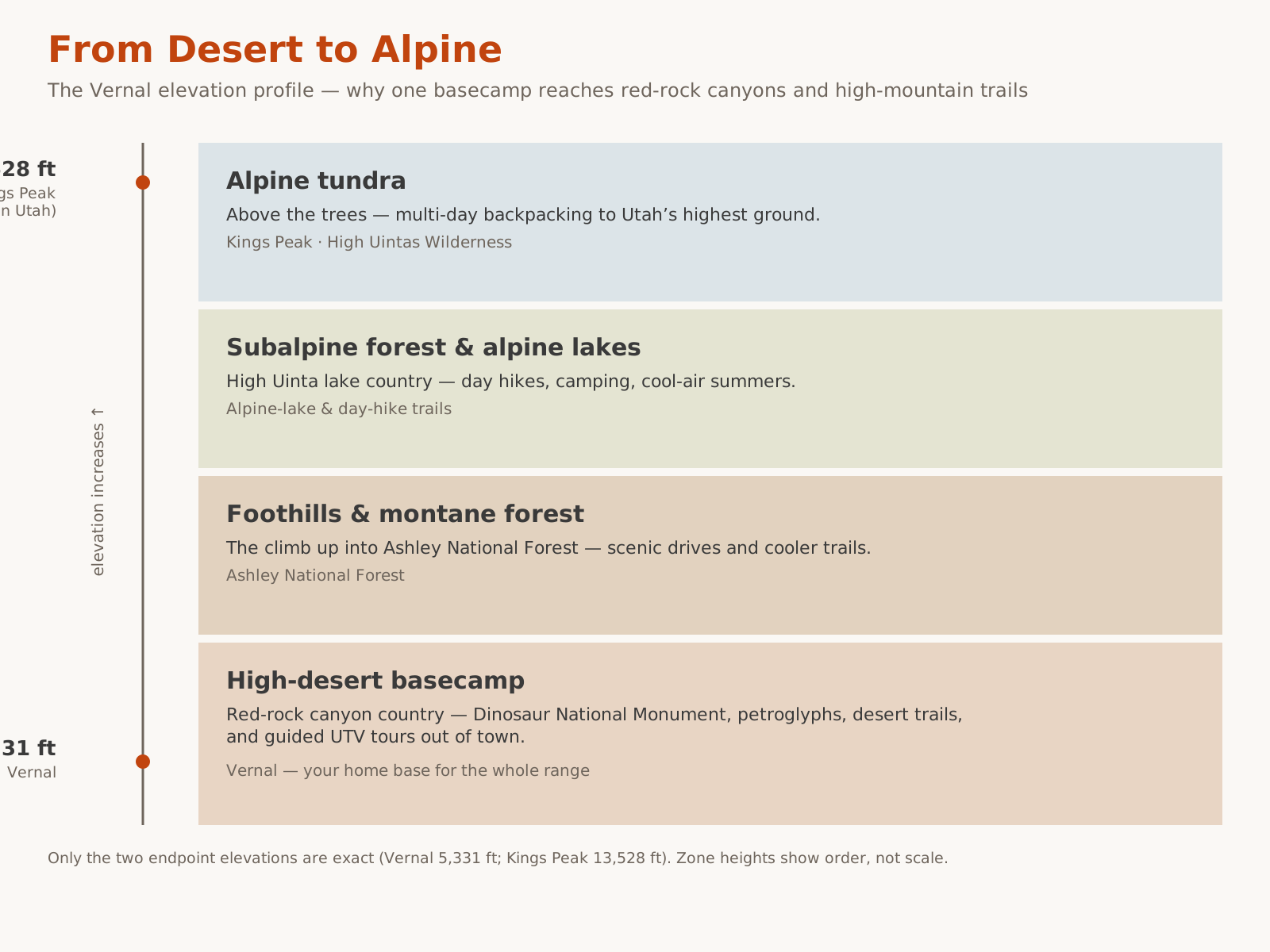
North and west of Vernal, the land climbs into the Uinta Mountains and the Ashley National Forest — and with it, the region's most spectacular high-country hiking. The Uintas are one of the few major ranges in the Lower 48 that run east–west, and they hold hundreds of alpine lakes, deep spruce-and-fir forest, open tundra above treeline, and — crowning it all — Kings Peak at 13,528 feet, the highest point in Utah, set deep in the High Uintas Wilderness. This is where locals go to escape the summer heat and where serious hikers come for genuine wilderness.
Alpine hiking here spans the full spectrum. Easy options include short lakeside and nature walks around the developed campgrounds and drive-up lakes — gentle, scenic, and ideal for acclimating to the altitude. Day hikes climb from trailheads into forest, meadow, and lake basins, delivering a big alpine payoff for a half-day of effort; many lead to a lake where you can picnic, fish, and turn around. And backpacking is the region's crown jewel: trails lead deep into the High Uintas Wilderness and its lake-strewn basins, and the long-distance Uinta Highline Trail traverses the range for those seeking a multi-day expedition.
The trade-off is season and seriousness. The high country has a short season, can hold snow into early summer and see it again in early fall, and rewards preparation and punishes complacency. Afternoon thunderstorms on exposed high ground are genuinely dangerous, nights are cold even in July, services are far, and cell coverage is thin to nonexistent.
Desert Hiking
At the other end of the spectrum is the region's high-desert hiking, and its heart is Dinosaur National Monument. Here the trails run through fossil-bearing rock layers, past ancient petroglyphs, and along the dramatic canyons of the Green and Yampa rivers. The monument's routes range from paved strolls to rugged backcountry, and each has its own character: short interpretive trails that link the visitor-center area toward the Quarry through fossil layers, an interpretive loop near Split Mountain with big desert views, rougher route-finding loops that reward confident hikers with solitude and slickrock, a ridgeline walk to a jaw-dropping river-confluence overlook at the end of the Colorado scenic drive, and short shady canyon walks near the historic Josie Morris cabin that are ideal for young children and hot afternoons.
The red-rock reservoirs add more desert hiking closer to town. Red Fleet State Park offers a shoreline route to its famous dinosaur trackway — reachable on foot or by paddling across the reservoir — set among glowing Navajo sandstone. These are easier, family-friendly desert walks with a genuine payoff.
Desert vs. Alpine Hiking
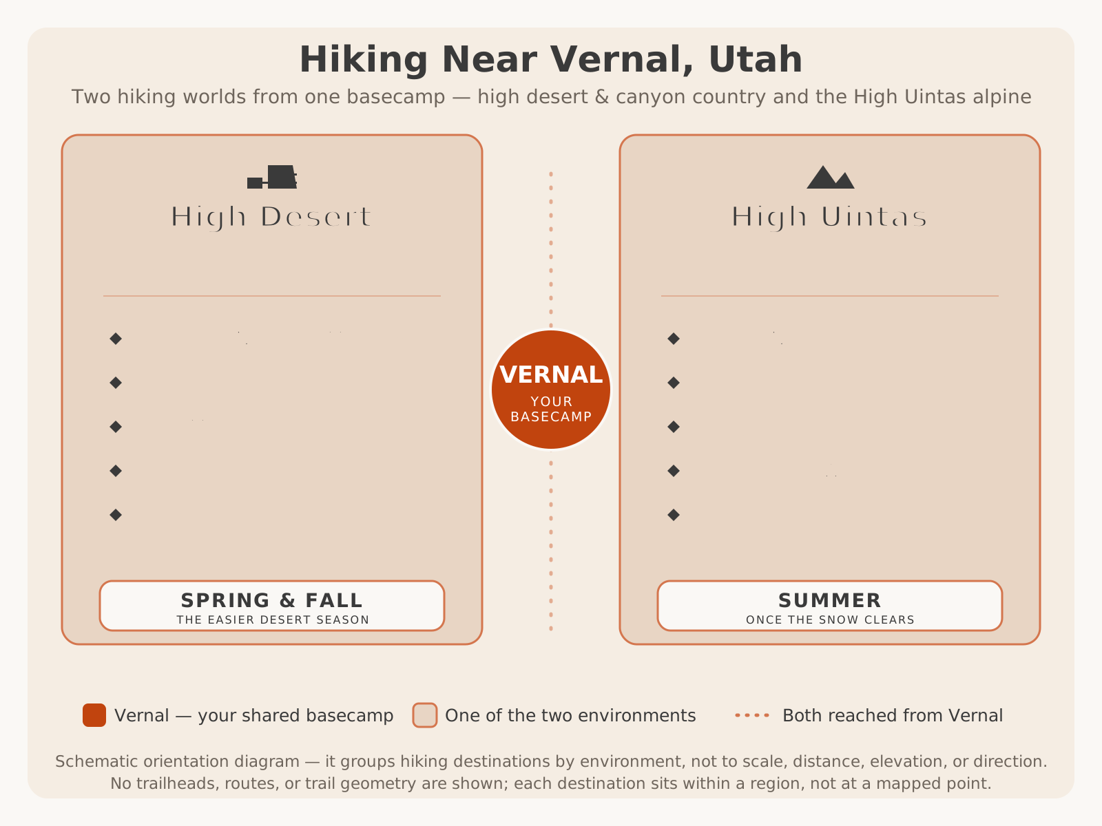
The two ends of the region's hiking spectrum could hardly be more different, and choosing between them — or sequencing both — is the essence of planning a trip here. This is how they compare.
| Factor | Desert (Dinosaur NM, reservoirs) | Alpine (High Uintas, Ashley NF) |
|---|---|---|
| Best season | Spring and fall; summer only with early starts | Summer, once the snow clears; short season |
| Signature draw | Fossils, petroglyphs, red-rock canyons, dinosaur tracks | Alpine lakes, high peaks, cool forest, wilderness |
| Main hazard | Heat, sun, dehydration, little shade | Altitude, cold, afternoon thunderstorms, remoteness |
| Elevation | Lower and warmer, near the rivers and town | High and cool, up to 13,528 ft at Kings Peak |
| Access | Close to Vernal; paved to trailheads at the monument and parks | 30–90+ minutes north; some rough, remote trailheads |
| Best for | Families, history and geology travelers, spring and fall trips | Backpackers, alpine hikers, summer heat-escapers |
Many of the best trips do both — a cool alpine hike in the heat of summer, or a mild desert canyon walk in spring or fall — and the region's compact size makes that easy. Match the elevation to the season and you can hike comfortably here for much of the year.
Wildlife Safety
Hiking here puts you in wildlife country, and a few habits keep both you and the animals safe. In the high desert, the main things to respect are heat and footing: watch where you put your hands and feet on warm rock and in brush, since rattlesnakes live in the region, and never reach blindly onto a ledge. In the mountains, keep a respectful distance from deer, elk, and especially moose — a moose deserves particular space — and never approach or feed any animal.
The most important habit everywhere is water and heat awareness: dehydration and heat are by far the most common real hazards on these trails, more than any animal. If you are camping between hikes, store all food, trash, and scented items secured and never in your tent, so you do not draw animals into camp. Watch for animals on the road at dawn and dusk when driving to and from trailheads, and give every animal room to be wild.
Photography
A hiking trip here is also a photography trip, and a little planning turns snapshots into keepers. Hiking puts you in the right places at the right hours — dawn and dusk, when the light is best and most day-trippers are gone.
- Shoot the golden hours. The warm, low light on red canyon walls at Dinosaur National Monument, Flaming Gorge, and Red Fleet is unbeatable at sunrise and sunset; midday flattens the color.
- Catch the reflections. Calm morning water at the reservoirs and mountain lakes mirrors red rock and peaks — get to the shoreline before the wind picks up.
- Frame the canyons and confluences. The overlook trails in the monument reveal the Green and Yampa canyons and their confluence; go on a clear morning before the haze builds.
- Chase the dark skies. Away from town, the high desert and the forest deliver superb star and Milky Way photography on clear, moonless nights.
- Frame the fall color. In early fall the aspens of the Uintas turn gold — plan an alpine hike around the change.
- Photograph fossils and tracks respectfully. Use natural low-angle light to bring out depth, and never chalk, wet, or touch a fossil, petroglyph, or dinosaur track to "improve" a photo — it damages an irreplaceable resource.
- Watch the storms. Dramatic skies make great photos but dangerous conditions — get off exposed ridges and open ground when lightning threatens.
Accessibility
The region's most accessible hiking is at the developed destinations. Dinosaur National Monument includes some paved and well-graded interpretive trails and visitor facilities that tend to be more accessible than the backcountry routes, and the developed state parks — Red Fleet and the reservoirs — generally offer accessible parking and day-use areas near their shorelines. Some scenic overlooks are reachable with little or no walking from a parking area, which puts big canyon views within reach of many visitors.
By contrast, the rugged desert route-finding loops, the reservoir trackway routes over uneven ground, and the high-country and wilderness trails are steep, unpaved, remote, and not uniformly accessible. Because specific accessible trails and facilities vary by site and change over time, VERIFY WITH OFFICIAL SOURCE (the National Park Service, Ashley National Forest, or Utah State Parks) for current accessibility provisions before a visit if you have specific needs.
Hiking by Traveler Type
Who you are hiking with changes the best plan as much as the season does. Here is how the region suits different travelers.
| Traveler | Best destinations & trails | Why it works |
|---|---|---|
| Families | Dinosaur NM interpretive trails, Red Fleet trackway, forest lake walks | Short, forgiving trails with a real payoff — fossils, tracks, or a lake — and town nearby |
| Beginning hikers | Reservoir shorelines, campground nature walks, paved monument trails | Gentle grades, easy access, and a place to build confidence and acclimate to altitude |
| Experienced hikers | High Uintas day hikes, route-finding loops at the monument, longer rim trails | Real elevation, solitude, and route-finding without a full expedition |
| Backpackers | High Uintas Wilderness, the Uinta Highline Trail, Kings Peak | Multi-day alpine wilderness, lake basins, and Utah's highest peak |
| Photographers | Monument overlooks, Flaming Gorge rims, Red Fleet at dawn, aspen basins in fall | Big canyon light, reflections, dark skies, and gold color for modest effort |
| International visitors & national-park travelers | Dinosaur NM plus one alpine or reservoir day, Vernal base | An iconic fossil park and genuine Western range, uncrowded, from one comfortable base |
Seasonal Hiking
One of the region's strengths is that something is always good to hike, as long as you match the destination to the season. The single most important rule is to pair elevation with the calendar: desert low, mountains high, and let the weather steer you. Here is how the year unfolds.
| Season | Best Destinations | What to Expect |
|---|---|---|
| Spring | Dinosaur NM, Red Fleet, Flaming Gorge rim, Vernal foothills | Ideal desert-hiking temperatures and thin crowds; high country still snowbound and muddy |
| Summer | High Uintas, Ashley National Forest, alpine lakes | Prime high-country season and the coolest air; desert trails need early starts; afternoon thunderstorms |
| Fall | Ashley NF (early), Dinosaur NM, reservoirs — nearly everywhere | Many locals' favorite — cool air, gold aspens, fewer people; high country closes as snow returns |
| Winter | Lower desert trails on mild days; Vernal base | Cold and often snowy; high country is for snow travel only; short days, limited access |
Seasonal timing is general and shifts with weather and elevation year to year. Trailhead access, road status, and closures change annually. VERIFY WITH OFFICIAL SOURCE for current openings, conditions, and access before a trip. For the region's month-by-month weather, see our Vernal weather guide.
Summer vs. Fall: A Closer Look
The two peak hiking seasons are worth comparing directly, because they reward different priorities and open different country.
| Factor | Summer | Fall (early) |
|---|---|---|
| High country access | Fully open and reliable | Open early, closing as snow returns |
| Desert hiking | Hot — early starts and lots of water required | Comfortable much of the day; the easier desert season |
| Crowds | Busiest, especially the monument and high lakes | Thinner; easier trailhead parking |
| Temperatures | Warm/hot days, cold nights up high | Cool days, cold nights; frost and early snow possible up high |
| Scenery | Green forest, full lakes, long days | Gold aspens, low warm light, quiet |
| Best for | Alpine trails, families on school break | Photographers, desert hikers, solitude seekers |
Suggested Day Hikes
Short on time? Any of these makes a complete day from a Vernal base — pick the one that matches the season and your group, and confirm the current trail details before you go.
- The fossil-and-canyon day (Dinosaur National Monument). Combine a short interpretive fossil trail near the Quarry area with a scenic overlook walk toward the Green and Yampa canyons — a half-day of history, geology, and big views. See Visiting Dinosaur National Monument.
- The alpine-lake day (High Uintas). Drive up into Ashley National Forest, hike from a trailhead into a lake basin, and picnic in the cool high country — as ambitious or gentle as your group wants. Be off exposed ground by early afternoon.
- The dinosaur-tracks day (Red Fleet). Walk the red-rock shoreline route to the Red Fleet dinosaur trackway in the cool morning, then swim or paddle the reservoir as the day warms.
- The big-water day (Flaming Gorge). Pair a rim or shoreline trail at Flaming Gorge with the byway overlooks and a picnic above the reservoir.
- The easy family day (Vernal area). A short interpretive walk plus the town's dinosaur museums and attractions — a gentle option for little legs, rest days, or uncertain weather. See things to do in Vernal.
Weekend Hiking Trips
With two or three days you can pair contrasting destinations and see the region properly.
The desert-and-alpine weekend. Spend day one in the cool of Ashley National Forest on an alpine-lake hike, then day two down in Dinosaur National Monument on the fossil and canyon trails — high and cool, then low and red, the region's whole range in one trip. Base in Vernal between them.
The family weekend. Two easy days: the Red Fleet dinosaur trackway and reservoir on day one, and the short interpretive fossil trails at the monument on day two, with swimming, paddling, and town comforts to break up the walking. Camping nearby turns it into a full adventure — see camping in Dinosaur Country.
The backpacker's weekend. For experienced, prepared hikers, a multi-day trip into the High Uintas Wilderness — a lake-basin basecamp or a stretch of the Uinta Highline Trail, with alpine fishing and some of the darkest skies in Utah. Bring warm layers even in July, watch the afternoon sky, and VERIFY WITH OFFICIAL SOURCE for trail, permit, and snow conditions first. Driving in from the west? See our Salt Lake City to Vernal guide.
Hiking Essentials: What to Bring
Your kit depends on the trail, but a few essentials cross every hike here, because the region's defining conditions — heat, sun, altitude, and fast-changing weather — are the same whether you are on a desert loop or a mountain trail. For any hike, carry far more water than you think you need and a way to carry it comfortably; dehydration is the most common real hazard on these trails, and shade is scarce in the desert. Add real sun protection — hat, sunscreen, and sunglasses — since the high-elevation sun is intense even on cool days.
Dress for range, not for the trailhead. Desert days are hot but mornings and nights are cool, and the high country can swing from warm sun to cold rain or even snow within an hour, so pack layers and a rain shell for anything longer than a short walk. Wear real footwear with grip for slickrock and rocky trails, and bring a map for the backcountry — much of Ashley National Forest and the monument's remote trails have little or no cell service, so do not rely on your phone for navigation. Round it out with snacks, a small first-aid kit, and a charged phone or beacon for emergencies, and always tell someone your plan and expected return.
For a full, region-specific packing breakdown across the seasons, see our what to bring guide, and time your trip with the Vernal weather guide, which covers the region's heat, cold, and afternoon-storm patterns month by month.
Planning Tips
- Choose the destination first, then the trail. Decide whether you want fossils and canyons, alpine lakes and peaks, or an easy family walk, then match the trail to your group's ability — the tables above are built for exactly this.
- Pair elevation with the season. Hike the high country in summer and the desert in spring and fall; in midsummer, save the desert for early morning and climb into the mountains for the heat of the day.
- Carry more water than you think you need. Heat and dehydration are the most common real hazards here, especially on exposed desert trails with little shade. Sun protection is not optional.
- Verify trail distances, difficulty, permits, and closures for your exact trailhead. These vary by source and change with maintenance and conditions — never assume; confirm with the managing agency.
- Respect the resources. Fossils, petroglyphs, and dinosaur tracks are irreplaceable — look, photograph respectfully, and never touch, chalk, wet, stack, or remove anything. Practice Leave No Trace everywhere.
- Watch the weather, especially up high. Afternoon thunderstorms on exposed ridges are dangerous; start early and be off high, open ground before they build.
- Base in Vernal for supplies. Fuel, groceries, and outdoor gear are in town, and every destination is a day trip away — a great fallback when weather turns. Pack with our what to bring guide.
- Know your limits in the backcountry. Kings Peak and the High Uintas are serious, remote, high-altitude country with little or no cell service — go prepared, carry a map, and tell someone your plan.
Dinosaur Country rewards the hiker who plans around the experience rather than stumbling into it. Pick the destination that fits your goal, your group, and your season; choose the trail that matches your ability; read that destination's dedicated guide; verify the current distances, permits, and closures; carry plenty of water; and give yourself time to enjoy one of the West's genuinely underrated hiking regions. When you want to trade the trail for a guided backcountry adventure between hikes, book a UTV tour with Adventure Tours Vernal and let Dave and Trudy show you country you would never reach on foot.
Frequently Asked Questions
Where is the best hiking near Vernal, Utah?
It depends on the hike you want. For fossils, petroglyphs, and dramatic river canyons, hike in Dinosaur National Monument, about twenty minutes east. For cool alpine forest, mountain lakes, and Utah's highest peak, head into Ashley National Forest and the High Uintas, roughly 30 to 90 minutes north. For red-rock reservoir walks and a famous dinosaur trackway, hike at Red Fleet State Park minutes from town. For big-water canyon overlooks, hike around Flaming Gorge. And for easy walks close to services, Vernal makes a comfortable base.
Do I need a permit to hike near Vernal?
It varies by area. Dinosaur National Monument charges an entrance fee, and backcountry or river trips there can carry their own requirements. Day hiking in Ashley National Forest generally does not require a permit, but the High Uintas Wilderness and overnight backcountry trips may have their own rules. State parks like Red Fleet charge a day-use fee. Permit and fee requirements change and are set by the managing agencies, so verify with the National Park Service, the U.S. Forest Service, or Utah State Parks for the exact area before you go.
What is the best hike in Dinosaur National Monument?
There is no single best hike — it depends on what you want. Families and fossil lovers gravitate to the short interpretive trails near the visitor-center and Quarry area; view-seekers love the ridgeline walk to the Harpers Corner overlook at the end of the Colorado scenic drive; and confident hikers who want solitude enjoy the rougher route-finding loops near Split Mountain. Trail distances, difficulty, and access change with maintenance and conditions, so verify current trail descriptions with the National Park Service before you commit.
Are there easy or family hikes near Vernal?
Yes — plenty. Short interpretive trails in Dinosaur National Monument let kids find fossils in place and read signs written for children; gentle lakeside and campground nature walks in Ashley National Forest are perfect for young families and for acclimating to the altitude; and the reservoir shoreline at Red Fleet pairs an easy walk with a genuine dinosaur trackway. Keep family hikes short, shady where possible, and well-supplied with water, and save the rugged desert and alpine routes for older kids and experienced groups.
When is the best time to hike near Vernal?
It depends on the elevation. The high country of the Uintas hikes best in summer, once the snow clears — it can hold snow into early summer and see it again in fall, and it is the place to escape the heat. The desert trails of Dinosaur National Monument and the lower reservoirs are best in spring and fall, when temperatures are moderate; midsummer desert hiking means early starts and lots of water. Early fall is many locals' favorite across the whole region — cool air, gold aspens, and thinner crowds.
How hard is it to hike Kings Peak?
Kings Peak, at 13,528 feet the highest point in Utah, is a serious, multi-day backcountry trip for fit, prepared, experienced hikers — not a casual day hike. It sits deep in the High Uintas Wilderness and involves a long drive to a remote trailhead, many miles of backcountry travel, a high pass, and a boulder-strewn summit ridge, typically done as a backpacking trip. It demands fitness, altitude acclimatization, navigation skill, real gear, and careful attention to fast-moving mountain weather. Verify the current trailhead access, route, and conditions with Ashley National Forest before attempting it.
Do I need to worry about wildlife when hiking in Dinosaur Country?
A little awareness goes a long way. In the high desert, watch where you put your hands and feet on warm rock because rattlesnakes live in the region, and give all animals plenty of room. In the mountains, keep a respectful distance from deer, elk, and especially moose, and never approach or feed wildlife. Store food properly at camp, watch for animals on the road at dawn and dusk, and carry more water than you think you need everywhere, since heat and dehydration are the most common real hazards on these trails.
How do I plan a hiking trip to Dinosaur Country?
Decide what kind of hiking you want — fossils and canyons, cool alpine lakes and peaks, red-rock reservoir walks, or easy family trails — and pick the destination that matches it, using Vernal as your supply base. Match the trail to your group's ability and the season to the elevation: high country in summer, desert in spring and fall. Verify current trail distances, difficulty, permits, fees, and closures with the managing agency, check the weather for both heat and afternoon storms, carry plenty of water, and read that destination's dedicated guide before you go.