Key Takeaways
- Extraordinary variety in a small radius. From one base in Vernal you can drive high desert, alpine forest, a red-rock reservoir, and dinosaur canyons — often in the same day.
- Match the drive to your time and interest. There is a great option for a spare hour, a half day, a full day, or a full weekend — and for scenery, geology, wildlife, or photography specifically.
- Season decides your options. Paved highways run most of the year; the best high-country and unpaved loops are seasonal and typically open late spring through fall.
- Vehicle type matters. RVs and trailers are fine on the paved byway and to Flaming Gorge, but narrow, winding, or gravel routes are better for smaller vehicles — plan accordingly.
- Always verify before you go. Road conditions, closures, drive times, seasonal openings, fees, and permits change every year — confirm current details with the managing agency before every trip.
Why Scenic Drives Matter Here
Some places have one famous road. Dinosaur Country has a whole network of them, and the reason is geology. This is where the high desert of the Colorado Plateau collides with the east–west wall of the Uinta Mountains — one of the few major ranges in North America that runs east to west — and where the Green River has carved canyons deep enough to expose hundreds of millions of years of rock. Drive an hour in almost any direction from Vernal and the landscape reinvents itself: sagebrush flats give way to aspen and pine, a desert horizon drops into a flooded red canyon, a quiet county road delivers you to petroglyphs older than any European cathedral.
That variety is the whole point. A scenic drive here is not just a way to get somewhere — it is one of the best things to do in the region in its own right, especially for travelers who want to see a lot without hiking every mile of it. For families with young kids, for older travelers, for photographers chasing light, for anyone with limited time or mobility, the car is the trail. You can experience the sweep of this country — the scale of Flaming Gorge, the geologic drama of the Uinta uplift, the wildlife of the high forest — through a windshield, on your own schedule, with the heat and the effort dialed down.
What makes the driving here special, though, is choice within reach. Few regions let you pick between an alpine forest loop, a red-rock canyon tour, and a big-water reservoir run, all from the same hotel. This guide is built to help you choose the right one for the day you actually have. For the bigger picture of the region and how to plan a trip around it, start with our Ultimate Guide to Vernal; for everything else there is to do between drives, see things to do in Vernal.
Best Scenic Drives Overview
Think of scenic driving in Dinosaur Country as a handful of distinct routes, each with its own character. You do not have to choose just one — many can be combined or chained across a weekend — but knowing what each offers is the key to a good plan.
The region's scenic driving comes down to four main drives, each a different kind of day from one Vernal base — here's the set at a glance:
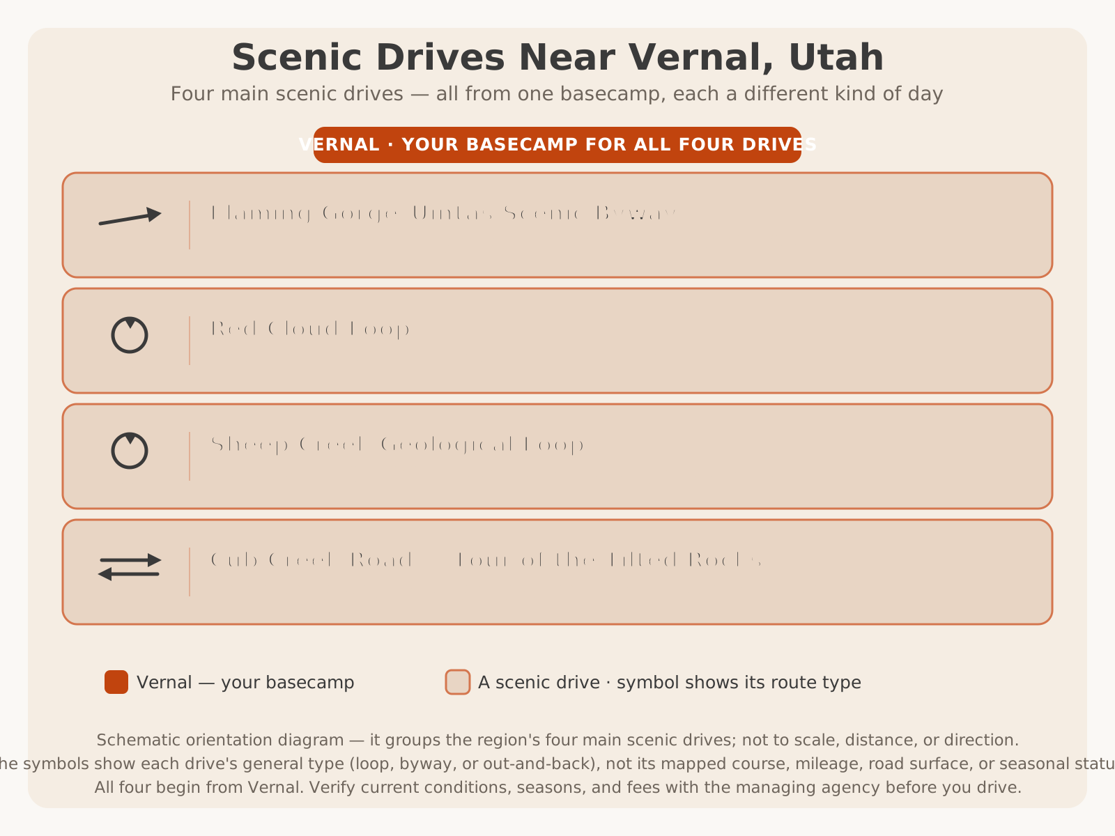
| Drive | Character | Known For | Rough Length | Best For |
|---|---|---|---|---|
| Flaming Gorge–Uintas Scenic Byway | Paved highway byway | Desert-to-forest-to-reservoir; geologic time signs | ~80+ miles | The complete full-day tour |
| Red Cloud Loop | Paved + improved gravel backway | Uinta high country, forest, reservoirs, solitude | ~70+ miles | Rugged half/full-day loop |
| Sheep Creek Geological Loop | Paved side loop (seasonal) | Dramatic tilted rock layers, canyon geology | ~13 miles | Short geology showcase |
| Cub Creek Road (Tour of the Tilted Rocks) | Paved + maintained dirt | Petroglyphs, dinosaur geology, Josie Morris cabin | ~10–11 miles one way | Dinosaur Monument, families |
| Harpers Corner Scenic Drive (DNM, CO side) | Paved monument road | Green/Yampa canyon overlooks | ~31 miles one way | Big canyon views |
| Vernal → Flaming Gorge (US-191) | Paved highway | Fast, scenic access to the reservoir | ~1 hour | Direct reservoir day trip |
| Vernal → Red Fleet / Steinaker | Paved highway | Red rock, water, quick and easy | ~5–15 min | Short outing, families |
Lengths are approximate and rounded; character and status change with construction, weather, and seasonal closures. VERIFY WITH OFFICIAL SOURCE (the U.S. Forest Service, National Park Service, Utah Department of Transportation, and Utah State Parks) for current distances, drive times, and road conditions on any route below.
The Flaming Gorge–Uintas Scenic Byway
If Dinosaur Country has one headline drive, this is it. The Flaming Gorge–Uintas National Scenic Byway follows US-191 north out of the Vernal area and up onto the flank of the Uinta Mountains, then connects via Utah SR-44 toward Flaming Gorge and the town of Manila. In a single, mostly paved run it climbs from high desert through juniper and sage into cool forested high country and then delivers you to the rim of one of the West's most dramatic red-rock reservoirs. It is a designated National Scenic Byway for good reason — few drives change scenery so completely, so quickly.
One of the byway's signature features is that it is, in effect, a drive through geologic time: as US-191 climbs the uplift, interpretive markers along the road identify the successive rock layers you pass and the immense spans of time they represent, so the drive doubles as an open-air geology lesson. Add in overlooks of the Uinta Mountains, forested stretches with wildlife, and the payoff of Flaming Gorge itself — the dam, the marinas, and canyon viewpoints — and you have the region's most complete scenic tour.
Plan on the better part of a day if you stop to enjoy it: the overlooks, the dam, a picnic, and a side trip or two to Sheep Creek or a reservoir viewpoint all add up. The byway is the paved backbone that many other drives branch off of, which makes it the natural first choice for a first-time visitor.
Driving the byway itself? Read the complete mile-by-mile guide to the Flaming Gorge–Uintas Scenic Byway for the best direction to drive, the "Drive Through the Ages" geologic-time signs in order, every overlook and stop, and ready-made half-day, full-day, and weekend itineraries.
The Red Cloud Loop
Where the byway is the polished paved tour, the Red Cloud Loop is the region's great backcountry drive. This Utah scenic backway loops north from the Vernal area up into the high country of Ashley National Forest and back, threading through forest, past mountain reservoirs, and along ridgelines with long views before dropping back toward town. Parts are paved and parts are improved gravel, and that mix is exactly what gives the loop its character: it feels like real high country, not a manicured overlook, and you will often have long stretches to yourself.
The loop rewards curiosity. It connects to side roads, trailheads, mountain reservoirs, and — in the Dry Fork area near its lower end — some of the region's notable rock-art sites. It is a favorite of travelers who want the forest, the wildlife, and the solitude of the Uintas without committing to a long hike, and it pairs naturally with fishing a high-country lake or a forest picnic along the way.
Because much of the loop is high, unpaved, and mountainous, it is a seasonal drive: it typically opens once the snow clears — often late spring through fall — and can be muddy, snowbound, or impassable outside that window. A higher-clearance vehicle is more comfortable on the gravel, and it is not the drive for a large RV or a low car.
Ready for the backcountry? Read the complete guide to driving the Red Cloud Loop for the route, seasonal timing, vehicle advice, wildlife and fall color, and ready-made half-day and full-day itineraries.
The Sheep Creek Geological Loop
Short, spectacular, and easy to add on, the Sheep Creek Geological Loop (through the Sheep Creek Canyon Geological Area) branches off the byway near Flaming Gorge and delivers an outsized dose of geology for its modest length. In roughly a dozen miles the loop winds through a canyon where the earth's crust has been dramatically tilted and folded, standing rock layers on end and exposing an enormous span of geologic history in the canyon walls. It is one of the most striking short drives in the region — a place where the forces that built these mountains are laid bare right beside the road.
The loop is a natural side trip from the Flaming Gorge–Uintas Byway: you can pull off, drive the canyon, take in the interpretive stops and viewpoints, and rejoin the main route without adding much to your day. For photographers and anyone curious about how this landscape came to be, it is a highlight out of all proportion to its size.
Like the region's other high, narrow drives, Sheep Creek is seasonal and can close in winter, and its winding canyon road is not ideal for large rigs. Because it sits in a steep canyon, it is also worth respecting weather — flash flooding and rockfall are canyon realities.
Adding the loop to your day? Read the complete guide to the Sheep Creek Geological Loop for the geological story, the interpretive stops, seasonal timing, vehicle tips, and how to combine it with a byway day.
Cub Creek Road: Tour of the Tilted Rocks
On the Utah side of Dinosaur National Monument, the Cub Creek Road — the self-guided auto tour often called the Tour of the Tilted Rocks — may be the single most rewarding short drive in the region for the sheer density of what you see. In roughly ten miles from the quarry area to the historic Josie Morris cabin, the drive strings together dramatically tilted rock layers, sweeping monument scenery, some of the area's finest Fremont petroglyphs, and a preserved homestead from the region's ranching past. It is dinosaurs, geology, ancient rock art, and pioneer history in one compact, family-friendly loop.
The road is largely paved with a maintained dirt section toward the end, and it is dotted with pullouts and short walks — to petroglyph panels, to viewpoints, to the cabin — which makes it easy to go at your own pace and let kids burn off energy between stops. It pairs perfectly with a visit to the monument's famous Quarry Exhibit Hall and its wall of dinosaur bones, turning a monument visit into a full, varied day.
Because it lies inside the monument, this drive requires paying the park entrance fee, and the petroglyphs and historic structures are fragile and protected — look, photograph, and never touch. For more on the rock art you'll see along the way, see our guide to petroglyphs and rock art near Vernal.
Touring the tilted rocks? Read the complete guide to driving Cub Creek Road for the self-guided auto-tour stops, the Fremont petroglyphs, the Josie Morris cabin, the geological story, and a half-day itinerary.
Dinosaur National Monument Scenic Drives
Dinosaur National Monument is enormous and spans the Utah–Colorado state line, and its scenic driving really comes in two distinct experiences on opposite sides of the monument. Knowing the difference saves a lot of confusion, because they are not close together by road.
On the Utah side, near the Quarry Visitor Center a short drive from Vernal, the star is the Cub Creek Road / Tour of the Tilted Rocks described above — the dinosaur-quarry, petroglyph, and homestead drive that most Vernal-based visitors do. It is the natural monument drive to pair with the famous quarry wall of bones.
On the Colorado side, reached from the town of Dinosaur, Colorado (well east of Vernal, on the far side of the monument), the marquee route is the Harpers Corner Scenic Drive. This paved monument road runs roughly thirty miles out to the Harpers Corner area, with a series of pullouts and overlooks gazing down into the deep canyons of the Green and Yampa rivers. It is a big-canyon, big-sky drive — the monument's grand overlook route — and it is a different, longer undertaking than the Utah-side Cub Creek loop. Note that this side has no dinosaur quarry; the fossils are on the Utah side, the canyon panoramas on the Colorado side.
Because the two sides are separated by the monument's rugged interior, you generally cannot quickly drive from one to the other inside the park — plan them as separate outings. For an overview of the monument, what to see, and how to plan a visit from Vernal, see our Ultimate Guide to Dinosaur National Monument and visiting Dinosaur National Monument. Road status, seasonal access, and fees change — VERIFY WITH OFFICIAL SOURCE (the National Park Service) before your trip.
Vernal to Flaming Gorge
The most-driven scenic route in the region is simply the run north from Vernal to Flaming Gorge on US-191. It is the fast, paved way to the reservoir — roughly an hour to the water — and it is scenic the whole way, climbing out of town through the geologic-time corridor of the byway and up onto the forested uplift before dropping toward the Gorge. You can treat it purely as access, or slow down and make the drive itself the attraction with stops at overlooks and interpretive signs.
This is the route for a straightforward reservoir day: drive up, spend the day boating, fishing, or sightseeing at Flaming Gorge, and drive home. Because it is a maintained paved highway, it handles RVs, trailers, and all vehicles, and it is generally drivable year-round with normal winter caution. For everything waiting at the other end — the dam, marinas, overlooks, and recreation areas — see the Ultimate Guide to Flaming Gorge, and to plan fishing the reservoir, our Dinosaur Country fishing guide. VERIFY WITH OFFICIAL SOURCE for current winter road conditions before a cold-season drive.
Vernal to Ashley National Forest
Head north and the land climbs into the Ashley National Forest and the Uinta Mountains, and the scenic driving turns green, cool, and high. There is no single "forest drive" so much as a network — the byway corridor, the Red Cloud Loop, forest roads to mountain reservoirs like Moon Lake and others, and countless side roads to trailheads and campgrounds. Together they make the forest one of the region's richest areas for unhurried scenic driving, particularly in summer and fall.
This is the country for travelers who want forest, wildlife, mountain water, and cool air — a welcome contrast to the high-desert heat below. Some routes are paved and easy; many of the best are improved gravel forest roads that reward a higher-clearance vehicle and a flexible schedule. Nearly all of the high forest driving is seasonal, opening as the snow melts and closing again with winter. Plan around that, carry the essentials for remote country, and see the Ashley National Forest guide for access and conditions. VERIFY WITH OFFICIAL SOURCE (the U.S. Forest Service) for current forest-road status and seasonal openings.
Vernal to Red Fleet and Steinaker
Not every scenic drive needs a full day. Just north of town, the short paved runs to Steinaker State Park (only a few minutes out) and Red Fleet State Park (a bit farther) are the region's easiest scenic outings — quick hops from Vernal that trade a desert highway for the sight of blue water set against dramatic red sandstone. They are ideal when you have an hour or an evening rather than a day, and they are among the most family-friendly drives here because the payoff comes fast and there is plenty to do at the other end.
Red Fleet in particular pairs a scenic drive with a genuine adventure: beyond the striking red "fleet" of sandstone fins that name the park, it is home to a famous dinosaur trackway you can reach by trail or paddle. Steinaker is the closest and easiest, a natural spot for a spontaneous evening drive, a swim, or a picnic. Both are paved, all-vehicle drives and the perfect low-commitment way to sample the region's scenery. See the Red Fleet and Steinaker guides for park details, and note both charge state-park day-use fees — VERIFY WITH OFFICIAL SOURCE for current fees and hours.
Choosing the Right Drive
With this many good options, the real question is which one fits your day. Use this quick decision guide to point yourself at the right route.
| If you want… | Drive… | Why |
|---|---|---|
| The one drive that shows it all | Flaming Gorge–Uintas Scenic Byway | Desert, forest, and reservoir in one paved full-day tour |
| Rugged high country and solitude | Red Cloud Loop | Forest, reservoirs, and long views with few other cars |
| Jaw-dropping geology, fast | Sheep Creek Geological Loop | Tilted, folded rock layers in a short canyon loop |
| Dinosaurs, rock art, and history | Cub Creek Road (DNM, Utah side) | Petroglyphs, geology, and a homestead in ten miles |
| Grand canyon overlooks | Harpers Corner Drive (DNM, Colorado side) | Overlooks into the Green and Yampa canyons |
| A quick, easy family outing | Vernal → Red Fleet or Steinaker | Red rock, water, and activities minutes from town |
| Cool forest and wildlife | Vernal → Ashley National Forest | High country, mountain reservoirs, shade, and animals |
Short on time? Do Cub Creek, Sheep Creek, or a Red Fleet/Steinaker hop. Have a full day? The byway, or a Red Cloud Loop. Chasing something specific — geology, wildlife, canyons, family ease? Match it above, then read that drive's section before you go.
Drive Difficulty
"Scenic drive" covers everything from a smooth paved highway to a remote gravel mountain loop, and knowing the difference keeps your day pleasant and your vehicle appropriate. Difficulty here is mostly about pavement, grades, narrowness, and remoteness — not danger, provided you drive to conditions and prepare.
| Drive | Surface | Difficulty | Notes |
|---|---|---|---|
| Vernal → Red Fleet / Steinaker | Paved | Easy | Short, gentle, all vehicles |
| Vernal → Flaming Gorge (US-191) | Paved | Easy | Highway grades; all vehicles; winter caution |
| Flaming Gorge–Uintas Byway | Paved | Easy–Moderate | Long, climbing; fine for RVs; a full day with stops |
| Harpers Corner Drive (DNM, CO) | Paved | Moderate | Long out-and-back; mountain road; far from Vernal |
| Cub Creek Road (DNM, Utah) | Paved + maintained dirt | Easy–Moderate | Short; dirt section near the end; park fee |
| Sheep Creek Geological Loop | Paved, narrow (seasonal) | Moderate | Winding canyon; not for large rigs; seasonal |
| Red Cloud Loop | Paved + improved gravel | Moderate–Harder | Remote, high, unpaved sections; seasonal; higher clearance better |
Difficulty is a general guide only and shifts with weather, construction, and maintenance. A dry gravel road in July is very different from the same road after a storm. VERIFY WITH OFFICIAL SOURCE for current conditions, and turn around if a road exceeds your vehicle or comfort.
Best Seasons
Season is the single biggest factor in what you can drive here, because elevation and pavement decide everything. Here is how the year unfolds for scenic driving.
| Season | Best Drives | What to Expect |
|---|---|---|
| Spring | Paved routes, Cub Creek, reservoir runs | Lower elevations green up; high country still snowbound; mud on unpaved roads |
| Summer | Everything, including the high loops | Peak season; all routes typically open; hot below, cool up high; afternoon thunderstorms |
| Fall | Byway, Red Cloud Loop, forest drives | Excellent color in the aspens; crisp air, thinner crowds; high routes begin to close |
| Winter | Maintained paved highways only | High and unpaved loops closed; snow and ice possible; carry winter gear |
Seasonal timing is general and shifts with elevation and weather year to year — a high loop may open in June one year and July the next. VERIFY WITH OFFICIAL SOURCE for current openings, closures, and conditions before a trip. For the region's month-by-month weather, see our Vernal weather guide. Fall deserves a special mention: the aspen and cottonwood color across the Uinta forests and along the byway and Red Cloud Loop makes autumn arguably the most photogenic season for driving here, if you time it before the high routes close.
Photography Stops
A scenic drive in Dinosaur Country is also a photography trip, and a little planning turns snapshots into keepers. These are the kinds of stops worth building a drive around.
- Flaming Gorge canyon overlooks. The classic red-canyon-over-blue-water shots come from the viewpoints near the dam and along SR-44 — best in warm, low light early and late in the day.
- Sheep Creek's tilted rock. The folded, upended rock layers are a geology photographer's dream; side light rakes across the strata and reveals the structure.
- Cub Creek petroglyphs. The Fremont rock-art panels near the end of the road photograph beautifully in soft, even light — shoot respectfully and never touch or chalk the art.
- Uinta forest and fall color. Along the byway and Red Cloud Loop, aspen stands in autumn and mountain reservoirs at first light are the standout subjects.
- High-desert badlands and big skies. The open stretches near town and toward the monument shine at golden hour, when low sun models the terrain and clouds build over the mountains.
- Wildlife at the edges of the day. Dawn and dusk in the forest are both the best light and the best odds for deer, elk, and moose — keep a long lens ready and stay in or beside the vehicle.
Two universal reminders: the best photographic light — the golden hours around sunrise and sunset — is also when wildlife moves and roads are quietest, so plan drives to be out early or late; and always pull completely off the road at a safe pullout to shoot, never stopping in a travel lane for a photo.
Wildlife Viewing
Scenic driving is one of the best ways to see wildlife here, because a slow-moving vehicle is a superb, non-threatening blind. The forested high country along the Flaming Gorge–Uintas Byway and the Red Cloud Loop offers the best odds: mule deer are common, elk range through the forest, and the region is genuine moose country — a highlight sighting for many visitors. Smaller mammals, raptors, and a wealth of birds round out the forest. Down in the high desert and along the reservoirs and rivers, watch for pronghorn on the flats, waterfowl on the water, and raptors, including the chance of eagles, hunting the open country.
The rules for good wildlife driving are simple and important. Animals are most active and visible at dawn and dusk, which is also when they are most likely to be on the road — drive slowly, stay alert, and be ready to stop. Never approach, feed, or crowd wildlife; use a zoom lens and stay in or right beside your vehicle. And remember that wildlife is never guaranteed and animals move seasonally and daily, so treat every sighting as a gift, not an expectation. Driving at dawn and dusk in animal country also means a real risk of collisions — slow down, especially in the forest, where a deer or moose can step into the road without warning.
Family-Friendly Drives
Scenic driving is one of the most family-friendly ways to experience this region, because it lets everyone see the country without the heat, distance, and effort of a big hike — and because the best family drives here are studded with things to stop and do. The winning formula is short driving segments broken up by frequent, kid-sized attractions.
The standout family drives are the Cub Creek Road in Dinosaur National Monument (petroglyphs to spot, a historic cabin to explore, dinosaur geology, and short walks — all in a compact loop paired with the quarry's wall of bones), and the quick hops to Red Fleet and Steinaker (fast payoff of red rock and water, with swimming, paddling, and Red Fleet's dinosaur trackway to turn a drive into an adventure). The Flaming Gorge–Uintas Byway works well too if you treat it as a series of stops — the geologic-time signs, overlooks, and the dam give kids a reason to get out and look.
A few tips make family driving here go smoothly: keep segments short and stops frequent, carry far more water and snacks than you think you need for the high-desert heat, plan around naps and meals, and let the day flex. For more kid-focused ideas around town, see fun things to do in Vernal with kids, and for packing specifics, our what to bring guide.
Half-Day Drives
Have a morning or an afternoon rather than a whole day? These make complete, satisfying half-day outings from a Vernal base.
- Cub Creek Road + the Quarry (Dinosaur National Monument). Tour the tilted rocks, petroglyphs, and Josie Morris cabin, and take in the famous wall of dinosaur bones — a rich half day close to town.
- Red Fleet & Steinaker loop. Combine both state parks in one easy paved outing north of town, with time for a swim, a picnic, or Red Fleet's dinosaur trackway.
- Sheep Creek Geological Loop as an add-on. If you are already near Flaming Gorge, the short geology loop is a perfect half-day highlight (seasonal — confirm it's open).
- A byway sampler. Drive the lower Flaming Gorge–Uintas Byway up into the forest for the geologic-time signs and overlooks, then turn back — you don't have to do the whole thing.
Full-Day Drives
With a full day, you can do a region's worth of scenery in a single loop or out-and-back.
- The complete Flaming Gorge–Uintas Byway. The signature full day: desert to forest to reservoir, with the dam, overlooks, and a Sheep Creek side loop, ending on the red-rock rim of the Gorge. Add a picnic or a short boat outing at the water. See the Flaming Gorge guide.
- The Red Cloud Loop. A full day of high-country forest, mountain reservoirs, and solitude, best in summer and early fall. Fuel up, carry essentials, and confirm it's open. See the Ashley National Forest guide.
- Dinosaur Monument, both drives — separately. Spend a full day on the Utah side (quarry + Cub Creek), or make the longer trek to the Colorado side for the Harpers Corner canyon overlooks. These are two different days, not one.
- A forest-and-water day. Combine a drive up into Ashley National Forest with fishing or a picnic at a mountain reservoir — the region's cool-country antidote to a hot day.
Weekend Road Trips
With two or three days you can chain the region's drives into a proper road trip and see it all without rushing.
The greatest-hits weekend. Day one, drive the full Flaming Gorge–Uintas Byway with the Sheep Creek loop and time at the reservoir. Day two, do Dinosaur National Monument — the quarry and Cub Creek Road on the Utah side. Add an optional third day for the Red Cloud Loop or a forest drive. Base in Vernal the whole time and sleep in the same bed.
The family weekend. Day one, the easy Red Fleet and Steinaker parks with swimming and the dinosaur trackway. Day two, Cub Creek Road and the quarry at the monument. Add an optional third day of other things to do around Vernal. Keep the driving segments short and the stops frequent. Coming in from the west? See our Salt Lake City to Vernal guide for the drive in.
The adventurer's weekend. Mix scenic driving with getting out of the car: a byway day, a Red Cloud Loop day, and a day trading four wheels for a guided backcountry UTV tour to reach country the paved roads never touch.
Vehicle and Road Conditions
The right vehicle depends entirely on the drive, and matching the two is the difference between a great day and a stressful one. Here is the honest breakdown by vehicle type.
RVs, trailers, and large vehicles. The paved highways — US-191 to Flaming Gorge and the main byway — are well-suited to big rigs, and Flaming Gorge has developed campgrounds and services. But narrow, winding, or unpaved routes — the Sheep Creek loop, the gravel sections of the Red Cloud Loop, and the dirt end of some monument roads — can be genuinely unsuitable for large RVs and trailers. Check length and road restrictions before committing a big vehicle to any unpaved or canyon route.
Motorcycles. The paved byway and canyon roads are a joy on two wheels — sweeping grades, changing scenery, and cool forest air — and the region is popular with riders. Watch for gravel, wildlife, sudden weather, and long gaps between services, and know that the unpaved loops are a different proposition best left to appropriate bikes and experienced riders.
Standard cars. Every paved drive here is fine for a normal passenger car with sensible caution. The improved-gravel and dirt sections — Red Cloud Loop, parts of Cub Creek, forest roads — are usually passable for a car when dry and well-maintained, but higher clearance is more comfortable, and any of them can deteriorate after weather.
Higher-clearance and 4WD vehicles. These open up the gravel loops and forest roads with the most confidence and are the best choice for the Red Cloud Loop and remote forest driving, especially outside the dry peak of summer.
Two constants apply to every vehicle: fuel up in Vernal or Manila before long drives, because services are sparse once you leave town; and never drive beyond conditions or your vehicle — a road that turns to mud, snow, or rough rock is a signal to turn around. Road conditions, closures, and vehicle restrictions change constantly, so VERIFY WITH OFFICIAL SOURCE before relying on any route.
Accessibility
Scenic driving is inherently one of the more accessible ways to experience this landscape, since so much of the reward comes from the car and from viewpoints close to parking. The most accessible experiences are the paved routes with developed pullouts and facilities: the Flaming Gorge–Uintas Byway and its overlooks, US-191 to the reservoir, the paved portions of the Dinosaur National Monument drives, and the developed state parks at Red Fleet and Steinaker, which generally offer accessible parking and facilities with day-use areas near parking. Many of the best views on these drives are visible from the vehicle or a short, near-parking walk.
By contrast, the unpaved loops, canyon roads, and forest routes — and the trails and rock-art panels that require walking over uneven ground — are more rugged and not uniformly accessible. Because specific accessible facilities, viewpoint access, and road conditions change by site and season, travelers with mobility needs should VERIFY WITH OFFICIAL SOURCE (the National Park Service, U.S. Forest Service, and Utah State Parks) for current provisions at a specific site before a visit.
Planning Tips
- Match the drive to your day. Decide how much time you have, the season, your interests, and your vehicle first, then pick the route using the tables above — don't just default to the nearest road.
- Verify conditions before every trip. Road status, closures, seasonal openings, drive times, fees, and permits change constantly and are set by the managing agencies. VERIFY WITH OFFICIAL SOURCE — never rely on last year's information or this guide's approximations.
- Fuel and supplies in town. Fill up in Vernal (or Manila near Flaming Gorge), carry more water than you expect to drink, and pack snacks — services are sparse once you leave.
- Respect the season and elevation. The high and unpaved loops are seasonal; assume they're closed in winter and shoulder seasons until you confirm otherwise.
- Drive dawn and dusk for light and wildlife — but slow down for animals on the road, and never stop in a travel lane for a photo; use pullouts.
- Bring layers and sun protection. You can go from high-desert heat to cool mountain forest in an hour; the weather and temperature change with elevation. See our what to bring guide and Vernal weather guide.
- Watch the sky in canyons and high country. Afternoon thunderstorms, flash flooding in canyons, and fast-changing mountain weather are real — plan drives for earlier in the day when storms threaten.
- Tell someone your plan on remote routes, and don't count on cell service in the backcountry.
Dinosaur Country rewards the traveler who plans a scenic drive rather than stumbling into one. Pick the route that fits your time, your season, your interests, and your vehicle; read that drive's section and its destination guide; fuel up in town; verify the current road conditions; and give yourself time to stop, look, and let the landscape change around you. Few places in the West offer this much variety through a windshield. And when you want to trade the pavement for country no road reaches, book a guided UTV tour with Adventure Tours Vernal and let Dave and Trudy show you the backcountry beyond the scenic drives.
Frequently Asked Questions
What is the best scenic drive near Vernal, Utah?
It depends on your time and interests. For the single most complete experience, the Flaming Gorge–Uintas National Scenic Byway climbs from high desert into forest and down to Flaming Gorge, and can fill a full day. For a rugged high-country loop, the Red Cloud Loop is hard to beat. For dramatic geology and red rock, the Sheep Creek Geological Loop and Dinosaur National Monument's Cub Creek Road are short, spectacular options close to their destinations. Choose by how much time you have, the season, and whether you want mountains, canyons, water, or wildlife.
How long is the Flaming Gorge–Uintas Scenic Byway?
The Flaming Gorge–Uintas National Scenic Byway is commonly cited at roughly 80-plus miles along US-191 and Utah SR-44, connecting the Vernal area over the flank of the Uinta Mountains to Flaming Gorge and Manila. With stops at overlooks, the dam, and side trips, most people spend the better part of a day on it. Distances and drive times change with construction and conditions, so VERIFY WITH OFFICIAL SOURCE before you go.
Are the scenic drives near Vernal open year-round?
Not all of them. The paved main routes — US-191 north to Flaming Gorge and the byway corridor — are generally maintained year-round but can close temporarily in winter storms. High-country and unpaved routes such as the Red Cloud Loop and the Sheep Creek Geological Loop typically close or become impassable in winter and open once the snow clears, often late spring through fall. Seasonal openings and closures change every year, so VERIFY WITH OFFICIAL SOURCE (the managing agency) before planning a trip.
Which scenic drives near Vernal are good for families?
The paved, shorter, and interpretive drives are the most family-friendly: the short hop to Red Fleet and Steinaker State Parks minutes north of town, the Cub Creek Road in Dinosaur National Monument (petroglyphs, a historic cabin, and dinosaur geology in a compact loop), and the scenic overlooks along the Flaming Gorge–Uintas Byway. They keep drive segments short, pack in things to stop and see, and have restrooms and facilities along the way.
Can you drive an RV or a large vehicle on these scenic drives?
The paved highways — US-191 to Flaming Gorge and the main byway — are suitable for RVs and trailers, and Flaming Gorge has developed campgrounds and services. Narrow, winding, or unpaved routes such as the Sheep Creek Geological Loop, the Red Cloud Loop, and the dirt end of some monument drives can be unsuitable for large rigs, trailers, or low-clearance vehicles. Always check current road status and vehicle restrictions with the managing agency before towing or driving a large vehicle. VERIFY WITH OFFICIAL SOURCE.
Do I need a permit or fee for these scenic drives?
The public highways and forest scenic backways generally do not charge a driving toll, but Dinosaur National Monument charges an entrance fee, and the state parks (Red Fleet, Steinaker) and some recreation areas at Flaming Gorge charge day-use or amenity fees. Fees, passes, and permit requirements change, so VERIFY WITH OFFICIAL SOURCE (the National Park Service, Utah State Parks, and the Forest Service) before your trip.
What is the best time of year for scenic driving in Dinosaur Country?
Late spring through fall is the broadest window: the high-country and unpaved loops are open, the weather is mild, and fall brings excellent color to the Uinta forests. Summer is peak season and the most reliable for high routes, though afternoon thunderstorms are common. Winter narrows you to the maintained paved highways and can add snow and ice. Conditions and openings vary every year — VERIFY WITH OFFICIAL SOURCE before you plan around a season.
Where can I see wildlife on scenic drives near Vernal?
The forested high country along the Flaming Gorge–Uintas Byway and the Red Cloud Loop offers chances at deer, elk, moose, and smaller mammals and birds, especially at dawn and dusk. The reservoirs and river corridors attract waterfowl and raptors, and the high-desert stretches have pronghorn and raptors. Wildlife is never guaranteed and animals move seasonally; drive slowly at dawn and dusk, watch for animals on the road, and never approach or feed wildlife.