Key Takeaways
- The most concentrated short drive in the region. Geology, Fremont rock art, canyon scenery, and pioneer history in roughly ten to eleven miles — a great deal of Dinosaur Country distilled into one road.
- It’s a self-guided auto tour. The Tour of the Tilted Rocks has numbered stops keyed to the monument’s official guide — pick one up first so you don’t drive past the best of it.
- The rock art is the headliner. The Fremont petroglyph panels near the road’s end — lizards, spirals, and figures on the cliffs — are among the finest and most accessible in the region. Look, photograph, never touch.
- Family-friendly and mostly paved. Short driving segments, frequent stops, box-canyon walks, and the dinosaur quarry nearby make it ideal for families — with a maintained dirt section near the end that turns slick when wet.
- Inside the monument, so verify the details. A park entrance fee applies, and fees, hours, road status, and interpretive stops are set by the National Park Service and change — confirm before every trip.
Why Drive Cub Creek Road
Most people come to the Utah side of Dinosaur National Monument for one thing: the wall of dinosaur bones in the Quarry Exhibit Hall. They see it, they’re rightly amazed — and then a surprising number of them drive back to town, never realizing that the best half day in the monument begins right where the quarry road keeps going. That road is Cub Creek Road, and the drive along it is the Tour of the Tilted Rocks, and it is the single most efficient way to understand what makes this corner of Utah extraordinary.
What sets Cub Creek apart from the region’s other great drives is density. The Flaming Gorge–Uintas Byway is a grand full-day sweep; the Red Cloud Loop is a long backcountry commitment. Cub Creek does something different — it packs four completely different stories into a drive short enough for a restless four-year-old. You watch the earth’s rock layers stand up on end along the shoulder of Split Mountain. You crane your neck at thousand-year-old Fremont petroglyphs carved high on sandstone cliffs. You walk into the cottonwood shade of a homestead cabin where a woman named Josie Bassett Morris — raised in Browns Park during its outlaw years — lived largely alone for about half a century. And it all unfolds beside the Green River, in the same country that entombed the dinosaurs whose bones you just saw. Deep time, ancient people, and living memory, all on one road.
It is also, frankly, the region’s best introduction to Dinosaur Country for families and first-time visitors. The driving is easy and mostly paved, the stops are short and varied, and the payoff at each one is immediate and visible — a lizard scratched into rock, a rusting cabin stove, a box canyon you can walk into in five minutes. Kids who would wilt on a long scenic drive stay engaged because something new happens every mile.
This guide is the definitive planning resource for driving Cub Creek Road well — the shape of the route, what to look for at each kind of stop, the geology and the rock art and the history, how to time it, what vehicle to bring, and how to see it all respectfully. It deliberately does not re-tell the whole Dinosaur National Monument guide or duplicate our dedicated petroglyphs and rock art guide — those cornerstones cover the monument and its rock art as destinations, and this article links to them rather than repeating them. Here, the drive itself is the subject. For how it fits among all the region’s routes, start with the Scenic Drives in Dinosaur Country pillar.
Route Overview
Cub Creek Road is refreshingly simple to plan, because it is a there-and-back drive, not a loop. It begins near the monument’s Quarry area — reached by the entrance road off US-40 near Jensen, east of Vernal — and runs out along Cub Creek to end at the Josie Morris cabin. You drive out, taking in the stops, and return the way you came, which means you get a second look at everything from the opposite direction (and the petroglyph light may be better on one leg than the other).
The distance is commonly cited at roughly ten to eleven miles one way, and the drive is mostly paved, with a maintained dirt or gravel section toward the far end near the cabin. It climbs and winds gently through high-desert and canyon terrain along the Green River and Cub Creek, past tilted rock formations, pullouts, petroglyph panels, and short walks. It is not a fast road and is not meant to be driven fast — the numbered stops of the self-guided tour are the reason to be here.
| Stretch | Character | What you’re doing |
|---|---|---|
| Quarry area to the open valley | Paved; dinosaur-quarry country opening into high desert | Leaving the Exhibit Hall area; first tilted-rock views of Split Mountain |
| Along the Green River / Cub Creek | Paved; canyon, river bottom, cottonwoods, tilted cliffs | Scenic driving; early auto-tour stops; geology and river views |
| The petroglyph cliffs | Cliffs rising above the road near the far end | Stopping for the Fremont rock-art panels — the drive’s headline |
| Road’s end at Josie’s | Maintained dirt/gravel; cottonwood flat below cliffs | The Josie Morris cabin and nearby box-canyon walks |
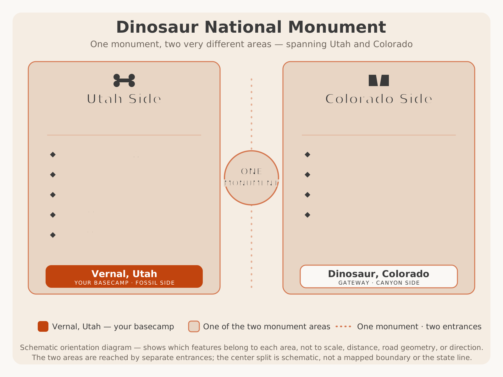
It helps to place this drive within the monument as a whole. Cub Creek Road is a Utah-side route — the fossil-and-history half near Vernal — while the monument’s other scenic drive, Harpers Corner, lies across on the Colorado canyon side, hours away and best saved for a separate day:
The Tour of the Tilted Rocks
The name is not marketing — it is geology you can read from the driver’s seat. The Tour of the Tilted Rocks is the monument’s self-guided auto tour, a sequence of numbered stops along Cub Creek Road keyed to a printed (and sometimes app or audio) guide that explains what you’re looking at, stop by stop. It is designed so that anyone, with no background in geology or archaeology, can drive the road and come away understanding the landscape. That’s the spirit to bring to it: this is a drive to take slowly, with the guide open, getting out at the stops rather than admiring them through the windshield.
The stops fall into a few kinds. There are geology stops, where pullouts and markers point out the tilted, upturned rock layers and explain how they got that way (see the Geological Story section below). There are scenic stops, framing Split Mountain, the Green River, and the canyon country. There are the petroglyph stops near the far end, where the Fremont panels are the reason to linger. And the road ends at the history stop — the Josie Morris cabin and its walks. A well-run visit moves unhurried from one to the next, treating the ten-odd miles as a half-day experience rather than a quick out-and-back.
Because the specific numbered stops, their markers, and any audio or app version are set by the monument and change over time, this guide describes the kinds of stops and what to look for rather than inventing stop numbers, mileposts, or exact locations. For the current, authoritative stop list, get the official guide at the visitor center. VERIFY WITH OFFICIAL SOURCE.
Fremont Rock Art
For many drivers, the petroglyphs are the reason to drive Cub Creek Road, and they deserve to be. Near the far end of the route, on the cliffs above the road, are some of the finest and most accessible panels of Fremont-culture rock art in the region — figures, spirals, and the celebrated lizard and reptile petroglyphs that have become an emblem of the monument. Pecked into the desert-varnished sandstone perhaps a thousand years ago, they are startlingly clear, sometimes larger than life, and set high enough on the rock to have survived the centuries remarkably well.
The Fremont were farming and foraging people who lived across this region roughly a thousand or more years ago, and Cub Creek was clearly a place that mattered to them — the combination of water, shelter, and workable stone. What the petroglyphs meant is not fully known, and honest interpretation resists tidy answers: they may mark territory, record events, express belief, or serve purposes we can no longer read. That mystery is part of standing beneath them. For the deeper story of who made this art and how to understand it, see our dedicated guide to petroglyphs and rock art near Vernal, which covers the Fremont, the panels, and viewing etiquette in full — this drive is where you go to see them.
Seeing them well takes a little care. Many panels sit above the road on the cliff face, so some reward binoculars or a zoom lens, and the best clarity often comes with raking, angled light rather than flat midday sun. The monument marks where to stop and look; follow those markers and stay on established pullouts and paths.
The Josie Morris Cabin
At the very end of Cub Creek Road, in a quiet cottonwood flat beneath the cliffs, stands the Josie Morris cabin — and it turns a scenic drive into a story. This was the homestead of Josie Bassett Morris, who settled here in the early twentieth century and lived on this spot largely alone for roughly half a century, running a small subsistence homestead — a garden, livestock, an orchard — miles from the nearest neighbor, into her old age. To stand in the cabin’s doorway and grasp that one woman built a life here, by herself, for that long, is to feel the whole human scale of this landscape in a way no overlook can deliver.
Josie’s story reaches back into the region’s frontier era. She came from the Bassett family of Browns Park, a ranching clan whose remote country and era brushed up against the outlaw history of the West — the kind of connections that have grown into local legend. Which threads are documented history and which are colorful lore is exactly the sort of detail to take from the monument’s own interpretation rather than repeat uncritically; the durable, verified core is remarkable enough: a self-reliant woman, a homestead at the end of the road, and about fifty years of a life lived on her own terms. For the specific dates, biography, and which stories the monument stands behind, VERIFY WITH OFFICIAL SOURCE (the National Park Service).
The site rewards getting out and walking. The cabin and grounds are yours to explore respectfully, and two nearby box canyons — short, easy walks up cottonwood-shaded draws that Josie is said to have used as natural corrals by fencing off their narrow mouths — make perfect leg-stretchers, especially for kids, at the end of the drive. It’s the natural place to turn around, eat a snack in the shade, and let the day settle before driving back out.
Canyon Scenery
Between its headline stops, Cub Creek Road is simply a beautiful desert drive. The route threads the country where Split Mountain and the Green River meet — a place where the river has sawed straight through a mountain, leaving cliffs, tilted ramparts of rock, and a green ribbon of cottonwood-lined river bottom running through dry, sculpted high desert. The contrast is the whole appeal: hard red-and-buff rock standing at improbable angles, and beneath it the soft green line of the river and creek, alive with birdsong.
The scenery shifts as you drive. Near the start you get the broad, open views toward Split Mountain’s tilted flank; along the middle stretches the road runs closer to the river and creek bottom, shaded and intimate; and toward the end the cliffs rise up beside the road, holding the petroglyphs and framing Josie’s cabin. It is compact, legible country — the kind where you can see the geology, the water, and the life it supports all in one frame — and it photographs beautifully in the low, warm light of early morning and late afternoon.
This is genuine high desert, though, and it asks the usual respect. Summer heat is real and largely shadeless along the drive, water sources along the way are not for drinking, and the river, for all its beauty, is cold and powerful and not a casual swimming hole. Enjoy the scenery fully — and carry water, sun protection, and good sense. For the region’s month-by-month weather, see our Vernal weather guide.
The Geological Story
The “tilted rocks” are not a metaphor — they are the literal subject of the drive, and understanding them turns pretty scenery into a story you can read. Across most of the world, rock layers lie roughly flat, stacked in the order they were deposited, oldest on the bottom. Along Cub Creek Road, they stand at steep angles, tilted and upturned, so that as you drive you pass across the layers rather than looking down through them — reading millions of years of Earth’s history sideways, one band of rock at a time.
The cause is the same great force that built this whole region: the slow, powerful uplift of the Uinta Mountains, one of the few major ranges in North America that runs east–west. As that uplift heaved the crust upward, it bent and tilted the once-flat sedimentary layers along its flanks, standing them on end here on the shoulder of Split Mountain. Then the Green River went to work, cutting down through the tilted layers — even carving directly through Split Mountain itself rather than going around it — and exposing the upturned edges of the rock in cliffs and ridges beside the road. Tilting by the mountains, then slicing by the river: that two-part story is written all along the drive.
It is also, of course, why the dinosaurs are here. The same tilting that stood these layers up is what brought the fossil-bearing rock of the famous quarry to the surface at an angle, letting erosion expose the bone bed you can see in the Quarry Exhibit Hall. Geology, fossils, river, and scenery are all the same story here — which is exactly what the self-guided tour is built to help you see.
Wildlife Viewing
Because Cub Creek Road follows water through the desert, it is quietly excellent wildlife country — the river and creek corridor draws animals that the surrounding dry country can’t support, and a slow drive with frequent stops is a fine way to see them. The cottonwood bottoms and riverside are the richest zones: watch for mule deer browsing in the shade, a wealth of birds in the trees and along the water, and, on the cliffs and thermals above, raptors riding the air.
The mix of habitats along the drive — river bottom, brushy slopes, open desert, and cliff faces — supports a real variety of life. Lizards basking on warm rock (a fitting echo of the petroglyphs above them), smaller mammals, and a range of desert and riparian birds are all part of the cast, and the open country back toward the monument entrance can turn up pronghorn and hunting raptors. As always, wildlife is a matter of luck and timing, not a guarantee.
The rules are the familiar ones, and they matter. Animals are most active and visible at dawn and dusk, which is also the best light for the drive — an argument for going early or late. Never approach, feed, or crowd wildlife; watch from the road or a pullout and use a zoom lens. And drive at a pace that lets you stop for an animal on the road — this is a slow tour, not a commute. Give every creature room, and treat a good sighting as the gift it is.
Photography Tips
Cub Creek Road is a photographer’s favorite precisely because it offers so many different subjects in a short distance — geology, rock art, historic architecture, canyon landscape, wildlife, and river light, all within ten miles. A little planning around light turns a good drive into a great shoot.
- Shoot the golden hours. Early morning and late afternoon light flatters everything here — warm on the tilted cliffs, soft on the petroglyphs, long across the desert. Midday sun is flat and harsh; the edges of the day are the payoff.
- Watch the light on the rock art. The Fremont panels read best with angled, raking light that brings out the pecked lines against the varnished rock, and in soft, even light rather than glare. The two directions of an out-and-back drive give you two shots at good light on the panels.
- Bring a zoom for the panels — and the wildlife. Many petroglyphs sit high on the cliff; a telephoto lets you fill the frame respectfully from the pullout without touching or approaching the rock. The same lens earns its place for deer, birds, and raptors.
- Frame the tilted geology. Compose to show the angle of the rock — a level horizon against steeply tilted layers tells the whole geological story in one frame. Split Mountain and the upturned cliffs are the signature shots.
- Use the river and cottonwoods. The green river-bottom line against dry rock, especially with fall cottonwood gold, is one of the drive’s best landscape subjects.
- Photograph the cabin as a story. Josie’s cabin in its cottonwood flat, shot in soft light, carries the human scale of the whole drive — interiors, the stove, the setting beneath the cliffs.
Family Considerations
Cub Creek Road is, quite simply, one of the best family drives in Dinosaur Country, and it earns that on design. The winning formula for kids — short driving segments broken up by frequent, hands-on stops — is exactly what this road offers. The petroglyphs become a treasure hunt (“who can spot the lizard?”), the cabin is a real pioneer home to explore, the box-canyon walks burn off energy, and the whole thing pairs with the wall of dinosaur bones at the quarry. Deep time, ancient art, and pioneer grit, in doses a child can absorb.
To make it work, treat it as a relaxed half day, not a checklist. Let kids get out at the stops, walk the short box canyons, and take their time with the rock art. Bring the usual high-desert kit — far more water than you think you need, snacks, sun protection, and hats, because the drive is hot and largely shadeless in summer — and plan around naps and meals. Pack binoculars so kids can spot the higher petroglyphs, and consider making a game of the numbered auto-tour stops.
The cautions are common-sense but real. Watch children near the cliffs and below the petroglyphs (no climbing — for their safety and the art’s), keep them back from the cold, powerful Green River, and mind footing on the box-canyon walks. Reinforce the look-don’t-touch rule at the rock art before you arrive, so it’s understood. Done this way, Cub Creek is the rare drive that genuinely delights a range of ages at once. For more kid-focused ideas around the region, see things to do in Vernal.
Accessibility
Scenic driving is one of the more accessible ways to experience this landscape, and Cub Creek Road is friendlier than most of the region’s drives because so much of it is paved and close to the car. Many of the tilted-rock and scenic views, and some of the petroglyph viewing, come from the road and its pullouts, so a traveler who cannot manage rough trails can still experience a great deal of the drive from the vehicle and from short movements near parking.
That said, some of the drive’s rewards involve uneven ground and looking up. The petroglyph panels are on cliffs and are best appreciated by getting out and often gazing upward; the box-canyon walks near Josie’s cabin cross natural, uneven desert ground; and the dirt section near the road’s end is a different surface from the paved miles. Accessible facilities at the visitor center, restrooms, and specific stops vary, and the monument is the authority on exactly what is accessible where.
Because specific accessible facilities, pullout access, trail surfaces, and current road conditions change, travelers with mobility needs should VERIFY WITH OFFICIAL SOURCE (the National Park Service) for the current accessible provisions at the Quarry Visitor Center and along Cub Creek Road before a visit. As a general matter, the paved portions and roadside stops are the most accessible part of the experience, and a great deal of the drive’s geology, scenery, and even some rock-art viewing can be enjoyed without leaving the immediate area of the car.
Vehicle Advice
Matching your vehicle to Cub Creek Road is easy, because for most of its length it is a gentle, paved scenic road — but the honest guidance still turns on that dirt section near the end and on the weather.
Passenger cars are the natural vehicle for this drive. The paved miles are easy, and in dry conditions the maintained dirt or gravel section toward Josie’s cabin is normally fine for an ordinary car driven slowly and carefully. This is a family scenic drive, not an off-road route — a standard car handles it well the great majority of the time.
Higher-clearance and 4WD vehicles aren’t necessary in good weather, but they add margin on the dirt section and after rain, when the unpaved end can turn slick. If you happen to be driving one, you’ll simply have more confidence on that final stretch — but you don’t need one to do the drive.
RVs, trailers, and large vehicles need more thought. The paved portion is generally manageable, but the narrow, winding character near the end and the dirt section are poorly suited to big rigs and trailers, and turning around at the road’s end can be tight. Many RV travelers drive the paved majority and are cautious about — or skip — the final unpaved stretch. Check current conditions and any restrictions, and consider leaving a large rig at the visitor center or campground and driving the tour in a smaller vehicle if you have one.
| Passenger car | RV / Trailer | Motorcycle | |
|---|---|---|---|
| Paved portion | Ideal — easy and comfortable | Generally manageable; drive slowly | Enjoyable — scenic, gentle grades |
| Dirt section (end) | Fine when dry; slick when wet | Poorly suited; tight turnaround | Fine when dry; caution on loose/wet surface |
| Main concern | Wet dirt; low clearance in mud | Length, narrowness, turnaround | Loose surface, gravel, wildlife |
| Best strategy | Go in dry conditions; drive slow | Drive paved part; be cautious past pavement | Watch the surface and the weather |
Seasonal Advice
Cub Creek Road is a lower, more accessible drive than the region’s high-country loops, so it has a longer usable season — but season still shapes the experience, mostly through heat, the dirt section, and monument hours. Here is the year at a glance.
| Season | What to expect | Notes |
|---|---|---|
| Spring | Mild temperatures, green river bottom, fine light | One of the best times; watch for mud on the dirt end after storms |
| Summer | Reliable access; hot and largely shadeless | Go early or late; carry ample water; watch afternoon storms and flash-flood risk in canyons |
| Fall | Cottonwood gold, crisp air, excellent light — arguably the best | Superb for photography; cooler and more comfortable than summer |
| Winter | Quiet and stark; access variable | Dirt end can be muddy, snowy, or impassable; reduced hours and services — verify |
Spring and fall are the sweet spots — mild, colorful, and comfortable, with the best light for both the scenery and the rock art. Summer is entirely doable and the most reliable for access, but the drive is hot and shadeless, so go in the cool of morning or evening, carry plenty of water, and keep an eye on afternoon thunderstorms (and stay out of narrow drainages and box canyons if storms threaten — desert canyons flash-flood). Winter turns the drive quiet and stark and can be beautiful, but the dirt end may be impassable and hours are reduced — confirm before you go.
Half-Day Itinerary
The classic way to experience Cub Creek Road is as a half day, and it pairs naturally with the quarry to fill a full one. Here is a relaxed, do-it-right plan.
The plan: Start at the Quarry Visitor Center in the morning — pay the entrance fee, pick up the official Tour of the Tilted Rocks auto-tour guide, use the restrooms, and fill water bottles. If you haven’t already, take in the Quarry Exhibit Hall and its wall of dinosaur bones first (this is what turns the half day into a full one). Then drive Cub Creek Road outbound, following the numbered stops: pause at the geology and scenic pullouts to read the tilted rocks and frame Split Mountain, then give real time to the Fremont petroglyph panels near the far end — binoculars out, zoom lens ready, necks craned. Finish at the Josie Morris cabin, exploring the homestead and walking one of the short box canyons in the cottonwood shade. Eat a snack, let it all sink in, and drive back out — catching everything a second time in different light.
This gives you geology, world-class rock art, canyon scenery, pioneer history, and a couple of easy walks in a compact, family-friendly package. To extend it into a full day, linger longer at the quarry, add a picnic, and take your time on the return; the drive rewards an unhurried pace. VERIFY WITH OFFICIAL SOURCE that the road (and especially the dirt section) is open and in good shape before you go.
| Half day | Full day | |
|---|---|---|
| Focus | The Cub Creek drive and its stops | Cub Creek drive + Quarry Exhibit Hall + more |
| Pace | Steady, unhurried out-and-back | Leisurely; linger at each stop, add a picnic |
| Best for | A focused morning or afternoon | First-timers wanting the complete monument day |
| Add-ons | Box-canyon walks at Josie’s | Quarry, picnic, extra time on the river bottom |
How Cub Creek Road Compares
Cub Creek is one of several great drives in Dinosaur Country, and knowing how it differs from its siblings helps you choose the right one — or the right order across a trip. Two comparisons come up most.
Cub Creek Road vs Sheep Creek Geological Loop
These two are the region’s short, spectacular geology drives, but they tell different stories. The Sheep Creek Geological Loop is a pure geology showcase — a seasonal canyon loop near Flaming Gorge where rock layers stand folded and on end, best added to a byway day. Cub Creek shares the tilted-rock theme but adds rock art, pioneer history, and the dinosaur quarry, all inside Dinosaur National Monument. Sheep Creek is geology distilled; Cub Creek is geology plus human history and fossils in one family-friendly package.
| Cub Creek Road | Sheep Creek Geological Loop | |
|---|---|---|
| Length | ~10–11 miles one way (out-and-back) | ~13-mile loop |
| Star attraction | Petroglyphs, tilted rocks, Josie’s cabin | Dramatically tilted and folded rock |
| Also offers | Fremont rock art, pioneer history, dinosaur quarry nearby | Canyon scenery, a rushing creek, interpretive stops |
| Surface | Mostly paved; dirt section at the end | Narrow, winding; mixed surface |
| Season | Long — spring through fall, often more | Seasonal; typically closed in winter |
| Fee | Park entrance fee (inside the monument) | Generally no driving toll (forest fees may apply at sites) |
| Best for | Families, history and rock art, first-timers | Geology, photography, a quick spectacular |
Cub Creek Road vs Red Cloud Loop
This is the contrast between a short interpretive drive and a long backcountry loop. The Red Cloud Loop is a remote, seasonal, part-gravel half-to-full-day circuit through the high forest of Ashley National Forest — solitude, wildlife, and fall color, for travelers ready for a bigger, wilder day. Cub Creek is its near-opposite: short, paved, interpretive, and family-friendly, dense with things to see and close to town. Choose Cub Creek for history, rock art, and an easy rich half day; choose Red Cloud for high-country remoteness and forest.
| Cub Creek Road | Red Cloud Loop | |
|---|---|---|
| Length & time | ~10–11 miles; a half day | ~70+ miles; a half to full day |
| Character | Short, paved, interpretive, family-friendly | Long, remote, part-gravel, backcountry |
| Star attraction | Petroglyphs, geology, pioneer history | High forest, reservoirs, solitude, fall color |
| Setting | Dinosaur National Monument, near town | Ashley National Forest high country |
| Services | Visitor center at the start; none on the road | None on the loop — remote |
| Best for | Families, history, rock art, first-timers | Adventurous drivers, wildlife, autumn color |
For the full menu of how these drives fit together — plus the Flaming Gorge–Uintas Byway and the monument’s Colorado-side overlooks — see the Scenic Drives in Dinosaur Country pillar.
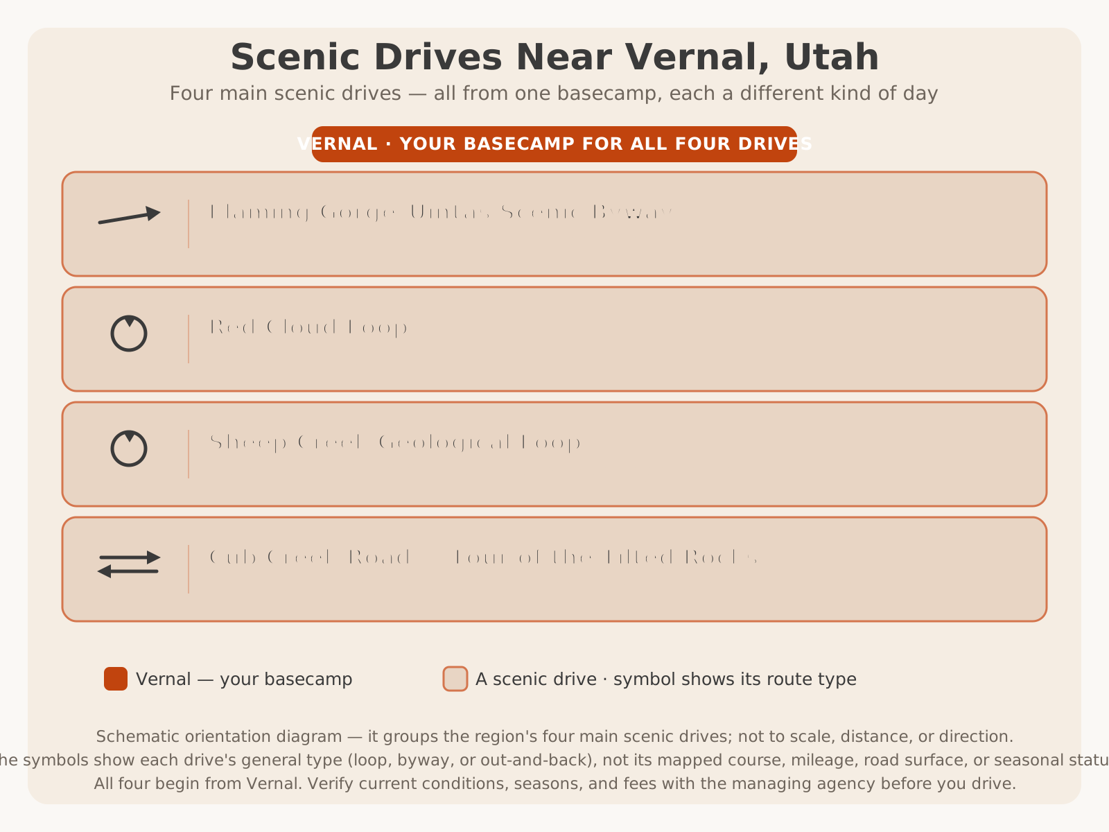
Here’s where Cub Creek fits among the region’s four main scenic drives — the monument’s out-and-back on the Utah side:
Planning Tips
A great Cub Creek Road drive comes down to a few simple moves. Keep these in mind:
- Start at the visitor center and get the auto-tour guide. The numbered stops are keyed to the official Tour of the Tilted Rocks guide — pick it up (and confirm it’s available), use the restrooms, and fill water bottles first. VERIFY WITH OFFICIAL SOURCE.
- Budget a half day, or a full one with the quarry. This is a slow, stop-often tour, not a quick out-and-back. Pair it with the Quarry Exhibit Hall for a complete monument day.
- Pay the park entrance fee (or bring your pass). Cub Creek Road is inside the monument; an entrance fee applies. Confirm current fees and pass acceptance before you go.
- Check the dirt section and the weather. The paved miles are easy; the unpaved end turns slick when wet. Confirm current road status, and avoid narrow canyons if storms threaten.
- Carry ample water and sun protection. The drive is hot and largely shadeless in summer, and there are no services on the road. See our what to bring guide and Vernal weather guide.
- Bring binoculars and a zoom lens. Many petroglyphs sit high on the cliffs — optics let you see and photograph them well without touching or approaching the rock.
- Protect the rock art and the cabin. Never touch, chalk, wet, or climb to a petroglyph; explore the homestead respectfully and leave everything as you found it.
- Go early or late for light, wildlife, and cooler air — and drive slowly enough to stop for both animals and the numbered stops.
Coming from out of town? If you’re driving in from the Wasatch Front, our Salt Lake City to Vernal guide covers the approach. For the monument as a whole, start with the Ultimate Guide to Dinosaur National Monument and visiting Dinosaur National Monument; for the rock art in depth, our guide to petroglyphs and rock art near Vernal; and to base your trip, the Ultimate Guide to Vernal.
Final Planning Notes
Cub Creek Road proves that a great drive doesn’t have to be a long one. In roughly ten miles it delivers what many far bigger trips can’t — a legible lesson in geology, a gallery of thousand-year-old Fremont rock art, the human story of a woman’s homestead at the end of the road, and canyon scenery along the Green River — all on an easy, mostly paved route a family can do in a half day. It is the drive that ties the whole monument together, turning the famous wall of bones into just the first chapter of a much richer story.
Do it right: start at the visitor center, get the auto-tour guide, go slowly, protect the fragile things you’ve come to see, and give yourself time to stop. Then let the tilted rocks, the lizards on the cliff, and Josie’s cabin do what they’ve done for every traveler before you — make the deep time and long human history of this country feel, for an afternoon, close enough to touch.
For the region’s other geology showcase, see the Sheep Creek Geological Loop; for a longer backcountry drive, the Red Cloud Loop; and for the grand paved tour, the Flaming Gorge–Uintas Scenic Byway. To see how Cub Creek Road fits among all the region’s great drives, return to the Scenic Drives in Dinosaur Country pillar. And when you’re ready to trade the pavement for country no road reaches — the backcountry beyond the monument — book a guided UTV tour with Adventure Tours Vernal and let Dave and Trudy show you Dinosaur Country from the seat of a side-by-side.