Key Takeaways
- It is a geology showcase, not a long drive. Short in miles, enormous in what it reveals — tilted and folded rock layers along a great fault, exposing hundreds of millions of years of Earth’s history right beside the road.
- Think of it as a branch, not a trunk. The loop hangs off the paved Flaming Gorge–Uintas Byway near the reservoir; most people add it to a byway day when it is open.
- Drive it slowly. The road is narrow, winding, and steep in places — the reward is in stopping at the pullouts and reading the rock, not in covering miles.
- It is seasonal and vehicle-sensitive. Typically open late spring through fall, closed or impassable in winter, and not suited to large RVs or trailers. Confirm before you turn off.
- Verify the changing details. Distances, road surface, closures, interpretive-stop specifics, campground availability, and fees change year to year and storm to storm — confirm with the U.S. Forest Service before you rely on any of them.
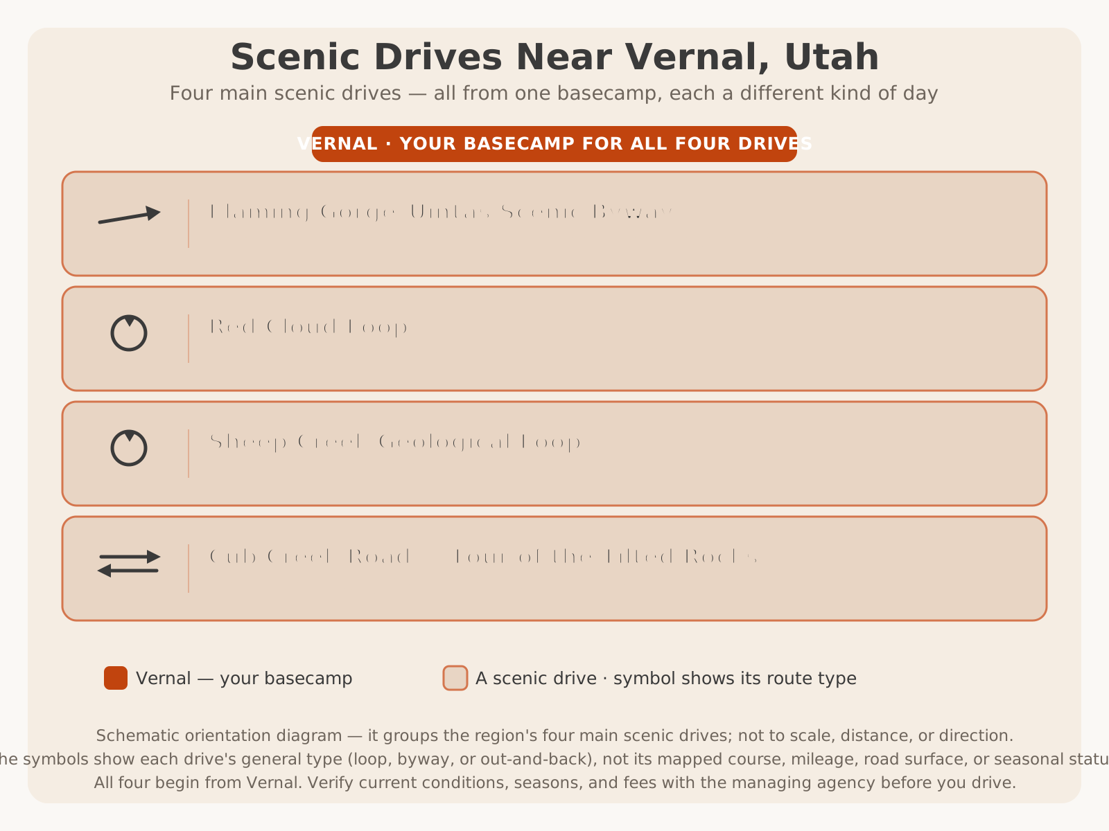
Here’s where Sheep Creek fits among the region’s four main scenic drives — the short geology-showcase loop:
Why Drive Sheep Creek
Most scenic drives ask you to look at the landscape. Sheep Creek asks you to look into it — into the layers, the folds, and the raw machinery of how a mountain range gets built. That is what makes this short loop worth going out of your way for. In the space of a few miles, the canyon walls rise around you with their rock layers bent, tilted, and standing nearly vertical, as if a giant had grabbed the edge of the earth and heaved it upward. Almost nowhere else in Dinosaur Country is the deep structure of the land so nakedly on display, so close to the car.
The loop earns its “geological” name honestly. It sits on the north flank of the Uinta Mountains, one of the few major mountain ranges in North America that runs east–west, and it crosses the great fault that helped lift them. That single fact is why the rock here behaves so dramatically — and why the Forest Service set the canyon aside as a designated geological area. You do not need a geology degree to feel it. You simply drive in, look up, and the sheer strangeness of rock standing on end does the rest.
But Sheep Creek is not only for geology enthusiasts. It is a genuinely beautiful, intimate canyon drive — a rushing creek, shaded pockets of forest, towering cliffs, and the constant sense of being deep inside something. It is a photographer’s dream, a family’s adventure, and a quiet counterpoint to the big, open scenery of the main byway. This guide is the definitive planning resource for driving it well: what you are seeing and why, where to stop, how to time it, what vehicle suits it, and how to fold it into a bigger Flaming Gorge day.
One thing this article deliberately does not do is re-tell the whole Flaming Gorge–Uintas Byway. That drive — the long paved climb from Vernal, the “Drive Through the Ages” roadside signs on US-191, the dam, the reservoir overlooks — has its own complete mile-by-mile guide. This one owns the loop. For the bigger regional picture and where this drive fits among all the others, start with the Scenic Drives in Dinosaur Country pillar and our Ultimate Guide to Vernal.
Route Overview
Before you turn off the highway, it helps to understand the shape of what you are getting into, because the loop is a very different animal from the road that feeds it.
The Sheep Creek Geological Loop branches off Utah SR-44, the western arm of the Flaming Gorge–Uintas Byway that runs between the Greendale area (near the US-191 junction at the top of the climb) and the town of Manila at the reservoir’s north end. You leave the wide, maintained highway, drop into the Sheep Creek drainage, follow the canyon and its creek past the tilted rock and interpretive stops, and climb back out to rejoin SR-44 — a loop, so you do not backtrack. Because both ends tie into SR-44, it slots neatly into a byway day: pull off, drive the canyon, and rejoin the main route.
The loop is short — commonly cited at roughly a dozen miles — but it drives far slower than that number suggests, because it is narrow, winding, and made for stopping. Do not judge it by mileage; judge it by the hour or two you will actually spend once the pullouts start pulling you in.
| Segment | Character | What you’re doing |
|---|---|---|
| Turnoff from SR-44 | Leaving the wide paved byway | Slowing down, dropping toward the drainage |
| Into the canyon | Narrowing walls, creek, tilted rock begins | First interpretive stops; the geology reveals itself |
| The canyon core | Dramatic folded and upended rock layers, cliffs | The headline stops — read, look up, photograph |
| Climbing back out | Forest and creek, gaining elevation | Final overlooks; rejoining SR-44 |
The Geological Story
If you read one section of this guide before you drive, make it this one — because understanding what you are looking at transforms Sheep Creek from a pretty canyon into one of the most jaw-dropping short drives in the West.
Here is the story in plain terms. The Uinta Mountains are unusual: while most North American ranges run north–south, the Uintas run east–west, a long uplift cored by very ancient rock. Millions of years ago, immense forces pushed this block of crust upward. As it rose, the rock layers that had been lying flat — deposited one atop another over hundreds of millions of years — got bent, tilted, and in places shoved nearly vertical along the great faults that bound the uplift. Sheep Creek Canyon cuts right across that structure, so instead of the neat horizontal layer-cake you see in most canyons, you get rock standing on edge, folded, and dramatically deformed.
The result is that a short drive through the canyon is, in effect, a cross-section through deep time and deep structure at once. The oldest, most ancient rock — the hard, resistant core of the Uinta uplift — is exposed alongside younger layers that were later draped over and around it, all of it caught in the act of being lifted and broken. Where a normal roadcut shows you a page of Earth’s history, Sheep Creek shows you the whole book, spine cracked open and pages fanned.
This is exactly why the canyon is a designated geological area and why it draws geologists, students, and curious travelers from far beyond the region. It is the natural companion to the byway’s famous “Drive Through the Ages” roadside geology lesson on US-191: where those signs walk you forward and backward through time as you climb, Sheep Creek shows you the structure — the faulting and folding — that put all that time on such spectacular display. Drive the byway’s time signs and then the Sheep Creek loop, and you have had about as complete a roadside geology education as any drive in America offers.
A note of respect: the canyon’s history
Sheep Creek’s beauty comes with a sober lesson worth carrying with you. This is a steep, narrow canyon with a creek at the bottom, and canyons like it can flood violently and without warning when storms hit the high country above. The canyon has a documented history of a deadly flash flood decades ago, and that history is exactly why every seasoned local treats canyon weather here seriously. You do not need to be afraid to drive Sheep Creek — you need to respect it: watch the sky, avoid the canyon when thunderstorms threaten, and never camp or linger in a low creekside spot when weather is building. For the specifics of that history and any interpretive memorial in the canyon, VERIFY WITH OFFICIAL SOURCE.
Major Stops
You could drive Sheep Creek without stopping and still be impressed — but the stops are the entire point, and they come fast in such a short canyon. Treat the list below as a menu of the kinds of stops you will encounter, roughly in the order the canyon delivers them. Because named sites, their signage, and their access change, this guide describes what to look for rather than inventing specific mileposts; for exact, current stop names and locations, VERIFY WITH OFFICIAL SOURCE.
- The first tilted-rock reveal. Not far in, the canyon walls start doing something your eye is not used to — layers leaning, then standing on end. The first pullout where this becomes obvious is the “oh, that’s what this is” moment. Stop and look up.
- Interpretive pullouts. The canyon is dotted with signed stops explaining the geology, the fault, and the formations. These are the heart of the drive — each one you actually read makes the next mile richer.
- The canyon core cliffs and folds. The most dramatic upended and folded rock is the loop’s climax — towering walls of deformed strata that photograph beautifully and humble you in person.
- The creek and its crossings. Sheep Creek itself is a constant companion — rushing water, shade, cottonwoods, and cooler air, a pleasant contrast to the exposed rock.
- Developed recreation and picnic sites. The canyon has developed sites for a break, a picnic, or (seasonally) camping. Availability, open dates, and fees change every year — never assume a site is open or has space; VERIFY WITH OFFICIAL SOURCE.
- Overlooks where the canyon opens up. As the loop climbs back toward SR-44, watch for viewpoints that pull the whole canyon and its structure into one frame.
Scenic Overlooks
Sheep Creek’s overlooks are a different species from the byway’s. On the main Flaming Gorge–Uintas Byway, the great overlooks look down and out — over the rim of the red canyon to the reservoir far below, or across the whole Uinta Basin. Sheep Creek’s views are intimate and vertical: you are inside the canyon, looking up at walls of tilted rock, or catching a sudden frame where the structure of the whole canyon lines up at once.
That intimacy is the appeal. Where the reservoir overlooks give you scale and distance, Sheep Creek gives you texture and immediacy — the grain of the rock, the angle of the layers, the play of light and shadow across a cliff face a stone’s throw away. The best viewpoints tend to come where the canyon bends or opens, giving you a clean line of sight along the walls, and where the loop climbs back out, offering a look back over the canyon you just drove.
Because specific overlooks and pullouts open, close, and change access with season, weather, and maintenance — and because a viewpoint that dazzles in clear morning light can be flat and gray under midday sun or socked in by weather — treat named viewpoints as subject to change and drive to whichever ones you can reach. VERIFY WITH OFFICIAL SOURCE (the U.S. Forest Service) for which overlooks and facilities are currently open. On a canyon drive this concentrated, there is no bad view — only better light.
Wildlife Viewing
A slow drive through a quiet canyon is one of the better wildlife blinds there is, and Sheep Creek’s mix of creek, forest, cliff, and rock rewards a watchful eye. As you move through the canyon, watch the forest edges and openings for mule deer, and know that the broader high country around the loop is genuine elk and moose country — a moose in the willows along a creek is the kind of sighting that outlasts the memory of any overlook. The canyon’s cliffs and rocky slopes are exactly the sort of terrain that can hold bighorn-type rocky-country wildlife and raptors, and along the water you may find smaller mammals and a variety of birds.
The rules for wildlife driving are simple and worth taking to heart. Animals are most active and visible at dawn and dusk, which is also when they are most likely to be in or near the road — so drive slowly at the edges of the day and be ready to stop. Never approach, feed, or crowd wildlife; use a zoom lens and watch from the vehicle. And treat every sighting as luck, not a promise — animals move seasonally and daily, and no drive can guarantee them. On a narrow canyon road, a deer stepping out on a blind curve is a real hazard as well as a thrill, so keep your speed down where cover is close to the pavement.
For travelers building a broader wildlife-focused trip, the forested high country of Ashley National Forest and the reservoir and river corridors around Flaming Gorge add more habitat and more chances — Sheep Creek is one excellent stop in a region full of them.
Photography Tips
Sheep Creek is one of the most photogenic short drives in the region, but it is a light-dependent canyon, and a little timing turns snapshots into portfolio frames. Because you are shooting inside a canyon with tall, tilted walls, the light behaves differently here than out on the open byway — the canyon can be in deep shade when the rim is blazing, and the angle of the sun dramatically changes how the rock reads.
- Chase raking side light. The tilted and folded rock layers reveal their structure best under low, angled light — early and late in the day — when shadows rake across the strata and pick out every fold. Flat midday sun is the enemy of this subject; it erases the very texture you came for.
- Work the canyon’s shade and contrast. Deep canyon shade against sunlit upper walls creates dramatic contrast; expose for the rock you care about, and consider returning at a different hour if the light is fighting you.
- Frame the structure. Look for compositions where the angle of the layers is the subject — a diagonal of upended rock, a fold caught mid-bend. This is a geology-portrait drive more than a grand-vista drive.
- Use the creek. Rushing water, cottonwoods, and reflections add life and a sense of place; a slower shutter can silk the water if you have a way to steady the camera.
- Keep a long lens ready. For wildlife at the edges of the day and for isolating details high on a cliff face, a zoom earns its place.
- Watch the sky for drama. Clouds building over the canyon rim can transform a shot — but the same building weather is your cue to be cautious about canyon flooding (see the geology section).
Family Considerations
Sheep Creek can be a genuinely great family drive, because it delivers big drama in a small package — no long hike required, plenty to get out and look at, and short driving segments between stops. The tilted, upended rock is the kind of thing that makes kids ask “how did it get like that?”, and the interpretive signs, the rushing creek, and the towering cliffs give them things to do and see at a child’s attention span.
Turn the geology into a game: have kids spot the next tilted layer, guess which way the rock is leaning, or find the fold in a cliff face. The creek is a natural draw for a supervised break, and the frequent pullouts mean you are never far from a chance to stretch little legs. Because the drive is short, it is easy to fold into a bigger day without wearing anyone out.
The cautions are real but manageable. The road is narrow and winding, so keep speeds low and hands off phones; facilities are limited inside the canyon, so use restrooms and top off water before you turn off; and canyon weather deserves respect, so avoid the drive when thunderstorms threaten and keep kids away from the creek’s edge when water is high or rising. Pack far more water and snacks than you think you need for the dry, changeable mountain air.
For more family-focused planning across the region, see things to do in Vernal and, for the wider corridor, the family sections of our byway guide.
Accessibility
Scenic driving is one of the more accessible ways to experience this landscape, because much of Sheep Creek’s reward comes from the car and from pullouts close to the road. The canyon’s drama is visible from the vehicle and from short stops at developed pullouts, which means a traveler who cannot manage rough trails can still take in the tilted rock, the cliffs, and the creek simply by driving slowly and stopping to look up.
That said, Sheep Creek is a rugged mountain canyon road, not a manicured, uniformly accessible corridor. The road is narrow and winding; some pullouts are small and uneven; and any feature that requires walking over rough ground — a creekside path, a viewpoint approach, a trail — may not accommodate all mobility needs. Developed recreation sites vary in what accessible facilities they offer, and those provisions change by site and season.
Because specific accessible parking, viewpoint access, restroom facilities, and current road conditions change site to site and year to year, travelers with mobility needs should VERIFY WITH OFFICIAL SOURCE (the U.S. Forest Service) for the current accessible provisions at a specific pullout, picnic area, or recreation site before a visit. When in doubt, the drive-and-look-up experience from the car is the most reliably accessible way to enjoy the canyon.
Vehicle Advice
Matching your vehicle to Sheep Creek is the difference between a memorable drive and a stressful one, because this is emphatically not the wide, forgiving highway of the main byway. Here is the honest breakdown.
Passenger cars generally handle the loop well when it is open and dry — the point is that you drive it slowly and carefully, not fast. Take the curves at a sensible pace, use low gears on grades, and give yourself room. A little extra ground clearance is a comfort on any rougher sections, but a normal car driven with care is usually fine when conditions are good.
RVs, trailers, and large rigs are where caution turns to real restraint. The loop is narrow, winding, and steep in places, and it can be genuinely unsuitable for big vehicles. Do not take a large RV or a trailer into the canyon without confirming current road condition and any length or vehicle restrictions first — and when in doubt, leave the big rig at the reservoir or in town and drive the loop in a smaller vehicle, or skip it. The main byway is the RV road; Sheep Creek often is not.
Motorcycles can enjoy the loop’s tight, scenic character, but riders must respect the same narrowness, the potential for gravel or debris washed onto the pavement, wildlife on blind curves, and fast-changing canyon weather. Ride it slow and read the road.
| Passenger car | RV / Trailer | Motorcycle | |
|---|---|---|---|
| Suitability | Generally fine when open and dry | Often unsuitable — confirm restrictions first | Enjoyable but demands caution |
| Main concern | Narrow curves; drive slowly | Length, width, tight turns, steep grades | Gravel, wildlife, weather, blind curves |
| Best strategy | Low gears, easy pace, stop often | Consider a smaller vehicle for the loop | Slow, deliberate riding; read the road |
| When to skip | When wet, snowy, or closed | When a big rig can’t be swapped out | When storms or wet pavement threaten |
Seasonal Advice
Season decides not just how Sheep Creek looks but whether you can drive it at all, because this is a high, narrow canyon loop rather than a maintained year-round highway. Here is the year at a glance.
| Season | What to expect | Notes |
|---|---|---|
| Spring | Opening as snow clears; high water in the creek | May still be closed or muddy early; variable weather; confirm before relying on it |
| Summer | Prime season; typically open; green and lively | Watch afternoon thunderstorms and canyon flash-flood risk; busiest |
| Fall | Crisp air, color, thinner crowds — arguably the best | Loop begins heading toward its seasonal close; go earlier in fall |
| Winter | Generally closed or impassable | Snow and ice; the loop is not a winter drive — stick to the paved main byway |
Seasonal timing is general and shifts with elevation, snowpack, and weather year to year — the loop may open in one month one year and later the next. VERIFY WITH OFFICIAL SOURCE for current openings, closures, and conditions before a trip. For the region’s month-by-month weather, see our Vernal weather guide. Remember that you are at real elevation here: you can leave hot high desert in Vernal and hit cool — even stormy — canyon weather within an hour, so pack layers regardless of the forecast in town.
Summer vs Fall
The two prime seasons offer genuinely different drives, and it is worth choosing deliberately.
| Summer | Fall | |
|---|---|---|
| Scenery | Green, lively canyon; full creek; long days | Autumn color in the cottonwoods and aspen; warm rock tones |
| Access | Typically open and at its most reliable | Open earlier in fall; heading toward seasonal close — verify |
| Weather | Warm; frequent afternoon thunderstorms and flood risk | Crisp, cooler, more stable; first storms arrive |
| Crowds | Peak season; busiest pullouts | Thinner crowds, quieter canyon |
| Best for | Pairing the loop with reservoir and water time | Photography, color, and an unhurried geology drive |
Half-Day Itinerary
Sheep Creek is short enough that it rarely fills a whole day on its own — its natural home is as the geology-and-scenery half of a Flaming Gorge day. Here is a relaxed half-day plan that pairs it with the byway’s western arm.
The plan: Leave Vernal in the morning with a full tank, food, and water. Climb US-191 to the top of the byway — stopping at a couple of the “Drive Through the Ages” geologic signs on the way up sets the geological table for what follows. At the Greendale area, take SR-44 west toward Manila, and stop first at the Red Canyon Overlook for the drive’s signature look down to the reservoir (confirm the visitor center is open if you want it). Then, when SR-44 reaches the Sheep Creek loop turnoff and if the loop is open and your vehicle suits it, drop into the canyon: drive it slowly, stop at the interpretive pullouts, read the geology, look up at the tilted rock, and give the creek and the canyon core the time they deserve. Have a picnic at a developed site along the way. Rejoin SR-44 and return over the byway toward Vernal in the afternoon, with the light behind you.
This gives you the region’s best roadside geology — the byway’s time signs, the canyon reveal at Red Canyon, and the tilted-rock climax of Sheep Creek — in roughly half a day, without committing to the dam or the full loop through Manila. Add the north end of the byway and the dam only if you have the extra time; on a half day, Sheep Creek is the highlight worth protecting.
How Sheep Creek Compares
Sheep Creek is one of several short, spectacular drives in Dinosaur Country, and knowing how it differs from its cousins helps you decide which to do — or in what order. Two comparisons come up most often.
Sheep Creek vs Cub Creek Road
Both are short, geology-rich drives, but they tell different stories. Cub Creek Road — the “Tour of the Tilted Rocks” inside Dinosaur National Monument on the Utah side near Vernal — combines tilted rock with petroglyphs, a historic homestead, and dinosaur geology, and pairs with the famous quarry wall of bones. Sheep Creek is a purer, more dramatic structural-geology showcase — folded and upended rock along a great fault — set in a deeper, wilder canyon far up near Flaming Gorge.
| Sheep Creek Geological Loop | Cub Creek Road (DNM, Utah side) | |
|---|---|---|
| Star attraction | Dramatically tilted/folded rock along a fault | Petroglyphs, homestead, dinosaur geology, tilted rock |
| Setting | Deep, wild canyon near Flaming Gorge | Open monument scenery near the Vernal quarry |
| Distance from Vernal | Farther — up near the reservoir | Close to town |
| Season | Seasonal — typically closed in winter | Generally open more of the year (park road) |
| Fees | Forest/recreation-area fees may apply at sites | Requires the park entrance fee |
| Best for | Structural geology, canyon drama, photography | Families, culture-plus-geology, dinosaur pairing |
Sheep Creek vs the Red Cloud Loop
These two represent opposite ends of the “side drive” spectrum. Sheep Creek is a short, concentrated geology loop — a spectacular hour or two, tightly focused, easy to add to a byway day. The Red Cloud Loop is the region’s long backcountry drive — a rugged, high, part-gravel loop through Ashley National Forest that can fill a half or full day and rewards those who want forest, solitude, and mountain reservoirs over a single showcase feature.
| Sheep Creek Geological Loop | Red Cloud Loop | |
|---|---|---|
| Length | Short — roughly a dozen miles | Long — a much bigger loop |
| Character | Focused geology showcase in a canyon | Rugged high-country forest, reservoirs, solitude |
| Surface | Narrow, winding; mixed surface | Paved and improved gravel; remote sections |
| Time needed | An hour or two, ideally as a byway add-on | A half to full day |
| Best for | Geology, photography, a quick spectacular | Backcountry driving, wildlife, getting away |
For the full menu of how these drives fit together — plus Cub Creek, the Harpers Corner drive, and the quick reservoir runs — see the Scenic Drives in Dinosaur Country pillar.
Planning Tips
A great Sheep Creek drive comes down to a handful of decisions made before you turn off the highway. Keep these in mind:
- Confirm it’s open first. The loop is seasonal and condition-dependent — assume nothing. Check current status before you build a day around it. VERIFY WITH OFFICIAL SOURCE.
- Match your vehicle honestly. If you are in a big RV or towing, plan to swap vehicles for the loop or skip it. The main byway is the big-rig road; Sheep Creek often isn’t.
- Fuel and provision in town. Fill up in Vernal or Manila and carry more water and snacks than you expect to need — there are no services inside the canyon.
- Respect canyon weather. Watch the sky, and avoid the canyon when thunderstorms threaten. Flash flooding is a real canyon hazard here, not a hypothetical.
- Drive slowly and stop often. The reward is in the pullouts, not the mileage. Give the loop an unhurried hour or two.
- Pair it well. Sheep Creek shines as part of a bigger day — the byway’s western arm, Red Canyon, and the reservoir. Plan the whole loop of your day, not just this loop.
- Bring layers and sun protection. You climb into real elevation and changeable mountain weather; the temperature can drop fast. See our what to bring guide.
- Verify every changing detail. Distances, road surface, closures, interpretive-stop specifics, campground availability, and fees change year to year and storm to storm. Confirm with the U.S. Forest Service before you rely on any of them.
Coming from out of town? If you are driving in from the Wasatch Front, our Salt Lake City to Vernal guide covers the approach, and for everything waiting at the reservoir end — marinas, camping, and recreation — turn to the Ultimate Guide to Flaming Gorge. Anglers can fold in a day on the water via our Dinosaur Country fishing guide.
Final Planning Notes
The Sheep Creek Geological Loop rewards the traveler who understands what they are looking at and plans a drive rather than stumbling into one. It is short, but it is not to be rushed: the tilted rock, the folded cliffs, the interpretive stops, and the creek are the reason to be here, and they give up their drama to the driver who goes slowly and stops often. Confirm it is open, match your vehicle to a narrow mountain road, respect the canyon’s weather, provision in town, and fold the loop into a larger day on the byway so the geology of Sheep Creek becomes the exclamation point on a full Flaming Gorge outing.
For the corridor this loop branches from, read the complete mile-by-mile Flaming Gorge–Uintas Scenic Byway guide. For the forest the canyon sits within, see the Ashley National Forest guide, and for the reservoir at the end of the road, the Ultimate Guide to Flaming Gorge. To see how Sheep Creek fits among all the region’s great drives — Red Cloud Loop, Cub Creek, and more — return to the Scenic Drives in Dinosaur Country pillar. And when you are ready to trade the pavement for country no scenic loop reaches, book a guided UTV tour with Adventure Tours Vernal and let Dave and Trudy show you the backcountry beyond the overlooks.