Key Takeaways
- This is the backcountry drive. Long, remote, part-gravel, and gloriously uncrowded — the Red Cloud Loop trades polish for high forest, mountain reservoirs, ridgeline views, and solitude.
- Desert to alpine in one loop. You climb from sagebrush high desert through pinyon-juniper into aspen and evergreen forest and back — a full ecological transition on a single drive.
- It is a fall-color headliner. When the Uinta aspen turn gold, the loop is arguably the best color drive in the region — but that is also when it heads toward its seasonal close.
- Match your vehicle and your prep. Smaller, higher-clearance vehicles suit the gravel; large RVs generally do not. Carry water, fuel up first, and don’t count on cell service.
- Verify everything that changes. Distances, road surface, seasonal openings, campground and facility availability, and fees change year to year and storm to storm — confirm with the U.S. Forest Service before every trip.
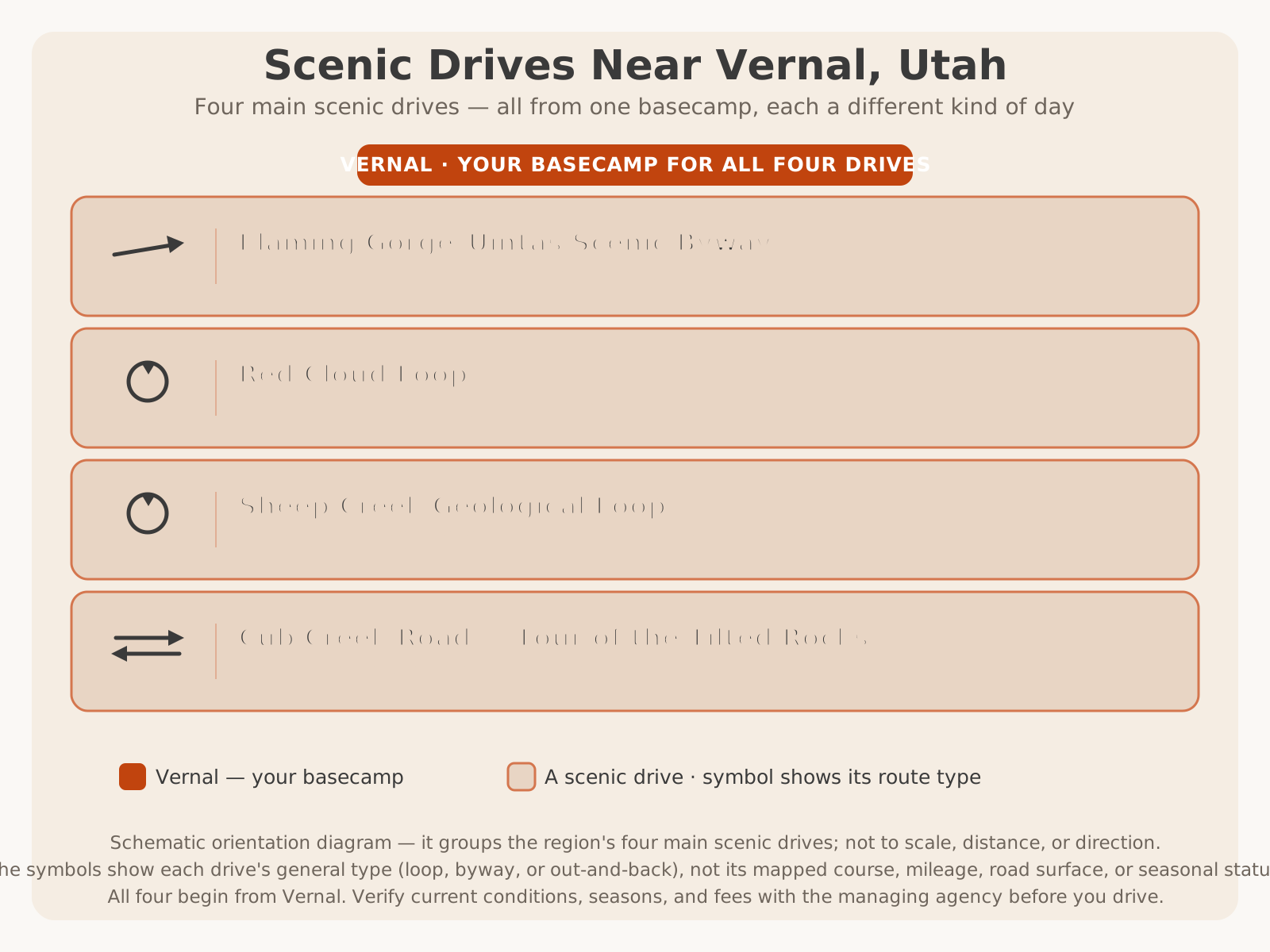
For orientation, here’s where the Red Cloud Loop sits among the region’s four main scenic drives — the rugged high-country loop:
Why Drive the Red Cloud Loop
There is a moment on the Red Cloud Loop — usually somewhere after the pavement gives way to gravel and the sagebrush gives way to aspen — when you realize you have not seen another car in a while, the air has turned cool and pine-scented, and the view has opened across miles of forest to the high Uintas. That moment is the whole reason to drive it. This is the route for travelers who want the mountains on the mountains’ terms: quiet, wild, unhurried, and genuinely remote in a way the paved byway never quite is.
The Red Cloud Loop is a Utah scenic backway, and the word backway matters. It is not a manicured highway with a viewpoint every mile and a visitor center at the top; it is a long loop of paved and improved-gravel forest road that carries you up into the high country of Ashley National Forest and back. Along the way it strings together the things the high Uintas do best — deep forest, mountain reservoirs, ridgeline overlooks, aspen groves, and abundant wildlife — with the added luxury of solitude. On a summer weekday you can have long stretches of it nearly to yourself.
What makes it special, beyond the scenery, is the transition. Few drives take you so completely from one world to another: you start in the hot, open, sage-and-juniper country near Vernal and finish in cool alpine forest a mile or more higher, then reverse the whole journey on the way down. It is a drive that changes the temperature on your arm and the smell of the air, not just the view out the window. For photographers, fall-color chasers, wildlife watchers, and anyone who measures a good drive by how far it takes them from the everyday, the Red Cloud Loop delivers.
This guide is the definitive planning resource for driving it well — the route’s shape, its landscape and ecology, where to stop, how to time it, what vehicle to bring, and how to stay safe on a remote mountain road. It deliberately does not re-tell the whole Ashley National Forest guide; that cornerstone covers the forest as a destination — its recreation, campgrounds, and the broader Uintas — and this article links to it rather than repeating it. Here, the road itself is the subject. For the other great drives it connects to, and how the region’s routes fit together, start with the Scenic Drives in Dinosaur Country pillar.
Route Overview
Before you set out, understand the shape of the drive — because a remote loop rewards a driver who knows roughly what is coming and where the decisions are.
The Red Cloud Loop is a loop, as the name says: it leaves the Vernal area heading north into the mountains, makes a large circuit through the high country of Ashley National Forest, and returns toward town, so you are not backtracking. Its lower reaches pass through the Dry Fork country — a scenic canyon area near Vernal known for notable rock art — before the road climbs in earnest into forest. Up high, it connects to mountain reservoirs, forest side roads, trailheads, and ridgeline viewpoints, then descends by a different arm back toward the valley.
The surface is a mix: paved sections give way to long stretches of improved gravel forest road, and that combination is exactly what defines the loop’s character. It is not a fast drive. Between the gravel, the grades, the curves, and the constant temptation to stop, it drives far more slowly than its mileage suggests — which is the point. Commonly cited at roughly 70-plus miles, it is a half-to-full-day undertaking once you factor in stops.
| Segment | Character | What you’re doing |
|---|---|---|
| Leaving Vernal / Dry Fork | High desert and scenic canyon country | Climbing out of the valley; rock-art country near the base |
| The climb into forest | Pinyon-juniper giving way to aspen and evergreen | Gaining elevation; pavement transitioning toward gravel |
| The high country | Forest, reservoirs, ridgelines, long views | The headline stretch — overlooks, water, wildlife, color |
| The descent | Forest back down to desert on a different arm | Completing the loop toward Vernal |
Landscape & Ecology
The Red Cloud Loop is, more than anything, a drive through change — and understanding the landscape you are climbing through turns a pretty drive into a legible one. In the space of the loop you pass through several distinct life zones, stacked by elevation on the flank of the Uinta Mountains, and watching them shift past the window is one of the drive’s quiet pleasures.
Down low, near Vernal and the Dry Fork country, you are in high-desert sage and grassland studded with pinyon pine and juniper — hot, open, and dry, with big skies and rocky canyon walls. As the road climbs, the junipers thin and the first aspen appear, their white trunks and shimmering leaves marking the transition into the mountains. Higher still, the aspen mix with and give way to evergreen forest — lodgepole pine, and, at the highest and coolest elevations, spruce and fir — cool, shaded, and fragrant. Interwoven through it all are mountain meadows, willow-lined creeks, and the reservoirs and lakes that dot the Uinta high country.
That layering is not just scenery; it is habitat, and it is why the loop is such good wildlife and bird country. Each zone supports different animals and plants, and the edges between zones — where meadow meets forest, or forest meets water — are where life concentrates. It is also why the loop photographs so richly in fall: the aspen zone lights up gold against the dark evergreens and the still-green meadows, a layered composition you simply do not get on a single-elevation drive.
Because you are climbing thousands of feet, you are also climbing into cooler, wetter, more changeable weather. The high country makes its own weather, and a warm, clear morning in Vernal can become a cool, cloudy, or stormy afternoon up top. That is a comfort in summer — the loop is a genuine escape from the desert heat — but it is also a planning reality. For the region’s month-by-month patterns, see our Vernal weather guide, and pack layers regardless of the valley forecast.
Scenic Stops
The Red Cloud Loop is less about a handful of marquee viewpoints and more about a continuous unspooling of scenery — but there are kinds of stops worth watching for and building your day around. Because named sites, facilities, and access change, this guide describes what to look for rather than inventing specific mileposts or amenities; for exact, current stop names, facilities, and access, VERIFY WITH OFFICIAL SOURCE.
- Dry Fork canyon and its rock art. Near the loop’s lower end, the Dry Fork area is scenic canyon country known for notable Fremont-era rock art. Some of the best-known panels are reached via local access that may cross private land, so confirm access and etiquette before visiting; for background on the region’s rock art, see our guide to petroglyphs and rock art near Vernal. VERIFY WITH OFFICIAL SOURCE for current access.
- The forest-transition pullouts. As the road climbs, watch for openings where you can pull off and take in the shift from desert to aspen to evergreen — some of the loop’s most photogenic layered views.
- Mountain reservoirs. The high country holds reservoirs and lakes reached on or just off the loop — cool, scenic spots for a break, a picnic, or (where allowed) fishing. Availability, facilities, and access change; VERIFY WITH OFFICIAL SOURCE, and see our Dinosaur Country fishing guide for the water side.
- Ridgeline and high-country overlooks. The loop’s high stretches open onto long views across forest and toward the Uinta peaks — the payoff for the climb.
- Meadows and aspen groves. Especially in fall, the mountain meadows and aspen stands are destinations in their own right for photographers and color-seekers.
- Developed recreation and camping sites. The forest has developed campgrounds and day-use sites on and near the loop, but their open dates, availability, and fees change every year — never assume a site is open or has space; VERIFY WITH OFFICIAL SOURCE.
Forest & Alpine Scenery
If Sheep Creek is about rock and the byway is about the big reveal of Flaming Gorge, the Red Cloud Loop is about forest — the deep, cool, living green (and, in fall, gold) of the high Uintas. This is the drive to take when you want to be among the mountains rather than looking at them from a distance: under the aspen canopy, alongside a willow-lined creek, past a still reservoir reflecting the peaks, through meadows loud with birds.
The alpine character builds as you climb. The highest stretches of the loop carry you into cool evergreen forest and open meadows where the air is thin and clean and the light has a high-country clarity. Long views open where the forest breaks — across drainages, toward ridgelines, out over a landscape that feels genuinely wild. It is a restorative kind of scenery, the antidote to a hot desert day, and it is why the loop pairs so naturally with a picnic by the water or an unhurried afternoon of stopping wherever the view or the light demands.
This is high country, though, and its beauty comes with the responsibilities of remoteness. Weather changes fast, storms build in the afternoon, and the forest that feels so welcoming on a blue-sky morning is a serious place to be caught unprepared. Enjoy the alpine scenery fully — and respect what it asks of you: preparation, layers, and an eye on the sky. For the forest as a destination in its own right — its campgrounds, lakes, trails, and recreation — the Ashley National Forest guide is your companion reference.
Wildlife Viewing
The Red Cloud Loop is one of the best wildlife drives in the region, precisely because it moves slowly through so much varied, uncrowded habitat. The mix of high desert, aspen, evergreen forest, meadow, and water along the loop supports a genuine diversity of animals, and a quiet vehicle on a gravel road is an excellent way to see them.
Watch the forest edges and meadows for mule deer, which are common, and know that this is real elk country — bugling elk in fall are a Uinta signature. The high country is also moose habitat, and a moose in the willows along a creek or reservoir is a highlight many drivers remember above any view. Smaller mammals, a wealth of birds (including raptors overhead and songbirds in the aspen), and, down in the more open lower country, the chance of pronghorn, round out the cast. Around the reservoirs and creeks, watch for waterfowl and the animals that come to drink.
The rules for wildlife driving apply with extra force on a remote loop. Animals are most active at dawn and dusk, which is also when they are most likely to be on or near the road, so drive slowly at the edges of the day and be ready to stop. Never approach, feed, or crowd wildlife — use a zoom lens and watch from the vehicle. Treat every sighting as luck, not a promise; animals move seasonally and daily. And be genuinely alert to the collision risk: on a forested gravel road, a deer, elk, or moose can step out on a blind curve without warning, and help is far away — keep your speed down where cover is close to the road.
Photography Tips
The Red Cloud Loop is a photographer’s drive, and its variety is its gift: in a single loop you can shoot high-desert canyon, aspen forest, mountain reservoir, meadow, and ridgeline vista. A little planning around light and season turns a good drive into a great shoot.
- Shoot the golden hours. The low, warm light of early morning and late evening flatters everything here — forest, water, and especially fall aspen glowing against dark evergreens. It is also the best time for wildlife and the quietest time on the loop.
- Chase the fall color. In autumn, the aspen zone is the headline subject; look for layered compositions where gold aspen meet green evergreen and open meadow, and for reflections in the reservoirs. (See the Fall Colors section for timing.)
- Use the reservoirs for reflections. Calm mornings turn the mountain lakes into mirrors — peaks, forest, and sky doubled in still water.
- Work the transition. The desert-to-alpine change is itself a subject; a frame that captures sage-and-juniper below giving way to forest above tells the loop’s whole story.
- Keep a long lens ready. For wildlife at the edges of the day and for isolating a distant ridgeline or a single blazing aspen stand, a zoom earns its place.
- Watch the sky. Building clouds and passing storms add drama to high-country shots — but the same weather is your cue to be cautious on remote roads.
Family-Friendly Stops
The Red Cloud Loop can be a wonderful family adventure — but it is a different proposition from a short paved drive, and setting expectations makes it work. The appeal for kids is real: forest and meadows to explore, reservoirs to skip stones at, the genuine thrill of a remote gravel road, and good odds of spotting deer, elk, or even a moose. The sense of going somewhere wild is itself the attraction.
The winning approach is to treat it as a relaxed, all-day outing rather than a quick loop: keep driving segments broken up by frequent stops at the reservoirs, meadows, and overlooks; let kids get out, stretch, and explore safely; and build in a picnic by the water. The variety of the landscape — desert to forest to lake — helps hold young attention across a long day.
The cautions are the flip side of the loop’s remoteness. It is long, partly unpaved, and far from services, restrooms, and cell coverage, so pack far more water and snacks than you think you need, bring layers for the cool high country, plan around naps and meals, and carry a basic kit for a remote drive. Keep speeds low on the gravel, and keep kids close near water and wildlife. Families wanting a shorter or easier first outing might prefer the paved overlooks of the Flaming Gorge–Uintas Byway or a quick reservoir run; the Red Cloud Loop rewards families ready for a bigger day. For more kid-focused ideas around the region, see things to do in Vernal.
Seasonal Advice
Season is the single biggest factor in whether — and how — you drive the Red Cloud Loop, because elevation and an unpaved surface decide everything. This is a high, seasonal mountain loop, not a year-round highway. Here is the year at a glance.
| Season | What to expect | Notes |
|---|---|---|
| Spring | High sections often still closed or muddy | Snowmelt and mud; access variable; confirm before relying on it |
| Summer | Prime season; most reliable access; cool relief up high | Long days; afternoon thunderstorms common; busiest (but still quiet) |
| Fall | Aspen color, crisp air, thin crowds — arguably the best | Loop heads toward its seasonal close; go earlier in fall; first storms arrive |
| Winter | Closed or impassable | Snowbound; not a winter drive — stick to the paved main highways |
Seasonal timing is general and shifts with elevation, snowpack, and weather year to year — the loop may open in one month one year and later the next. VERIFY WITH OFFICIAL SOURCE for current openings, closures, and conditions before a trip. Because the loop spans such a range of elevation, remember you can leave hot high desert in Vernal and hit cool — even stormy — mountain weather within an hour or two. Pack layers regardless of the forecast in town, and watch the afternoon sky in summer for building thunderstorms.
Summer vs Fall
The two prime seasons offer genuinely different drives, and it is worth choosing on purpose.
| Summer | Fall | |
|---|---|---|
| Scenery | Deep green forest, full reservoirs, wildflowers, long days | Aspen gold against evergreen; crisp, clear high-country light |
| Access | Most reliable; the high sections at their most open | Open earlier in fall; heading toward seasonal close — verify |
| Weather | Warm below, cool up high; frequent afternoon thunderstorms | Cooler, often more stable; first snows possible up high |
| Wildlife | Active; young animals about; birds abundant | Elk rut and bugling; animals moving to lower ground |
| Best for | Escaping the heat, reservoirs, long exploratory days | Fall color, photography, an unhurried scenic drive |
Fall Colors
If you can time it, fall may be the single best reason to drive the Red Cloud Loop. When autumn moves through the Uinta high country, the aspen turn brilliant gold and the whole forested heart of the loop lights up — mile after mile of color layered against dark evergreens, still-green meadows, and the blue of the reservoirs. Combined with crisp air, clear light, elk bugling in the distance, and thin crowds, a fall drive here is one of the great scenic experiences of the region, and it is why the loop is a natural anchor for a future fall-color drives guide.
The catch, as always in high country, is timing and access. Peak color is a moving target that depends on elevation and the year’s weather, and it generally arrives higher up first and works downslope. Fall is also exactly when the loop begins heading toward its seasonal close, and early storms can arrive, so the very color you came for may coincide with narrowing access and changeable weather. The move is to go earlier in the fall window for the best combination of open road and turning leaves, to drive in the golden hours for the richest color, and to VERIFY WITH OFFICIAL SOURCE for both current color conditions and current road status before you commit a day to it. Because the loop is long and remote, give yourself margin — you do not want to be chasing the last light far from town on a cold, deteriorating gravel road.
Accessibility
Scenic driving is one of the more accessible ways to experience high country, since much of the Red Cloud Loop’s reward comes from the car and from stops close to the road. A traveler who cannot manage rough trails can still take in the forest, the reservoirs, the meadows, and the ridgeline views by driving the loop slowly and stopping at wide, level pullouts and developed sites.
That said, the Red Cloud Loop is a remote, partly unpaved mountain road, and it is not a uniformly accessible corridor. The gravel surface, the grades, small or uneven pullouts, and the distance from services all raise the bar compared with a paved, developed drive. Developed campgrounds and day-use sites vary in the accessible facilities they offer, and any feature reached by walking over rough ground — a lakeshore, a viewpoint, a trail — may not accommodate all mobility needs.
Because specific accessible facilities, site access, and current road conditions change site to site and season to season, travelers with mobility needs should VERIFY WITH OFFICIAL SOURCE (the U.S. Forest Service) for current accessible provisions at a specific campground, day-use area, or viewpoint before a visit. Travelers who want the high-country scenery with more developed, paved, and accessible facilities may find the Flaming Gorge–Uintas Byway and its overlooks a better match.
Vehicle Advice
Matching your vehicle to the Red Cloud Loop is the most important planning decision you’ll make, because this is a long, remote, partly unpaved drive where the wrong vehicle turns a great day into a stressful — or stuck — one. Here is the honest breakdown.
Passenger cars can often manage the loop when it is open, dry, and well-maintained, driven slowly and carefully. But much of the loop is improved gravel, and a car is more vulnerable to a rough or wet surface, so this is conditional, not guaranteed — and after rain or early in the season the surface can deteriorate fast. If you drive a car, go when conditions are good, keep your speed down, and be willing to turn around.
Higher-clearance and 4WD vehicles are the best tool for the loop. They handle the gravel, the grades, and any rough or wet sections with the most confidence and comfort, and they open up the loop’s side roads and forest spurs. If you have the choice, this is the vehicle to bring, especially outside the dry peak of summer.
RVs, trailers, and large rigs are generally the wrong choice for the Red Cloud Loop. It is long, narrow in places, unpaved, and far from services — a poor fit for a big vehicle. RV travelers are far better served by the paved byway and the developed campgrounds at Flaming Gorge. If you must, confirm current conditions and any restrictions first — but the honest advice is to leave the big rig behind and drive the loop in something smaller.
| Passenger car | Higher-clearance / 4WD | RV / Trailer | |
|---|---|---|---|
| Suitability | Conditional — good conditions only | Best tool for the loop | Generally unsuitable |
| Main concern | Rough/wet gravel; low clearance | Few — the right vehicle here | Length, narrowness, remoteness |
| Best strategy | Go dry, drive slow, be ready to turn back | Explore with confidence; still prepare | Take the paved byway instead |
| When to skip | When wet, rough, or freshly opened | When closed or snowbound | Almost always for this loop |
Motorcycle Tips
For the right rider on the right bike, the Red Cloud Loop is a memorable ride — but it is not the same proposition as the paved byway, and honesty matters. The paved sections offer the sweeping grades, cool forest air, and constant scenery that make Uinta riding so good. The improved-gravel sections, however, are a different discipline: loose surface, washboard, and remoteness that reward dual-sport and adventure bikes and experienced riders far more than street bikes.
If you ride the loop, ride it smart. Watch the surface — gravel, washboard, and debris washed onto the road demand respect and lower speeds. Watch for wildlife stepping into the road, especially in the forest at dawn and dusk. Watch the weather — high-country storms build fast and can turn a warm ride cold, wet, and slick in minutes, and wet gravel is treacherous. And watch your fuel and supplies — there are no services on the loop, so fuel up in town and carry what you need, including layers for the temperature drop up high. Riders wanting a pure paved experience will be happier on the Flaming Gorge–Uintas Byway; the Red Cloud Loop is for riders who want the backcountry and have the bike and skills for gravel.
Half-Day Itinerary
Short on time, or want a taste of the high country without committing to the full remote loop? A half day works well if you drive the loop’s more accessible lower-and-mid reaches as an out-and-back rather than the whole circuit.
The plan: Leave Vernal in the morning with a full tank, food, and water. Head up toward the loop through the Dry Fork country, taking in the scenic canyon and — if you’ve arranged access — its rock art. Climb into the forest as far as the pavement and your time comfortably allow, stopping at the forest-transition pullouts and, if you reach them, a mountain reservoir for a break, a picnic, and photos. Turn around when your half day is half gone and return the way you came, downhill toward Vernal, with the light behind you.
This gives you the desert-to-forest transition, some high-country scenery, and a reservoir stop without the full remote circuit, the gravel high sections, or the all-day commitment. It is the ideal choice for a first taste, a family testing the waters, or a day you’re splitting with something else around town. Save the complete loop for a day when you have the hours — and the right vehicle — to do it properly. VERIFY WITH OFFICIAL SOURCE that your intended sections are open before you go.
Full-Day Itinerary
With a full day, you can drive the complete Red Cloud Loop and do the high country justice — the transition, the forest, the reservoirs, the ridgelines, and the wildlife, at an unhurried backcountry pace.
The plan: Start early from Vernal, fueled and provisioned, ideally in a higher-clearance vehicle. Climb through the Dry Fork country into the forest, watching the landscape shift from desert to aspen to evergreen. Take your time through the high country — stop at the reservoirs for a picnic and photos, pull off at the ridgeline overlooks, and drive the forested stretches slowly for wildlife, especially in the cooler morning and evening hours. Complete the loop back toward Vernal by a different arm, timing the descent so you’re not caught far from town after dark. If the color is on in fall, plan the day around the golden hours in the aspen zone.
This is the complete experience: a full ecological transition, hours of high forest and mountain water, long views, solitude, and real wildlife country, all on one loop. Pace it generously — the loop rewards lingering, and the remoteness means you never want to be rushing on gravel as the light fails. Confirm the entire loop is open and in good condition before you build the day around it: VERIFY WITH OFFICIAL SOURCE. Want to make it a weekend? Pair the loop with the paved byway and time at Flaming Gorge, or a day of fishing a mountain reservoir.
How the Red Cloud Loop Compares
The Red Cloud Loop is one of several great drives in Dinosaur Country, and knowing how it differs from its siblings helps you choose the right one — or the right order. Two comparisons come up most.
Red Cloud Loop vs Sheep Creek Geological Loop
These two are the region’s classic scenic side loops, but they could hardly be more different in scale and focus. The Sheep Creek Geological Loop is short, paved-ish, and intensely focused — a spectacular hour or two of tilted-rock geology in a deep canyon near Flaming Gorge. The Red Cloud Loop is long, remote, and expansive — a half-to-full-day backcountry circuit of high forest, reservoirs, and ridgelines. Sheep Creek is a geology showcase you add to a byway day; Red Cloud is a destination drive in its own right.
| Red Cloud Loop | Sheep Creek Geological Loop | |
|---|---|---|
| Length | Long — roughly 70-plus miles | Short — roughly a dozen miles |
| Star attraction | High forest, reservoirs, fall color, solitude | Dramatically tilted and folded rock geology |
| Surface | Paved and improved gravel; remote | Narrow, winding; mixed surface |
| Time needed | A half to full day | An hour or two, often as a byway add-on |
| Best vehicle | Higher-clearance; not for big RVs | Smaller vehicles; drive slowly |
| Best for | Backcountry driving, wildlife, fall color | Geology, photography, a quick spectacular |
Red Cloud Loop vs Flaming Gorge–Uintas Byway
This is the fundamental choice between backcountry and highway. The Flaming Gorge–Uintas Byway is the long paved main event — RV-friendly, reliably open more of the year, dotted with developed overlooks and services, ending at the reservoir. The Red Cloud Loop is the unpaved backcountry counterpart — remote, seasonal, quieter, and wilder, with no services and a rougher surface. Many travelers do both across a trip; if you can only do one, choose by what you want.
| Red Cloud Loop | Flaming Gorge–Uintas Byway | |
|---|---|---|
| Surface | Paved and improved gravel | Fully paved highway |
| Character | Remote, quiet, backcountry | Polished, developed, reliable |
| Season | Seasonal — summer through fall | Main route maintained more of the year |
| RV-friendly? | Generally no | Yes — a classic RV drive |
| Services | None on the loop | Services at the ends and reservoir |
| Best for | Solitude, forest, wildlife, fall color | The complete, easy, first-visit tour |
For the full menu of how these drives fit together — plus Cub Creek Road, the Harpers Corner drive, and the quick reservoir runs — see the Scenic Drives in Dinosaur Country pillar.
Planning Tips
A great Red Cloud Loop drive comes down to preparation, because remoteness is the whole character of the route. Keep these in mind:
- Confirm it’s open and in good shape first. The loop is seasonal and unpaved in stretches — assume nothing. Check current status and surface before you build a day around it. VERIFY WITH OFFICIAL SOURCE.
- Bring the right vehicle. A higher-clearance vehicle is the right tool; a passenger car works only in good, dry conditions; a big RV generally does not belong here.
- Fuel and provision fully in town. Fill up in Vernal and carry more water, food, and layers than you expect — there are no services on the loop.
- Don’t count on cell service. Tell someone your route and expected return, and carry a paper map or offline maps.
- Respect the weather and the clock. Afternoon thunderstorms are common in summer; wet gravel is slick; and you never want to be finishing a long remote drive after dark. Start early and build in margin.
- Drive slowly and stop often. The reward is in the reservoirs, meadows, overlooks, and wildlife — not in the miles. Give the loop a half to full day.
- Watch for wildlife and other traffic. Slow down at dawn and dusk and on blind curves; watch for log trucks and other backcountry drivers.
- Pack layers and sun protection. You climb into real elevation and changeable mountain weather. See our what to bring guide and Vernal weather guide.
Coming from out of town? If you’re driving in from the Wasatch Front, our Salt Lake City to Vernal guide covers the approach. For the forest as a destination — its campgrounds, lakes, and recreation — turn to the Ultimate Guide to Ashley National Forest, and for a day on the water, our Dinosaur Country fishing guide.
Final Planning Notes
The Red Cloud Loop rewards the traveler who plans a backcountry drive rather than stumbling into one. It is long, remote, and seasonal, and it asks more of you than a paved byway — the right vehicle, a full tank, extra water, an eye on the weather, and a willingness to go slowly and turn around if conditions demand. Give it those things and it gives back what few drives can: a full desert-to-alpine transition, hours of high forest and mountain water, ridgeline solitude, real wildlife country, and — in fall — some of the best color in the state, almost entirely to yourself.
For the paved main corridor and the reservoir at its end, see our Flaming Gorge–Uintas Scenic Byway guide and the Ultimate Guide to Flaming Gorge. For the region’s geologic showpiece side loop, the Sheep Creek Geological Loop. For the forest this drive climbs through, the Ashley National Forest guide. And to see how the Red Cloud Loop fits among all the region’s great drives, return to the Scenic Drives in Dinosaur Country pillar. When you’re ready to trade even the backways for country no road reaches, book a guided UTV tour with Adventure Tours Vernal and let Dave and Trudy show you the backcountry beyond the loop.