Key Takeaways
- This is the region’s headline drive. In one mostly paved run you go from high desert to alpine forest to a red-rock reservoir — few drives change scenery so completely, so fast.
- Drive south-to-north from Vernal. It reads the geology in order, builds toward the Flaming Gorge reveal, and keeps the return flexible — up-and-back or a longer loop through Manila.
- Budget for stops, not just miles. The driving is quick; the overlooks, geologic signs, dam, and Sheep Creek side loop are the reason to come. Half a day minimum, a full day ideally.
- The main byway is easy and paved — good for cars, RVs, trailers, and motorcycles. The side loops (Sheep Creek especially) are narrower, steeper, and seasonal.
- Verify before every trip. Drive times, mile markers, closures, fees, overlook access, and campground availability change year to year and storm to storm — confirm with the managing agencies.
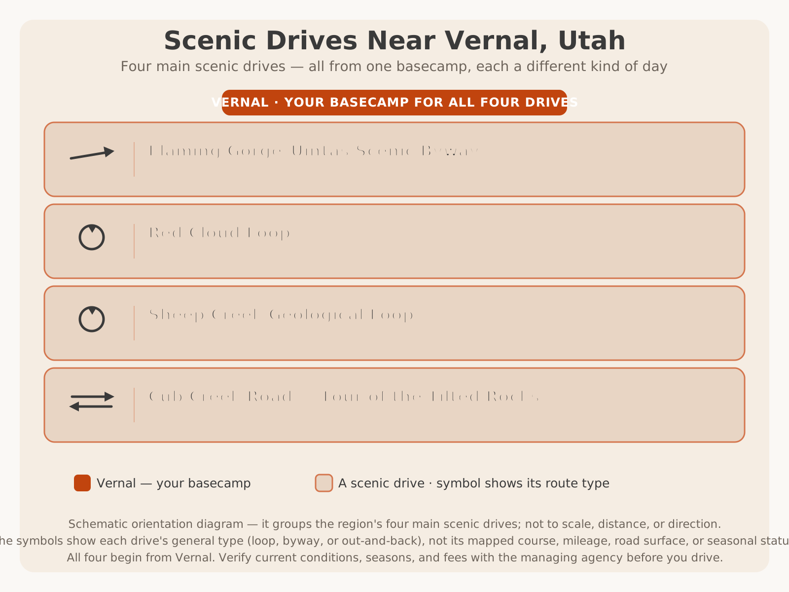
Here’s where the byway sits among the region’s four main scenic drives — it’s the byway, the complete desert-to-reservoir tour:
Why Drive This Route
Some scenic drives give you one kind of scenery for an hour. The Flaming Gorge–Uintas Scenic Byway gives you three completely different worlds in a single afternoon, and that is exactly why it earns its National Scenic Byway designation. You leave Vernal in high-desert sagebrush country, climb through juniper and then into cool aspen-and-pine forest on the flank of the Uinta Mountains, and finish on the rim of a flooded red-rock canyon a thousand-plus feet above the water. Very few roads in the American West compress that much change into so few miles.
What makes it special for a road tripper, though, is not just the variety — it is that the drive itself is engineered to be experienced. This byway is famous for a roadside geology lesson: as US-191 climbs the uplift, a series of interpretive signs identifies each rock layer you pass and the immense span of time it represents, so the climb doubles as a drive backward through hundreds of millions of years. Add the overlooks, the dam, and the Sheep Creek geology, and the road becomes the attraction, not just the way to one.
This article is about the drive — how to plan it, which direction to go, what to stop for, how much time to allow, and what not to miss. It is not a guide to Flaming Gorge the destination (the marinas, the fishing, the camping) or to Ashley National Forest as a whole; those have their own cornerstones, linked throughout. Think of this as the driver’s manual for the byway. For the full picture of the region and where this drive fits, start with our Ultimate Guide to Vernal and the Scenic Drives in Dinosaur Country overview.
Route Overview
Before you turn a wheel, it helps to picture the shape of the drive. The byway has two paved arms that meet on top of the uplift, and understanding them is the key to planning your day.
The spine is US-191, which runs north out of the Vernal area and climbs steadily up onto the flank of the Uinta Mountains. This is the geologic-time climb, and it is the segment every version of the drive shares. Near the top the highway reaches the high, forested Greendale area, where it meets the byway’s second arm.
That second arm is Utah SR-44, which branches west and drops toward the reservoir past Red Canyon, the Sheep Creek country, and on toward the town of Manila at the north end. Meanwhile US-191 continues north past the Flaming Gorge Dam and the Dutch John area toward the reservoir’s eastern side.
So you have a natural Y: climb US-191 from Vernal, then choose your arm at the top — west on SR-44 toward Red Canyon, Sheep Creek, and Manila, or north on US-191 to the dam and the reservoir’s east side. Many travelers drive one arm out and, if time allows, connect the two into a loop through Manila and back. Others simply drive US-191 up and back. There is no single “correct” route; the right one depends on your time and what you came to see.
| Segment | Road | Character | Headline stops |
|---|---|---|---|
| Vernal → the climb | US-191 north | High desert giving way to juniper | Town services; first geology signs |
| The geologic climb | US-191 ascending | Forested uplift; “Drive Through the Ages” | Numbered rock-layer signs; forest overlooks |
| Greendale / the top | US-191 / SR-44 junction | High, cool, forested plateau | The Y — choose your arm |
| West arm | SR-44 toward Manila | Forest to red-rock reservoir rim | Red Canyon; Sheep Creek loop; Manila |
| North/east arm | US-191 toward Dutch John | Forest down to the dam and water | Flaming Gorge Dam; reservoir access |
Planning Your Drive
A little planning turns this from a nice drive into a great day. Six decisions shape everything:
- How much time do you have? A half day gets the highlights; a full day lets you add the dam, a side loop, and unhurried overlook time; a weekend lets you fold in the reservoir, the monument, and the forest. Match your route to your hours, not the other way around.
- Which direction? This guide drives south-to-north from Vernal for reasons covered in the next section — but know your plan before you leave.
- Up-and-back or a loop? Decide whether you will return the way you came on US-191 or make the longer loop through Manila. The loop is more driving but less backtracking.
- What’s your vehicle? The main byway suits anything; the Sheep Creek loop and forest side roads do not. Sort this before you commit to a side trip.
- What season is it? Season decides which side loops are even open, what the weather will do, and whether you are chasing fall color or dodging winter storms.
- Where will you fuel and eat? Services are concentrated in Vernal at the south end and Manila near the north end, with limited options in between. Top off the tank and pack food and water before you leave town.
Best Direction to Drive
You can drive the byway either way, but south-to-north — starting in Vernal and climbing US-191 — is the direction I recommend, for three reasons.
First, the geology reads in order. The “Drive Through the Ages” interpretive signs are laid out to be encountered as you climb, walking you forward and backward through geologic time in sequence. Driving up from Vernal keeps that story in its intended reading order; driving down from the top runs the lesson in reverse.
Second, the scenery builds to a payoff. Going up, you start in ordinary high desert and the landscape keeps escalating — juniper, then forest, then the sudden reveal of Flaming Gorge dropping away below you. Ending on that canyon overlook is a far better dramatic arc than starting with the best view and driving away from it.
Third, it keeps your options open. Climbing from Vernal, you reach the Greendale Y with a decision still to make — west to Red Canyon and Manila, or north to the dam — and you can shape the rest of the day around your time and energy.
That said, there is a real case for driving north-to-south on the way home: afternoon and evening light falls differently, and some photographers prefer the descending light on the return leg. If you make the full loop, you effectively get both directions. Whichever way you go, the drive rewards you — this is a recommendation, not a rule.
Suggested Stops
You could drive the byway without stopping and still enjoy it, but the stops are the whole point. Here are the ones worth building your day around, roughly in south-to-north order. Treat this as a menu — you will not do all of them in a half day.
- The “Drive Through the Ages” geologic signs (US-191 climb). A sequence of roadside interpretive signs identifying each rock formation and its age as you ascend the uplift. Pull off safely at the signed stops and read a few — it reframes the entire drive.
- Forested overlooks on the climb. As US-191 gains elevation, developed pullouts open up views back across the basin and out toward the Uinta high country. Stop where it is signed and safe.
- Red Canyon Overlook and Visitor Center (off SR-44). The classic, not-to-be-missed viewpoint — a dramatic look straight down the red cliffs to the blue water of Flaming Gorge far below. The visitor center offers information and interpretive displays. Hours and seasonal opening change, so VERIFY WITH OFFICIAL SOURCE before counting on it being open.
- Sheep Creek Geological Loop (off SR-44). A short seasonal side loop through a canyon of dramatically tilted and folded rock — an outsized dose of geology for its length. Covered in its own right below and on the Scenic Drives pillar.
- Flaming Gorge Dam (US-191 / Dutch John area). The engineering centerpiece of the reservoir, with a visitor center and, at times, tours. It’s a natural turnaround or highlight on the north/east arm. Access, tour availability, and hours change — VERIFY WITH OFFICIAL SOURCE.
- Reservoir overlooks and recreation areas. Numerous signed viewpoints and developed recreation areas give access to the water at the north end. For which ones suit boating, fishing, camping, or a picnic, see the Flaming Gorge destination guide.
Scenic Overlooks
The overlooks are where the byway earns its reputation, and they fall into two broad families. On the climb, the overlooks look outward and back — across the Uinta Basin, over the forested uplift, into big high-country sky. On the reservoir end, the overlooks look down and in — over the rim of the red canyon to the water far below, which is the image most people carry home.
The single most famous is the Red Canyon Overlook, reached from SR-44, where sheer red cliffs plunge to the reservoir in a view that defines Flaming Gorge in photographs. Along US-191 near the dam, additional signed viewpoints open up the water and the canyon from the eastern side. And on the climb, developed pullouts frame the forest and the basin below.
Because specific overlooks open, close, and change access with seasons, construction, and maintenance, and because a viewpoint that’s spectacular in clear air can be socked in by weather, always check current conditions and treat named overlooks as subject to change. VERIFY WITH OFFICIAL SOURCE (the U.S. Forest Service) for which overlooks and facilities are currently open, and drive to whichever ones you can reach — on this byway, there is no bad view.
Geology Along the Route
If the byway has a signature, it is geology. The road climbs the flank of one of North America’s few major east–west mountain ranges — the Uinta Mountains — and in doing so it cuts across rock layers that record an enormous span of Earth’s history. That is what the “Drive Through the Ages” geologic tour along US-191 is built to reveal: a series of roadside signs, encountered as you climb, that name each formation you pass and the age it represents, turning the highway into a timeline you can drive.
You do not need a geology degree to appreciate it. The signs do the work — you simply stop, read, and look at the rock beside the road, and the immense age of what you are seeing starts to sink in. It is one of the best examples anywhere of interpretation making a landscape legible from the driver’s seat, and it is a huge part of why families, students, and international visitors find this drive so memorable.
The geology climaxes twice more: at the canyon of Flaming Gorge itself, where the reservoir has flooded a gorge cut deep enough to expose the red rock the whole area is named for, and — for those who take the side loop — at Sheep Creek, where the earth’s crust has been dramatically tilted and folded, standing rock layers on end right beside the road. Between the roadside signs, the great canyon, and the tilted rock of Sheep Creek, the byway is as much a geology tour as a scenic drive.
Wildlife Viewing
A slow drive is one of the best wildlife blinds there is, and the forested high country along this byway is genuine wildlife country. As you climb into the trees, watch for mule deer and elk, and know that this is real moose country — a moose sighting in the willows or forest is a highlight many drivers remember longer than any overlook. Smaller mammals, raptors, and a variety of birds fill in the forest, and down in the more open country and near the water you may spot pronghorn on the flats and waterfowl and raptors around the reservoir.
The rules for wildlife driving are simple and worth taking seriously. Animals are most active and visible at dawn and dusk, which is also when they are most likely to be in or beside the road — so drive slowly through the forest at the edges of the day and be ready to stop. Never approach, feed, or crowd wildlife; use a zoom lens and watch from the vehicle. And treat every sighting as luck, not a guarantee — animals move seasonally and daily, and no drive can promise them.
There is a safety dimension too: driving at dawn and dusk in this country means a real risk of hitting an animal. A deer or a moose can step into the road without warning on a forested curve, so ease off the accelerator when visibility drops and cover is close to the road.
Photography Locations
This is a photographer’s drive, and a little timing turns snapshots into keepers. The best light — the golden hours around sunrise and sunset — is also when the canyon glows and wildlife moves, so plan to be out early or late. Here are the locations and subjects worth chasing:
- The Red Canyon overlook. The signature shot of the whole region: red cliffs plunging to blue water. It photographs best in warm, low, early or late light; harsh midday sun flattens the color.
- Sheep Creek’s tilted rock. The folded, upended strata are a geology photographer’s dream, and low, raking side light reveals the structure of the rock far better than overhead sun.
- The forested climb and fall color. Along US-191 and SR-44, aspen stands — especially in autumn — and forest openings framing the basin below make strong, layered compositions.
- The dam and canyon from the east side. The engineering of the dam set against the red canyon is a distinctive, less-photographed subject on the US-191 arm.
- Big-sky and basin views on the climb. The outward-looking pullouts shine at golden hour, when low sun models the terrain and clouds pile over the mountains.
- Wildlife at the edges of the day. Keep a long lens ready in the forest at dawn and dusk, and shoot from or beside the vehicle — never approach.
Family-Friendly Stops
The byway is one of the most family-friendly ways to see this region, because it delivers big scenery without a big hike — and because the best stops give kids something to do. The winning formula is short driving segments broken up by frequent, get-out-and-look stops.
The standouts for families are the “Drive Through the Ages” geologic signs (turn it into a game — have kids spot the next sign and the rock it names), the Red Canyon overlook (a genuinely jaw-dropping view kids remember, with a visitor center for a break), and the Flaming Gorge Dam (big, impressive engineering that fascinates children, sometimes with a visitor center). The overlooks generally have parking close to the view, so little legs don’t have far to go.
A few tips keep family driving smooth here: keep the segments short and the stops frequent, carry far more water and snacks than you expect to need in the dry high-desert-to-mountain air, plan around naps and meals, and let the day flex. Restrooms and facilities are concentrated at developed sites like visitor centers and recreation areas rather than spaced evenly along the road — plan stops accordingly, and VERIFY WITH OFFICIAL SOURCE for which facilities are currently open. For more kid-focused ideas around the area, see fun things to do in Vernal with kids.
Picnic Opportunities
A byway this long is made for a picnic, and eating with a view is one of the drive’s simplest pleasures. Because services are sparse between Vernal and Manila, packing a picnic in town is both practical and the best way to enjoy a midday break — you’re rarely near a restaurant when hunger hits, but you’re often near a spectacular spot to spread a blanket.
The most reliable picnic settings are the developed recreation areas and overlooks with tables and facilities, many of them on the reservoir end and in the forest near the top of the climb. The forest picnic spots trade the big canyon view for shade and cool air — a welcome swap on a hot day — while the reservoir-area sites give you water and red rock with your lunch.
Because specific picnic areas, their tables, water, and restrooms open and close seasonally and some sit within fee areas, VERIFY WITH OFFICIAL SOURCE (the U.S. Forest Service) for currently open picnic facilities and any day-use fees before you rely on a particular spot. When in doubt, a tailgate lunch at a signed overlook pullout is always an option — just pack out everything you pack in.
Seasonal Advice
Season is the single biggest factor in how this drive goes, because elevation and pavement decide what’s open and what the weather does. Here’s the year at a glance.
| Season | What to expect | Notes |
|---|---|---|
| Spring | Lower elevations green up; high country still cold | Side loops may still be closed; variable weather; mud on unpaved roads |
| Summer | Everything typically open; warm and busy | Peak season; cool relief up high; afternoon thunderstorms common |
| Fall | Aspen color; crisp air; thinner crowds | Arguably the best driving season — but high side loops begin to close |
| Winter | Paved main highways only; snow and ice | Side loops closed; storms can close roads temporarily; carry winter gear |
Seasonal timing is general and shifts with elevation and weather year to year — a side loop may open in June one year and July the next. VERIFY WITH OFFICIAL SOURCE for current openings, closures, and conditions before a trip. For the region’s month-by-month weather, see our Vernal weather guide. Because the drive spans a huge range of elevation, remember you can leave hot high desert in Vernal and hit cool — even stormy — mountain weather within an hour. Pack layers regardless of the forecast in town.
Summer vs Fall
The two prime seasons deserve a head-to-head, because they offer genuinely different drives.
| Summer | Fall | |
|---|---|---|
| Scenery | Green forest, full reservoir, long days | Aspen and cottonwood color at its peak |
| Access | Everything typically open, including side loops | High side loops start closing; verify before relying on them |
| Weather | Warm; frequent afternoon thunderstorms | Crisp, cooler; more stable but first storms arrive |
| Crowds | Peak season; busiest overlooks and services | Thinner crowds, quieter overlooks |
| Best for | Combining the drive with boating and water | Photography, color, and an unhurried drive |
Fall Colors
If you can time it, fall may be the single best season to drive this byway. As autumn moves down the mountain, the aspen and cottonwood across the Uinta forests turn gold and the whole climb takes on color, with the added bonus of crisp air, stable-ish weather, and thinner crowds at the overlooks. The forested stretches of US-191 and SR-44 are the heart of the show, and a fall drive that ends on the red-rock rim of Flaming Gorge — warm autumn color meeting red canyon and blue water — is hard to beat anywhere in the state.
The catch is timing and access. Peak color is a moving target that depends on elevation and the year’s weather, and it typically arrives higher up first and works downslope. And fall is exactly when the high side loops begin to close for the season, so the very color you came for may coincide with reduced access. The move is to go earlier in the fall window for the best combination of open roads and turning leaves, and to VERIFY WITH OFFICIAL SOURCE for both current color and current closures before you commit a day to it. A dedicated fall-color drives guide is a natural next step (see future spokes below).
Winter Considerations
Winter narrows the drive but doesn’t erase it. The paved main highways — US-191 and SR-44 — are generally maintained through the cold season, so a winter drive up the byway is possible and can be starkly beautiful, with snow on the forest and ice on the canyon rim. But it comes with real caveats you must respect.
Storms can close the highways temporarily, snow and ice make the grades and curves genuinely hazardous, and the side loops (Sheep Creek and the unpaved forest roads) are closed or impassable. Services are even sparser in winter, daylight is short, and a breakdown in cold, remote country is serious. This is not the season for a casual, unprepared drive.
If you do go in winter: check road conditions and the forecast the morning you leave, carry winter gear (traction, warm clothing, food, water, a full tank, a charged phone with the understanding that service is spotty), tell someone your plan, and be willing to turn around. VERIFY WITH OFFICIAL SOURCE (the Utah Department of Transportation for highway status and the U.S. Forest Service for area conditions) before any winter drive, every time.
Accessibility
Scenic driving is inherently one of the more accessible ways to experience this landscape, because so much of the reward comes from the car and from viewpoints close to parking. On this byway, the most accessible experiences are the paved main route and its developed overlooks and visitor centers, where many of the best views are visible from the vehicle or a short, near-parking walk, and where developed sites more often provide accessible parking and facilities.
By contrast, the side loops, unpaved forest roads, and any viewpoint or feature that requires walking over uneven ground are more rugged and not uniformly accessible. Trails to specific features, and some overlook approaches, may not accommodate all mobility needs.
Because specific accessible facilities, viewpoint access, and current road conditions change by site and season, travelers with mobility needs should VERIFY WITH OFFICIAL SOURCE (the U.S. Forest Service and, at the dam and recreation sites, the managing agency) for the current accessible provisions at a specific overlook, visitor center, or recreation area before a visit.
RV & Trailer Advice
Good news for road trippers hauling a home: the main byway is RV- and trailer-friendly. US-191 and SR-44 are maintained paved highways built for through traffic, the grades and curves are manageable at a sensible pace, and the north end at Flaming Gorge has developed campgrounds and services — so an RV touring loop that overnights at the reservoir is a classic way to do this drive.
The cautions are about the side loops, not the spine. The Sheep Creek Geological Loop is steep, narrow, and winding and can be genuinely unsuitable for large rigs and trailers; the unpaved forest side roads are worse. Do not take a big vehicle onto a side loop without confirming its length limits and current condition. Even on the main route, remember you are climbing and descending significant elevation — use low gears on long descents, watch your brakes, and give yourself extra room.
Practical RV planning: fuel and dump/fill in town (Vernal or Manila), because services thin out badly in between; confirm campground availability and reservations in advance, since sites at the reservoir fill in peak season; and VERIFY WITH OFFICIAL SOURCE for current campground status, RV length limits on any side road, and road conditions. For camping and services at the reservoir end, the Flaming Gorge destination guide is your reference; never assume a campground is open or has space without checking.
Motorcycle Tips
For riders, this byway is a genuine bucket-list road. The sweeping paved grades, constant changes of scenery, cool forest air after the desert heat, and the payoff of the canyon make it one of the most enjoyable rides in the region, and it’s popular with motorcyclists for good reason. Ridden south-to-north, the climb keeps the good stuff coming and the descents on the return are a reward in themselves.
Ride it smart, though. Watch for gravel washed onto the pavement on curves, wildlife stepping into the road (especially in the forest at dawn and dusk), sudden mountain weather that can turn a warm ride cold and wet fast, and long gaps between services — fuel up before you climb and carry what you need. The elevation change means real temperature swings, so pack layers you can add and shed. And know that the unpaved side loops are a different proposition best left to appropriate bikes and experienced riders — the main paved byway is the ride.
Car vs RV vs Motorcycle
The byway welcomes every kind of vehicle on its main route, but the experience — and the limits — differ. Here’s the honest breakdown.
| Car | RV / Trailer | Motorcycle | |
|---|---|---|---|
| Main byway (US-191 / SR-44) | Ideal — easy and flexible | Well-suited; watch grades and brakes | Excellent — a standout ride |
| Sheep Creek / side loops | Fine when open and dry; higher clearance helps | Often unsuitable — check length limits | Skilled riders only; watch gravel |
| Best strength | Go-anywhere versatility | Camp at the reservoir; bring it all | Sheer driving pleasure |
| Main caution | Deteriorating side roads after weather | Length limits, brakes, campground space | Weather, wildlife, gravel, fuel gaps |
Suggested Half-Day Trip
Short on time? A half day still delivers the byway’s greatest hits, especially if you focus and don’t try to do the whole loop.
The plan: Leave Vernal in the morning with a full tank, food, and water. Climb US-191, stopping at two or three of the “Drive Through the Ages” geologic signs and a forest overlook or two on the way up. At the top, take SR-44 toward Red Canyon and stop at the Red Canyon Overlook for the drive’s signature view down to the water (check that the visitor center is open if you want it). Have a picnic or a break there, then return the way you came, downhill toward Vernal, with the afternoon light behind you.
This gives you the geology, the forest, and the single best canyon view in roughly half a day, without committing to the dam, the full loop, or a side loop. It’s the ideal choice for a first taste, a family with limited patience, or a day you’re splitting with something else around town. Add the Sheep Creek loop only if it’s open and you have the extra hour.
Suggested Full-Day Trip
With a full day, you can do the byway justice — the geology, the overlooks, the dam, a side loop, and time at the water.
The plan: Start early from Vernal. Take your time on the US-191 climb, stopping at the geologic signs and forest overlooks. At the top, go west on SR-44 and drive the Red Canyon Overlook, then — if it’s open and your vehicle suits it — the Sheep Creek Geological Loop for its tilted-rock geology (allow extra time; it’s slow and winding). Continue toward Manila at the north end, then work back east/south along US-191 to the Flaming Gorge Dam, taking in the reservoir overlooks and, if available, the dam visitor center or tour. Have lunch at a developed picnic area or overlook along the way. Return to Vernal on US-191 in the late afternoon, or make the full loop if you routed it that way.
This is the complete tour: desert to forest to reservoir, geology and engineering, and the two arms of the byway in one day. Pace it so you’re driving the forest at the quieter, better-lit ends of the day, and don’t over-schedule — the overlooks reward lingering. Confirm every side loop and facility is open before you build the day around it: VERIFY WITH OFFICIAL SOURCE.
Suggested Weekend Itinerary
Give the byway a weekend and it becomes the backbone of a full Dinosaur Country road trip, with time to get out of the car.
Day one — the byway, unhurried. Drive the full route as described in the full-day plan above: the US-191 climb and geology, Red Canyon, Sheep Creek if open, the dam, and the reservoir overlooks. Spend the afternoon at the water — a boat outing, a swim, or just the view — and overnight in Vernal or at a reservoir campground (confirm availability first).
Day two — go deeper. Pick your second act based on what pulled at you on day one. Anglers can spend it fishing the reservoir (see fishing Flaming Gorge) or the Green River below the dam; families can do the easy, close-to-town parks and the monument; forest lovers can head up into Ashley National Forest for a mountain-reservoir drive or picnic. Base out of Vernal so you sleep in the same bed.
Optional day three — off the pavement. Trade four wheels for country the byway never reaches with a guided backcountry UTV tour, then combine the weekend with a day at Dinosaur National Monument. Coming in from the west? Our Salt Lake City to Vernal guide covers the drive in. For a broader menu of what to do between drives, see things to do in Vernal.
Scenic Stops Ranked by Time Available
The honest way to plan is by the clock. Here’s what to prioritize as your available time grows — each row assumes you keep everything above it.
| Time available | Do this | Why |
|---|---|---|
| 1 hour | Climb US-191, a couple of geology signs, first overlook, turn back | Gets you the forest and the geologic story fast |
| Half day | Add SR-44 to the Red Canyon Overlook and a picnic | Adds the signature canyon-to-water view |
| Full day | Add the Sheep Creek loop (if open), the dam, and reservoir overlooks | The complete two-arm byway experience |
| Weekend | Add time at the water, the forest, fishing, or the monument | Turns the drive into a full regional road trip |
Final Planning Notes
The Flaming Gorge–Uintas Scenic Byway rewards the traveler who plans a drive rather than stumbling into one. Decide your time and direction, sort your vehicle against any side loops, respect the season, and — above all — build in time to stop. The driving is the easy part; the geologic signs, the overlooks, the dam, and the Sheep Creek country are where the day becomes memorable. Fuel and provision in Vernal, verify current conditions before you leave, and drive it south-to-north so the landscape builds toward that first look down into Flaming Gorge.
For the destination at the end of the road — the reservoir, its marinas, camping, and recreation — turn to our Ultimate Guide to Flaming Gorge. For the forest the byway climbs through, see the Ashley National Forest guide. And for the other great drives of the region — the Red Cloud Loop, Sheep Creek, Cub Creek, and more — return to the Scenic Drives in Dinosaur Country pillar. When you’re ready to trade the pavement for country no scenic byway reaches, book a guided UTV tour with Adventure Tours Vernal and let Dave and Trudy show you the backcountry beyond the overlooks.