Key Takeaways
- It’s the highest point in Utah — 13,528 feet. Kings Peak crowns the High Uintas Wilderness inside Ashley National Forest, and standing on top is a genuine Lower-48 accomplishment.
- This is an expedition, not a day hike. For nearly everyone it’s a multi-day backpacking trip: a long drive to a remote trailhead, many backcountry miles, a high pass, and a boulder-strewn summit ridge.
- Altitude and weather are the real hazards. Above 13,000 feet, thin air, cold nights, and near-daily afternoon thunderstorms demand acclimatization, an early summit, and honest self-assessment.
- Fitness and experience are non-negotiable. Kings Peak is for prepared, experienced hikers and backpackers — beginners and families should build up on the region’s easier trails first.
- Verify every specific. Mileage, elevation gain, trailhead access, permits, and seasonal snow are set by Ashley National Forest and change every year — this guide describes the mountain by character and never invents the numbers.
Why Climb Kings Peak
There is a particular pull to standing on the highest ground in an entire state, and Kings Peak has it in full. At 13,528 feet it is the highest point in Utah, and for peak-baggers, highpoint collectors, and bucket-list hikers it is one of the most coveted summits in the West. But the appeal runs deeper than a number on a map. Kings Peak sits at the heart of the High Uintas Wilderness, the wild, roadless, motor-free core of a mountain range unlike almost any other in the country — the Uintas are one of the few major ranges in the Lower 48 that run east–west rather than north–south, and they hold a high, broad, lake-strewn alpine world that feels genuinely remote.
Getting to the top means walking for days through some of the finest wilderness scenery in Utah: dark spruce-and-fir forest giving way to open alpine tundra, meadows stitched with wildflowers in summer, and hundreds of glittering alpine lakes below high granite basins. You camp under some of the darkest skies in the state, wake in the cold thin air, and climb a high pass and a long boulder ridge to a summit where the whole range falls away beneath you. It is the kind of trip that stays with people for the rest of their lives — earned, not delivered.
That’s the honest heart of why people climb it: not because it’s easy or convenient, but because it’s hard, remote, and beautiful, and because the summit is Utah’s rooftop. It anchors the region’s high country the way Dinosaur National Monument anchors its deep-time desert. For the full picture of the forest that holds it — its history, geology, lakes, and logistics — this guide is the planning companion to our Ultimate Guide to Ashley National Forest, which owns the destination while this article owns the mountain.
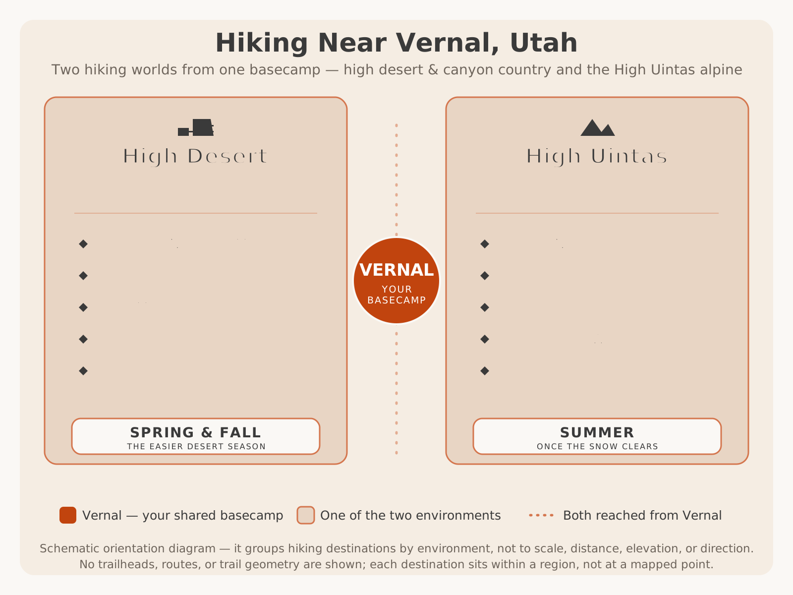
That contrast is worth picturing. Kings Peak crowns the alpine half of a two-world hiking region — the high, remote counterpart to the desert country down near Vernal:
Is Kings Peak Right for You?
Before anything else, be honest with yourself about whether this is your mountain right now. Kings Peak is not a trail you rise to on willpower alone — it rewards a specific kind of hiker and quietly punishes everyone who underestimates it. The single most important planning decision you’ll make is not what gear to carry or when to go; it’s whether you and everyone in your group genuinely belong up there this season.
Kings Peak is a good fit if you are a fit, experienced hiker or backpacker who has spent multiple nights in the backcountry, who is comfortable with navigation and self-sufficiency, who has been at altitude before and knows how your body responds, and who can carry a multi-day pack over long, rough miles. It’s a natural bucket-list objective for backpackers, adventure travelers, and photographers building a serious Uintas trip, and for anyone who wants to stand on the highest point in Utah and has done the work to earn it safely.
It is not the right choice if you are new to hiking, have never carried an overnight pack, have no experience at altitude, are hoping for a marked, easy-to-follow path with amenities, or are looking for a family outing with young children. There is no shame in that — it simply means the mountain isn’t your next step yet. The region is full of spectacular hikes that build exactly the skills Kings Peak demands. Start there, get strong, learn how you handle altitude and multi-day travel, and come back for the summit when it’s the right challenge rather than a gamble.
Physical Difficulty
Make no mistake: Kings Peak is a strenuous, demanding trip by any reasonable measure. The difficulty comes from the combination of factors stacking on top of one another rather than any single obstacle. You’re covering many miles of backcountry trail — most people over multiple days — while carrying a full multi-day pack, gaining significant elevation to cross a high pass, and then working up a long, boulder-strewn summit ridge where the footing is rocky and slow and the air is thin. None of those things is trivial on its own; together, at altitude, they add up to a serious mountain day.
The final stretch to the summit in particular is not a smooth trail but a route over rock and boulders that requires careful footwork, patience, and sound judgment about where to step. Add the effects of altitude — where your usual pace can slow dramatically and your heart and lungs work far harder than at low elevation — and you have a hike that asks for real physical reserves. This is why fitness isn’t a nice-to-have here; it’s a safety factor. A hiker with margin to spare can respond to bad weather, help a struggling partner, and make good decisions when tired. A hiker running on empty at 13,000 feet has none of those options.
The right preparation is months, not days: build up your endurance and leg strength with long hikes carrying a loaded pack, ideally at elevation, and get comfortable with sustained effort over multiple days. Because exact distances and elevation gain vary by route and change with trail conditions, VERIFY WITH OFFICIAL SOURCE (Ashley National Forest) for the current figures — but plan your training around the reality that this is one of the more demanding hikes in the state, not a stroll to a viewpoint.
Preparation
Preparation for Kings Peak happens on three fronts long before you reach the trailhead: your body, your skills, and your gear — plus the research that ties them together. Treat all three as mandatory.
Physical preparation is a months-long project. Build cardiovascular endurance and leg strength with progressively longer hikes carrying a weighted pack, and get time at elevation if you possibly can so altitude isn’t a complete unknown on the mountain. The goal is to arrive fit enough that the hiking itself has margin to spare.
Skills preparation matters just as much. You should be genuinely comfortable with backcountry navigation using a map and compass (and, ideally, a GPS as backup — but never only a GPS), reading mountain weather, choosing safe campsites, managing water, and practicing Leave No Trace in a fragile wilderness. If any of these are shaky, gain that experience on easier trips first. The High Uintas are not the place to learn to navigate.
Gear preparation means a complete, tested multi-day backcountry kit suited to genuine alpine conditions — including layers for cold, wind, and rain even in summer, reliable shelter, adequate insulation for cold nights, sun protection for intense high-altitude sun, a way to treat water, navigation tools, a first-aid kit, and emergency communication given the lack of cell service. Test your gear before the trip, not on the mountain.
Finally, research the specifics for your exact trip — current trailhead access and road conditions, the route you intend to take, permit and wilderness rules, group-size limits, campsite regulations, and the current snow situation. All of these change, so VERIFY WITH OFFICIAL SOURCE (Ashley National Forest / the ranger district) close to your trip date. For a general packing foundation, our what to bring guide is a starting point — but a high-alpine backpacking trip demands considerably more than a day outing.
Altitude Considerations
Altitude is one of the two hazards most likely to turn back a fit, determined hiker on Kings Peak — and it deserves respect independent of your fitness. The summit tops out above 13,500 feet, and you spend much of the trip at high elevation where the air holds far less oxygen than most visitors are used to. Altitude illness can affect anyone, regardless of how strong or experienced they are, and it is notoriously unpredictable: people who feel invincible at sea level can be laid low high in the Uintas.
The proven strategy is gradual acclimatization. Rather than racing from a low-elevation home to the summit in a single push, the multi-day backpacking approach naturally helps — you gain elevation over days, sleep a night or two camped high before summit day, and give your body time to adjust. Stay very well hydrated throughout (dehydration worsens altitude symptoms), eat well even when your appetite fades, and pace yourself deliberately, especially on summit day.
Know the warning signs and take them seriously: a worsening headache, nausea, dizziness, unusual fatigue, and shortness of breath beyond what the effort explains. The most reliable treatment for altitude illness is simple and non-negotiable — descend. If symptoms are mild, stop climbing and rest; if they worsen, go down, because continuing up can turn a manageable situation into a genuine emergency far from help. Building extra time into your itinerary gives you the freedom to acclimatize slowly and to turn around without wrecking the whole trip. Because individual response to altitude varies so widely, plan conservatively and treat acclimatization as a core part of the plan, not an afterthought.
Backpacking vs Day Hike
The most consequential planning choice for Kings Peak is how you’ll do it — as a multi-day backpacking trip or a single long day. For the overwhelming majority of visitors, the answer is backpacking, and understanding why makes the whole trip safer.
| Multi-Day Backpacking | Single-Day Push | |
|---|---|---|
| Who it suits | Nearly everyone — the standard, recommended approach | Only elite, fully acclimatized, highly experienced mountain athletes |
| Altitude | Time to acclimatize by sleeping high before summit day | No acclimatization — altitude hits hard and fast |
| Weather margin | Can wait out or time around afternoon storms | Little room to adjust; pressure to push in bad weather |
| Physical load | Mileage broken across days; carry a full pack | Enormous single-day distance and effort; lighter pack |
| Experience of the place | Camp in the wilderness, dark skies, lakes, unhurried | Head-down effort; little time to absorb the surroundings |
| Main risk | Heavier packs, more nights exposed to weather | Altitude, fatigue, and being caught high late in the day |
For nearly everyone, backpacking is the right call. Spreading the trip across several days lets you acclimatize to the altitude, break the long distance into manageable pieces, camp high so you can start summit day early and be off the exposed ridge before afternoon storms build, and actually experience the wilderness you came so far to see. A small number of exceptionally fit, acclimatized, experienced hikers do attempt Kings Peak as a single very long day — but that approach strips away your margin for altitude, weather, and fatigue, and it is emphatically not a model for first-timers or casual hikers. Unless you have specific, honest reasons to believe you’re in that elite category, plan a backpacking trip. VERIFY WITH OFFICIAL SOURCE for current route distances and camping regulations as you build your itinerary.
Weather
Weather in the High Uintas is the other hazard that turns back strong hikers, and on an exposed 13,000-foot ridge it is not a matter of comfort but of safety. The defining pattern of a Uintas summer is the afternoon thunderstorm: mornings often start clear and calm, and then clouds build through midday until storms — with lightning, wind, rain, hail, and plunging temperatures — sweep the high country in the afternoon. Being caught on the summit ridge or the high pass when lightning is close is one of the most dangerous situations you can be in up there.
This single fact shapes the entire climbing strategy: summit early. The mountaineer’s discipline of camping high, starting in the dark or at first light, reaching the summit in the morning, and being back down off the exposed high ground before the afternoon storms build is exactly why the multi-day approach is so strongly favored. It’s why hikers set a hard “turnaround time” and honor it even if the summit is close — the mountain will be there another year; a hiker caught in a lightning storm on the ridge may not have that luxury.
Beyond thunderstorms, expect genuinely cold nights even in the middle of summer, strong sun during the day at an elevation where UV is intense, wind above treeline, and the real possibility of snow in any month — this is high alpine country. Conditions can change fast and dramatically. Check the most current mountain forecast you can find close to your departure, build flexibility into your plans so you can wait out a bad day, and be prepared to turn back. Our Vernal weather guide covers the region’s general patterns, but always seek a specific high-elevation mountain forecast for the wilderness and VERIFY WITH OFFICIAL SOURCE for current conditions before you go.
Wildlife
Part of what makes the High Uintas so special is that they are genuinely wild, and you may share the country with its residents. The forest and alpine zones are home to a range of wildlife — deer and elk, smaller mammals, marmots and pikas among the high boulders, and birds of the high country — and moose are present in the Uintas’ wet meadows and willow bottoms. Seeing wildlife in this setting is one of the quiet privileges of a backcountry trip.
With that privilege comes responsibility. Keep a respectful distance from all animals and never approach or feed them; moose in particular deserve real caution and space, as they can be unpredictable and are far larger and faster than they look. Store your food properly to avoid attracting animals to your camp, both for your safety and for their well-being — an animal that learns to associate people with food is an animal in danger. Practice good Leave No Trace habits with all food, trash, and scented items.
Because specific wildlife guidance, food-storage requirements, and any seasonal advisories are set by the managing agency and can change, VERIFY WITH OFFICIAL SOURCE (Ashley National Forest) for the current wildlife and food-storage rules that apply to the High Uintas Wilderness before your trip. For a broader look at what lives across the region, see our Ashley National Forest guide.
Photography
For photographers, Kings Peak and the High Uintas are a spectacular reward — but the best images come to those who plan for the light and respect the conditions. The high country offers a rare combination of subjects: open alpine tundra, granite basins, hundreds of reflective lakes, summer wildflower meadows, dramatic storm skies, and, at night, some of the darkest skies in Utah for stars and the Milky Way.
A few local instincts pay off. Shoot the golden hours at dawn and dusk, when low, warm light rakes across the tundra and rock and turns the lakes to mirrors — flat midday light does the scenery no justice. Because you’re likely summiting in the morning to beat the storms, that early light works in your favor for summit and ridge shots. Use the alpine lakes as foregrounds and reflections; a still lake at dawn with the high peaks behind it is a signature Uintas image. Watch the weather as a subject — building thunderheads make dramatic photographs, but get yourself off exposed ground before lightning threatens; no image is worth that risk. And on a clear, moonless night from a high camp, the night sky here is extraordinary.
Photographers should also treat the fragile alpine environment with care: stay on durable surfaces, keep off delicate tundra where you can, and leave every scene exactly as you found it. The weight of camera gear adds up on a multi-day trip at altitude, so pack thoughtfully and prioritize. This mountain is one of the marquee original-photography opportunities in the entire region — the kind of firsthand alpine imagery that no competitor and no stock library can replicate.
Family Considerations
To be direct: Kings Peak is not a family objective for those with young children. It is a strenuous, high-altitude, multi-day wilderness expedition with genuine exposure to weather, altitude, remoteness, and rough terrain, far from any help and often with no cell service. Those are exactly the conditions that make it unsuitable for small children and for families without serious backcountry experience.
That is not the end of the story for families, though — far from it. The region around Vernal is unusually rich in family-friendly hiking that offers real adventure without the risks of Utah’s highest peak. Families are far better served by the fossil walks and short interpretive trails in Dinosaur National Monument, by the drive-up alpine lakes and easy forest nature trails elsewhere in Ashley National Forest, and by reservoir shorelines and gentle loops closer to town. These deliver mountain scenery, wildlife, and a genuine taste of the high country at a scale that works for kids.
For older teens who are fit, experienced, and properly prepared, a Kings Peak trip can be an extraordinary family accomplishment — but only within an experienced group that treats the preparation and the hazards with full seriousness. For most families, the smart move is to build a love of the outdoors on the region’s accessible trails now and save Utah’s rooftop for later. For kid-focused ideas around Vernal, see fun things to do in Vernal with kids.
Accessibility
Kings Peak itself is, by its very nature, not an accessible destination. It is a remote, high-altitude wilderness summit reached only by many miles of rugged backcountry travel over rough ground and boulders — there is no road, no shuttle, no developed access, and no easy way to shorten the effort. That is part of what protects it as wilderness, and it means the summit is genuinely out of reach for visitors who can’t undertake a strenuous multi-day backcountry trip.
The encouraging news is that the wider forest offers far more accessible ways to experience the same high country. Elsewhere in Ashley National Forest, paved scenic byways, developed overlooks reachable with little walking, drive-up alpine lakes, and developed campgrounds put real mountain scenery within reach of many visitors regardless of hiking ability. You don’t have to stand on the summit of Kings Peak to feel the grandeur of the Uintas — a scenic drive to a high overlook can deliver a version of it from the comfort of the road.
Because specific accessible facilities, trails, and services vary and change over time, VERIFY WITH OFFICIAL SOURCE (Ashley National Forest) for the current accessible options if you have specific needs. Our Ashley National Forest guide and the scenic drives hub point toward the drive-up and low-effort ways to enjoy the high country.
Best Seasons
Timing is everything on Kings Peak. Because it’s a high-alpine objective, the realistic climbing window is narrow, centered on the high-summer-to-early-fall stretch when the snow has largely cleared from the high basins and the pass. Even within that window, the mountain hands out cold nights, lingering snow in shaded pockets, and near-daily afternoon storms — the “best” season is the least severe one, not a mild one.
| Summer (roughly July–early September) | Early Fall (roughly September) | |
|---|---|---|
| Snow | Snow largely cleared from the high route in a normal year, though pockets can linger | Route usually clear early on, but first heavy snows can arrive any time |
| Temperatures | Warmest window, but still cold nights even in July | Cooling fast; colder nights and shorter days |
| Storms | Near-daily afternoon thunderstorms — summit early | Fewer daily storms but bigger, colder systems possible |
| Crowds | The busiest window; the most company on the trail | Quieter, with beautiful light and fall color lower down |
| Main watch-out | Lingering early-summer snow and daily lightning | Early-season winter storms and much colder conditions |
| Best for | The most reliable overall window for most climbers | Experienced hikers wanting solitude and cool air, watching the forecast closely |
Early summer can still hold dangerous snow on the high pass and ridge well after the valleys have greened up, which can make the route harder and riskier than the calendar suggests. Late fall and beyond bring the first serious snows, much colder conditions, and shorter days — pushing the trip toward genuine mountaineering rather than backpacking. And because this is high alpine country, snow can fall in any month of the year. The exact safe window shifts every single year with the snowpack, so don’t plan around the calendar alone: VERIFY WITH OFFICIAL SOURCE (Ashley National Forest) for the current snow and trail conditions before you lock in dates. For the forest’s broader seasonal rhythm, see our Ashley National Forest guide.
Safety
Every other section of this guide feeds into this one, because on Kings Peak safety is the plan. A handful of disciplines separate a great trip from a dangerous one:
- Respect the weather and summit early. Afternoon thunderstorms are the defining hazard. Camp high, start early, set a firm turnaround time, and honor it — get off the exposed ridge and pass before storms build, even if it costs you the summit.
- Take altitude seriously. Acclimatize by gaining elevation gradually and sleeping high before summit day, stay hydrated and fed, watch for worsening headache, nausea, and dizziness, and remember that descending is the cure. If it gets worse, go down.
- Navigate for real. This is trail-and-off-trail travel in a large wilderness with little or no cell service. Carry a map and compass, know how to use them, don’t rely solely on a phone or GPS, and keep track of where you are.
- Be fully self-sufficient. You are far from help. Carry a complete first-aid kit and the skills to use it, emergency communication suited to a no-signal area, and enough food, water treatment, and layers to handle a delay or a night out.
- Manage the terrain. The boulder-strewn summit ridge demands careful footing and patience; move deliberately, and be extra cautious when tired or when rock is wet, snowy, or icy.
- Hike with margin and good judgment. Fitness gives you options; fatigue takes them away. Keep reserves, watch your partners, and never let summit fever override the decision to turn around.
How Kings Peak Compares
It helps to see where Kings Peak sits among the region’s hikes — both against your own experience level and against the other, very different hiking experiences of “Dinosaur Country.” First, an honest look at what the mountain asks of a beginner versus an experienced hiker:
| Beginner / Casual Hiker | Experienced Hiker / Backpacker | |
|---|---|---|
| Is Kings Peak suitable? | No — build experience first | Yes, with proper preparation and timing |
| Multi-day pack experience | Little or none | Comfortable carrying a loaded pack for days |
| Altitude experience | Often untested — a real unknown | Has been high before and knows their response |
| Navigation | Relies on marked, obvious trails | Confident with map, compass, and route-finding |
| Better starting point | Fossil walks, reservoir trails, drive-up lakes, easy forest loops | High Uintas day hikes and shorter backpacking trips, then Kings Peak |
| Main risk if they attempt it | Altitude, exhaustion, and being in over their head far from help | Weather and altitude — manageable with good judgment |
And here’s how climbing Kings Peak compares with the other signature hiking experiences around Vernal — a reminder that “hiking in Dinosaur Country” spans an enormous range, and Kings Peak is the far, expert end of it:
| Experience | Character | Effort | Best For |
|---|---|---|---|
| Kings Peak | Utah’s highest peak; remote alpine wilderness expedition | Strenuous, multi-day, high-altitude | Fit, experienced, prepared hikers and backpackers |
| High Uintas day hikes & alpine lakes | Cool, scenic high-country trails to lakes and meadows | Easy to strenuous, mostly day trips | A wide range, from families to serious hikers |
| Dinosaur National Monument hikes | Fossils in the rock, petroglyphs, canyon overlooks | Easy to moderate desert walks | Families, first-timers, fossil and history lovers |
| Reservoir & state-park trails | Red-rock shorelines, easy loops near the water | Easy, short | Families, casual walkers, anglers |
Planning Tips
Pull it all together into a plan built around honesty, time, and flexibility:
- Decide honestly whether it’s your year. Kings Peak rewards fit, experienced, prepared hikers and quietly punishes everyone else. If you’re not there yet, build up on the region’s other trails and come back stronger — that’s a win, not a defeat.
- Plan it as a backpacking trip and give it enough time. For nearly everyone the right approach is multiple days, which lets you acclimatize, break up the mileage, camp high, summit early, and keep a spare day for weather. Don’t try to shoehorn Utah’s highest peak into a single squeezed outing.
- Time it for the summer-to-early-fall window — and verify the snow. The realistic window is narrow and shifts every year with the snowpack. VERIFY WITH OFFICIAL SOURCE (Ashley National Forest) for current snow, trail, road, and permit conditions before you commit dates.
- Train your body and your skills for months, not days. Long hikes with a loaded pack, time at altitude where possible, and solid navigation, weather-reading, and Leave No Trace practice are all part of the preparation. Test your full gear kit before the trip.
- Build your trip from Vernal. Vernal is the region’s gateway and nearest full-service base for supplies, lodging, and a comfortable night before and after the wilderness — and the remote trailheads are a real drive beyond it. Pair the climb with camping in Ashley National Forest, an alpine scenic drive, and the rest of a Uintas trip. Coming from out of state? See our Salt Lake City to Vernal guide.
- Read the destination guide, and verify everything that changes. For the forest’s full history, geology, lakes, and logistics, pair this planning guide with our Ultimate Guide to Ashley National Forest. This article deliberately describes the mountain by character and never invents mileage, elevation gain, trailhead access, or permit details — confirm all of those with Ashley National Forest before you go.
Climbed with humility, fitness, and a flexible plan, Kings Peak delivers something few hikes anywhere can: the highest ground in Utah, earned across days of wild, beautiful, remote high country. Decide honestly whether it’s your mountain this season, give it the time and preparation it demands, time it for the clear window, summit early and turn back without ego when the mountain says so, and treat the wilderness as the irreplaceable thing it is. And when you want to trade the long approach for a guided backcountry adventure closer to town, book a UTV tour with Adventure Tours Vernal and let Dave and Trudy show you the country at the foot of the Uintas.