Key Takeaways
- You can experience the High Uintas without climbing Kings Peak. The range is full of alpine lakes, meadows, and overlooks reachable on day hikes — the summit is one option among many, and the wrong one for most visitors.
- There’s a day hike for every ability. From drive-up lakes and stroller-friendly nature walks to challenging basin climbs, the high country meets families and strong hikers alike — choose by character, not just distance.
- Altitude and afternoon storms set the rules. This is genuine high country: start early, be off exposed ground before midday thunderstorms build, hydrate, and give your body time to adjust to the elevation.
- Summer through early fall is the window. The high country has a short season, holds snow into early summer, and sees it again in fall — time your trip to the snowpack, not the calendar.
- Verify every specific. Trail distances, elevation gain, trailhead access, parking, permits, road openings, and water are set by Ashley National Forest and change — this guide describes hikes by character and never invents the numbers.
Why Hike the High Uintas
Most travelers picture Utah as red rock and slickrock — and then they drive up into the High Uintas and discover an entirely different Utah: a high, cool, lake-strewn alpine world that feels more like the northern Rockies than the desert an hour south. The Uintas are one of the very few major ranges in the Lower 48 that run east–west rather than north–south, and that unusual grain gives them a broad, high, open character all their own — long alpine basins studded with hundreds of glittering lakes, deep spruce-and-fir forest, wildflower meadows in summer, and open tundra above the trees, all crowned by Kings Peak at 13,528 feet, the highest point in Utah.
What makes the range so rewarding for hikers is that all of this beauty is reachable, and not only by the hardcore. You don’t have to be a backpacker or a peak-bagger to stand beside a mirror-still alpine lake with high country reflected in it, to walk a meadow stitched with summer wildflowers, or to look out over a sweep of forest and rock from a high overlook. Much of the finest High Uintas scenery is available on a day hike — some of it a short walk from where you park, some of it a satisfying half-day climb — which means a family, a photographer, a weekend visitor, or a seasoned hiker can each find exactly the day they’re after.
There’s also the simple relief of the cool. When the high desert around Vernal and Dinosaur National Monument is baking in midsummer, the high country is where locals go to escape the heat — thin, clean mountain air, shade under the spruce, and cold lakes to sit beside. It’s the natural summer counterpoint to the region’s desert hiking, and part of what makes hiking near Vernal a genuinely year-round proposition depending on elevation.
This article is the companion to our Ultimate Guide to Ashley National Forest, which owns the destination as a whole — its history, geology, lakes, and logistics. Where that guide covers the forest, and our Kings Peak guide covers the summit, this one owns the best day hikes throughout the High Uintas: how to choose the right one, and how to enjoy the range’s alpine heart in a single, well-planned day.
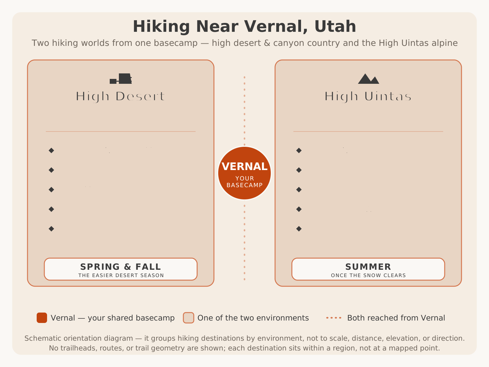
It helps to place these day hikes in the region’s bigger picture. They belong to the alpine half of a two-world hiking region — the cool, high counterpart to the desert trails down near Vernal:
Why Choose a Day Hike
For the overwhelming majority of visitors, a day hike — not a summit attempt, not a multi-day backpacking trip — is the smartest way to experience the High Uintas, and there’s no shame in that. It’s the choice that gets the most people into the most beautiful country with the least risk and the least logistical burden.
Start with what a day hike gives you. You can be picking a trail after breakfast in Vernal, standing beside an alpine lake by late morning, and back to a hot shower and a real dinner by evening — no heavy pack, no permit for an overnight, no gear list the length of your arm, no night out in the cold at altitude. You carry a light daypack, you choose your effort level, and you turn around whenever you like. For a family, a photographer, a weekend traveler, or a national-park visitor extending a trip, that flexibility is the whole point.
A day hike is also the safer introduction to high country. The two hazards that most often catch people out up here — altitude and afternoon thunderstorms — are far easier to manage on a day trip. You gain less elevation, you’re rarely far from the trailhead, and the discipline of “start early, be back down by early afternoon” naturally keeps you off exposed ground when storms build. You get to learn how your body responds to the elevation on a forgiving outing rather than deep in the wilderness.
And crucially, a day hike delivers most of the reward for a fraction of the commitment. The alpine lakes, the wildflower meadows, the cool forest, the dark-sky evenings, the wildlife — none of that is reserved for those who climb the highest peak. Kings Peak is a magnificent objective for the fit, experienced, and prepared, and we’d never talk a qualified hiker out of it — but it is genuinely the wrong choice for most visitors, and choosing a day hike instead isn’t settling. It’s often the better trip.
High Uintas Day Hikes vs Kings Peak
It helps to see the two side by side, because they are genuinely different trips for different people — and for most visitors, the day-hike column is the right one.
| High Uintas Day Hikes | Kings Peak | |
|---|---|---|
| Who it suits | Nearly everyone — families, photographers, weekend visitors, hikers of all levels | Fit, experienced, well-prepared hikers and backpackers only |
| Time required | A few hours to a full day; back to a comfortable base by evening | Typically a multi-day backpacking trip |
| Effort | Your choice — from drive-up strolls to challenging half-day climbs | Strenuous, sustained, at high altitude, carrying a full pack |
| Gear | A light daypack, layers, water, and the day-hike essentials | A complete tested multi-day backcountry and alpine kit |
| Altitude exposure | High, but manageable — you gain less and stay near the trailhead | Above 13,000 ft on the summit ridge; serious acclimatization needed |
| Main reward | Alpine lakes, meadows, forest, and overlooks — most of the beauty, little of the risk | Standing on the highest ground in Utah, earned over days |
| Main risk | Underestimating altitude and afternoon storms | Altitude, weather, remoteness, and fatigue far from help |
Types of High Uintas Hikes
The single most useful thing to understand before you choose a trail is that “a High Uintas day hike” can mean wildly different things — from a five-minute walk to a lakeshore to a lung-busting climb toward a high pass. Matching the type of hike to your group, your time, and your fitness is what separates a great day from a miserable one. Here are the broad types you’ll find, described by character rather than by mileage.
- Drive-up lakes and roadside overlooks. The gentlest option: alpine lakes and scenic viewpoints reachable with little or no walking from where you park along the high mountain roads. Perfect for young children, for anyone with limited mobility, and for a quick taste of the high country between other activities.
- Short lakeside and nature walks. Easy loops and out-and-backs around developed campgrounds and popular lakes — gentle footing, cool air, and a mountain lake to circle or sit beside. Ideal for families, rest days, and acclimating to the altitude.
- Half-day basin day hikes. The classic High Uintas day hike: a trail that climbs from a trailhead through forest and meadow into a lake basin, delivering a big alpine payoff for a morning’s effort. As gentle or as ambitious as you make it — many lead to a lake where you can picnic, fish, and turn around.
- Meadow and wildflower walks. Summer routes through open meadows that fill with wildflowers once the snow clears — high on scenery, modest on effort, and a photographer’s favorite.
- Overlook and ridge hikes. Climbs to high vantage points and passes that open up sweeping views across the basins and peaks. More effort and more exposure to weather, best for stronger hikers who start early.
- Longer, remote day hikes. Ambitious out-and-backs deep toward the high basins — the domain of fit, experienced hikers who want solitude, and the natural training ground for anyone building toward backpacking or a Kings Peak attempt.
| Type | Character | Effort | Best For |
|---|---|---|---|
| Drive-up lakes & overlooks | Scenery with little or no walking | Minimal | Young kids, limited mobility, quick stops |
| Lakeside & nature walks | Gentle loops around lakes and campgrounds | Easy | Families, rest days, altitude acclimation |
| Half-day basin hikes | Climb into a lake basin for a big payoff | Easy to moderate | Most day hikers wanting a real reward |
| Meadow & wildflower walks | Open summer meadows, high scenery-per-effort | Easy to moderate | Photographers, casual walkers, families |
| Overlook & ridge hikes | Climbs to high views and passes | Moderate to strenuous | Stronger hikers who start early |
| Longer remote day hikes | Ambitious routes toward the high basins | Strenuous | Fit, experienced hikers; solitude seekers |
Best Scenic Day Hikes
If your goal is simply to be surrounded by the High Uintas at their most beautiful — and to bring home the photographs to prove it — the range rewards you generously without asking for a summit’s worth of effort. The best scenic day hiking here trades on a few signature landscapes: the alpine lakes and their reflections, the summer meadows, the cool forest, and the open, long-view overlooks that the range’s east–west grain makes possible.
The highest scenery-per-effort comes from the drive-up lakes and short lakeside walks. Because some of the range’s loveliest water sits close to the high mountain roads, you can be standing at a mirror-still alpine lake, high peaks reflected in it, after only a short walk. Circle a lake on an easy loop, find a boulder to sit on, and you’ve experienced the essence of the Uintas without breaking a sweat. These are the hikes to bring skeptical companions on — the ones who think a mountain hike has to hurt.
For a bit more effort and a bigger sense of discovery, the half-day basin hikes climb through spruce and fir into open country where lakes and meadows stack up toward the peaks. The reward builds as you go: forest gives way to meadow, a lake appears, and then another, each framed by rock and sky. And for stronger hikers, the overlook and ridge routes open up the long views — sweeps across whole basins, ranks of peaks, and the broad high tundra that makes the Uintas feel so different from a typical alpine range.
The unifying local instinct for scenic hiking here is timing. The high country is at its most photogenic in the calm, warm light of early morning and evening, when the lakes go still and the low sun rakes across the meadows and rock. Because you’ll want to be off exposed ground before afternoon storms anyway, an early start does double duty — better light and better safety. Combine your hiking with the region’s high scenic driving, too: the alpine byways connect trailheads and overlooks into a full day, and our Red Cloud Loop scenic drive and the broader scenic drives hub are the natural pairing for a hike-and-drive outing.
Best Alpine Lake Hikes
If the High Uintas have a signature, it’s water — the range holds an extraordinary density of alpine lakes, scattered across the high basins like spilled coins, and reaching them is the quintessential Uintas day hike. This is the country to head for if you want a mountain lake to be the goal: somewhere to picnic, to fish, to soak your feet in cold water after a climb, and to sit while the reflections settle.
Alpine-lake day hikes come in every size. At the easy end, some lakes sit close to the high roads and campgrounds, reachable on short, gentle walks that suit families and anyone acclimating to the altitude — you get the full alpine-lake experience for very little effort. In the middle, the classic half-day basin hikes climb from a trailhead into a lake basin, often stringing several lakes together so you can push on to the next one or turn back satisfied at the first. And at the ambitious end, longer routes carry strong hikers deep toward the high basins where the lakes are wildest and the crowds thin to nothing.
A few local instincts make an alpine-lake hike better. Go early, both for the calm, mirror-still water that makes the best photographs and to be off exposed ground before the afternoon storms. Bring layers — even a warm summer day turns cold fast at a shaded, breezy lakeshore at altitude. Carry a way to treat water rather than assuming any source is safe to drink, and never count on finding water where you expect it. And treat the fragile lakeshore gently: stay on durable ground, camp nowhere on a day hike, and pack out everything you bring in.
Here’s how the accessible alpine-lake day hikes compare with the far more serious summit hikes like Kings Peak — a reminder that “alpine hiking in the Uintas” spans an enormous range, and the lakes are where most people belong.
| Alpine Lake Day Hikes | Summit Hikes (e.g. Kings Peak) | |
|---|---|---|
| Goal | Reach a mountain lake or basin | Reach a high, exposed summit |
| Typical effort | Easy to moderate; your choice of distance | Strenuous and sustained at high altitude |
| Time | A few hours to a full day | Usually a multi-day trip |
| Altitude exposure | High, but you can stop and turn back anywhere | Extreme — long stretches on exposed high ground |
| Storm risk | Manageable with an early start; shelter of forest nearby | Severe on an open ridge with no shelter |
| Who it’s for | Families, photographers, and hikers of all levels | Fit, experienced, well-prepared hikers only |
| Reward | Lakes, reflections, fishing, meadows, cool air | The highest point in Utah, earned over days |
Best Family Day Hikes
The High Uintas may be one of the best family-hiking destinations in Utah that nobody talks about, and the reason is simple: the payoff comes cheap. Much of the best scenery — cool air, a mountain lake, wildflowers, maybe a marmot on a rock — is reachable on short, gentle walks, so kids get a real “wow” without a long or steep climb. That’s the recipe for a family hike that ends in delight rather than a meltdown.
The winning family formula up here starts with the drive-up lakes and short lakeside loops. A lake you can reach in a few minutes’ walk gives children everything they want — water to throw pebbles into, a shoreline to explore, a picnic spot — with the shortest possible distance between the car and the reward. Add the easy campground and nature walks for gentle, forgiving footing, and you have a full, low-stress day. Older, fitter kids can take on a half-day basin hike to a higher lake, but keep it well within their limits; altitude turns a “short” hike hard fast for little legs.
A handful of local habits keep a family day in the high country happy and safe. Start early — not only for parking and calm water, but to be back down before the afternoon thunderstorms that build almost daily in summer. Respect the altitude: everyone, kids included, tires faster and can feel headachy or cranky at elevation, so go slow, snack often, and hydrate hard. Pack layers even on a warm morning, because the high country turns cold and windy in a hurry. And keep hikes short with a clear goal — a named lake, a meadow, a bridge — so there’s always something to hike toward.
For older teens who are fit and experienced, the High Uintas can also be the place to catch the backpacking or peak-bagging bug on a well-supervised day hike toward the higher basins — the honest first step toward bigger goals like Kings Peak. But for most families, the smart, joyful move is the easy lakes and meadows. For more kid-focused ideas around the region, see things to do in Vernal, and for the region’s other great family hikes — fossils and a dinosaur trackway — see our guide to the best hikes in Dinosaur National Monument.
Here’s how to size any High Uintas day hike to your group, whether that’s a family with small children or a party of strong adults:
| Family / Easy | Moderate | Challenging | |
|---|---|---|---|
| What it looks like | Drive-up lakes, short lakeside and campground loops | Half-day climbs into a lake basin or meadow | Long routes toward high basins, overlooks, and passes |
| Best for | Young kids, casual walkers, altitude acclimation | Reasonably fit adults and older kids wanting a real payoff | Fit, experienced hikers and those training for bigger goals |
| Effort & footing | Short, gentle, forgiving ground | Sustained climbing, uneven trail, more distance | Long, rough, high; real endurance required |
| Main watch-outs | Altitude, cold, sun; keep it short | Afternoon storms, elevation gain, navigation | Altitude, exposure, weather, distance from help |
| Turn-back rule | Any time — the walk itself is the reward | By early afternoon, before storms build | At a firm, pre-set turnaround time — no exceptions |
Wildlife Viewing
Part of what makes a High Uintas day hike memorable is that you’re walking through genuinely wild country, and you may share it with its residents. The forest and alpine zones are home to a range of wildlife — deer and elk, smaller mammals, and the two little animals that delight hikers most, the marmots that whistle and sun themselves on high boulders and the pikas that dart through the rockslides with mouthfuls of grass. Birds of the high country work the meadows and lakeshores, and moose frequent the range’s wet meadows and willow bottoms. Seeing any of them in this setting is one of the quiet privileges of a day in the mountains.
With that privilege comes responsibility, and a little etiquette keeps both you and the animals safe. Keep a respectful distance from everything, never approach or feed wildlife, and give moose in particular real space — they’re far larger, faster, and more unpredictable than they look, and a cow moose with a calf deserves a wide berth. If you’re picnicking at a lake, keep your food under control and never leave scraps behind; an animal that learns to associate people with food is an animal headed for trouble. Watch for wildlife on the mountain roads at dawn and dusk, when the drive to and from the trailhead can be as much of an encounter as the hike.
The best wildlife viewing rewards the same habits as the best photography: go early or late, move quietly, and simply pay attention. The margins of the day, the edges of meadows, and the quiet lakeshores are where you’re most likely to see something. Bring binoculars if you have them, keep your distance, and let the animals stay wild.
Because specific wildlife guidance, food-storage requirements, and any seasonal advisories are set by the managing agency and can change, VERIFY WITH OFFICIAL SOURCE (Ashley National Forest) for the current wildlife and food-storage rules before your trip. For more on what lives across the region, see our Ashley National Forest guide.
Photography Tips
For photographers, a High Uintas day hike is a gift: it puts you among alpine lakes, wildflower meadows, granite basins, and some of the darkest skies in Utah, and it does it on trails short enough that you can carry real gear and still move well. A few local instincts turn a good day into a portfolio.
- Shoot the golden hours. Dawn and dusk are everything up here. Low, warm light rakes across the meadows and rock and turns the lakes to fire and gold, while flat midday light does the scenery no justice. Because you’ll want an early start for the weather anyway, morning light works in your favor.
- Use the lakes as mirrors. A still alpine lake at dawn, with high country reflected in it, is the signature Uintas image. Get to the shoreline before the wind picks up and the surface breaks — the calm rarely lasts past mid-morning.
- Work the wildflowers. In summer the meadows fill with color once the snow clears; get low and use the flowers as a foreground with the peaks behind. It’s a fleeting, high-payoff window.
- Watch the weather as a subject. Building thunderheads make dramatic photographs — but get yourself off exposed ground before lightning threatens. No image is worth that risk.
- Stay for the stars. Away from any town, a clear, moonless night in the high country delivers extraordinary star and Milky Way photography. If you day-hike to a lake for sunset, plan your descent carefully and carry a good headlamp and layers.
- Tread lightly. The alpine environment is fragile. Stay on durable surfaces, keep off delicate tundra and lakeshore vegetation where you can, and leave every scene exactly as you found it.
The High Uintas are one of the marquee original-photography opportunities in the entire region — the kind of firsthand alpine imagery no competitor and no stock library can replicate. Pack thoughtfully, because camera weight adds up even on a day hike at altitude, and prioritize the shots that only this country can give you.
Preparing for High Elevation
Here’s the single most important thing to understand before a High Uintas day hike, and the one visitors most often underestimate: this is genuine high country, and altitude is the great equalizer. Even the easy day hikes here start high — well above the elevations most visitors live at — so a trail that would feel trivial at home can leave you short of breath, tired, and headachy far sooner than the distance suggests. The range is crowned by Kings Peak at 13,528 feet, and while you needn’t go anywhere near that on a day hike, you’re still hiking in thin air.
Altitude affects people unpredictably, regardless of fitness — a strong sea-level athlete can feel worse than a modest hiker who lives at elevation. The good news is that day hiking makes altitude far easier to manage than a summit or backpacking trip, and a few sensible habits go a long way:
- Arrive a little early if you can. Spending a night at a moderate elevation — in Vernal or at a mountain campground — before a bigger day hike gives your body a head start on adjusting.
- Go slow and pace yourself. Set an easy, sustainable pace, especially on the climbs. There’s no prize for rushing, and a slower pace at altitude is simply smart, not weak.
- Hydrate hard and eat well. Dehydration worsens altitude symptoms, and the dry mountain air pulls moisture from you faster than you notice. Drink steadily and keep snacking even if your appetite fades.
- Know the warning signs. A worsening headache, nausea, dizziness, unusual fatigue, and shortness of breath beyond what the effort explains are the signals to heed. The reliable cure is simple and non-negotiable: descend. If mild symptoms don’t ease with rest, or if they worsen, turn around and go down.
Build a little margin into every plan — a slower pace, an earlier start, and the willingness to cut a hike short — and altitude becomes a factor you manage rather than a hazard that manages you. Because individual response varies so widely, treat acclimatization as part of the plan, not an afterthought, and never push a hiker who’s feeling the elevation.
Weather
Weather in the High Uintas is not a background detail — it’s a headline factor that shapes how you plan every day hike, and the defining pattern is the afternoon thunderstorm. On a typical summer day the morning starts clear and calm; clouds build through midday; and then storms — with lightning, wind, rain, hail, and a sharp temperature drop — sweep the high country in the afternoon. Being caught on an exposed overlook, ridge, or open meadow when lightning is close is one of the most dangerous situations you can be in up here.
That single fact drives the golden rule of High Uintas day hiking: start early and be off exposed ground by early afternoon. Hike in the calm, clear morning, plan to reach your high point or your lake before midday, and be heading down as the clouds build. Set a turnaround time before you start and honor it, even if your goal is close — the lake or the overlook will be there another day. On the easier hikes, the shelter of the forest is rarely far, which is one more reason day hiking is the safer way to experience this country.
Beyond thunderstorms, expect genuinely cold conditions even in high summer — chilly mornings, cold nights, and a fast temperature drop whenever the sun goes behind a cloud or you reach a breezy, shaded lakeshore. The high-elevation sun is intense, so sunburn and dehydration are real even on cool days. Wind picks up above the trees. And because this is high alpine country, snow can fall in any month of the year — a warm July morning can turn to sleet by afternoon.
The practical upshot: check the most current mountain forecast you can find close to your departure, build flexibility into your plans so you can wait out a bad day or swap to a lower, sheltered hike, and always be prepared to turn back. Our Vernal weather guide covers the region’s general month-by-month patterns, but the high country makes its own weather — always seek a specific high-elevation forecast and VERIFY WITH OFFICIAL SOURCE for current conditions before you go.
Seasonal Advice
Timing matters more in the High Uintas than almost anywhere else you might hike near Vernal, because the high country has a genuinely short season. The realistic day-hiking window centers on high summer through early fall — roughly July into September — once the snow has cleared from the high basins and the trailheads and roads are open. Outside that window, deep snow, mud, and closed roads take most of the range off the table for casual day hiking.
Within the season, summer and early fall each offer a distinct experience, and which you prefer comes down to what you value. Summer brings the warmest, most reliable access, the fullest lakes, wildflower meadows, and the longest days — at the cost of the busiest trailheads and near-daily afternoon storms. Early fall trades some of that reliability for cooler air, gold aspens lower down, thinner crowds, and beautifully clear light — at the cost of shorter days and the first risk of an early snow that can close the high country abruptly.
| Summer (roughly July–early September) | Early Fall (roughly September) | |
|---|---|---|
| Access | Fullest and most reliable once the snow has cleared | Usually open early on, but closing as snow returns |
| Temperatures | Warmest window, but still cold mornings and nights | Cooling fast; cold nights and shorter days |
| Scenery | Full lakes, green forest, summer wildflowers, long days | Gold aspens lower down, clear light, quiet lakes |
| Storms | Near-daily afternoon thunderstorms — start early | Fewer daily storms, but bigger, colder systems possible |
| Crowds | The busiest window; the most company on the trail | Thinner crowds and easier trailhead parking |
| Best for | Families on school break, wildflowers, the most reliable access | Photographers and solitude seekers watching the forecast closely |
Early summer can still hold dangerous snow on higher trails and shaded pockets well after the valleys have greened up, which can make routes harder and riskier than the calendar suggests. Late fall and beyond bring the first serious snows, much colder conditions, and short days — pushing hiking toward genuine winter travel. And because the exact window shifts every single year with the snowpack, don’t plan around the calendar alone: VERIFY WITH OFFICIAL SOURCE (Ashley National Forest) for the current snow, trail, and road conditions before you lock in dates. For how the high country fits the region’s year as a whole, see our Ashley National Forest guide and the hiking hub.
Accessibility
The High Uintas are more welcoming to visitors of varying abilities than their rugged reputation suggests, precisely because so much of the best scenery sits close to the high roads. The most accessible experiences are the drive-up lakes, roadside overlooks, and developed areas, where paved or well-graded surfaces and facilities near the parking areas can put real alpine scenery — a mountain lake, a sweeping view, cool air under the spruce — within reach of many visitors with little or no walking. You don’t have to hike deep into the wilderness to feel the grandeur of the range; sometimes a short stroll from the car delivers it.
By contrast, the basin day hikes, overlook climbs, and any longer routes cross uneven, rocky, sometimes steep ground at altitude, and are not uniformly accessible. The high country is remote, its trails are unpaved, and conditions change with the weather and season.
Because specific accessible facilities, trails, day-use areas, and services vary and change over time, VERIFY WITH OFFICIAL SOURCE (Ashley National Forest) for the current accessible options if you have specific needs. Pairing an accessible overlook or lake with one of the region’s scenic drives is often the best way to experience the high country from the comfort of the road — our Ashley National Forest guide points toward the drive-up and low-effort options.
Safety
Every other section of this guide feeds into this one, because a safe High Uintas day hike is mostly a matter of a few disciplines applied consistently. None of them is complicated, and together they turn the high country’s real hazards into manageable factors.
- Respect the weather and start early. Afternoon thunderstorms are the defining hazard. Hike in the morning, plan to be off exposed overlooks, ridges, and open meadows before storms build, and set a turnaround time you’ll actually honor.
- Take altitude seriously. Even easy hikes here start high. Pace yourself, hydrate and eat well, watch for a worsening headache, nausea, or dizziness, and remember that descending is the cure. If it’s getting worse, go down.
- Carry the essentials and dress for range. The weather can swing from warm sun to cold rain or snow within an hour, so pack layers, a rain shell, sun protection, food, and more water than you think you need on every hike — even a short one.
- Don’t count on a phone. Much of the high country has little or no cell service. Carry a map, know roughly where you are, tell someone your plan and expected return, and consider an emergency beacon for longer or remote hikes.
- Treat water and mind your footing. Don’t assume any water source is safe to drink without treating it, and move carefully on the rocky, uneven ground that’s common up here — especially when it’s wet or you’re tired.
- Know your limits and turn back freely. The willingness to cut a hike short — for weather, altitude, time, injury, or just a gut feeling — is the most important safety skill there is. The mountain isn’t going anywhere.
Packing
You don’t need a backpacker’s kit for a High Uintas day hike, but you do need to pack for range — because the high country’s defining conditions (altitude, intense sun, cold, and fast-changing weather) show up whether you’re on a short lakeside loop or a longer basin climb. A light daypack with the right contents is the difference between a comfortable day and a cold, sunburned, dehydrated one.
- More water than you think you need, plus a way to treat more if you run out. Dehydration is common at altitude in the dry mountain air, and you can’t count on finding safe water on the trail.
- Layers and a rain shell. A warm base layer, an insulating mid-layer, and a waterproof shell cover the swing from warm sun to cold wind, rain, or even summer snow. Pack them even on a warm morning.
- Real sun protection. A hat, sunglasses, and sunscreen — the high-elevation sun is intense even on cool or cloudy days.
- Sturdy footwear with grip for rocky, uneven, sometimes wet trails.
- Food and snacks beyond what you think you’ll eat; altitude and cold burn through your energy faster.
- A map and navigation you don’t have to charge, since cell service is unreliable. Don’t rely on your phone alone.
- A small first-aid kit, a headlamp, and emergency essentials — the headlamp matters even on a day hike if a lake sunset or a slow descent runs you into dusk.
Scale the kit up for longer, higher, or more remote hikes, and down for a short drive-up walk — but never skip the water, layers, and sun protection. For a full, season-by-season packing breakdown for the region, see our what to bring guide, and time your trip with the Vernal weather guide.
Planning Tips
Pull it all together into a simple, flexible plan built around the way the High Uintas actually work:
- Choose the hike, then the group — honestly. Match the type of hike to your party’s time, fitness, and experience: drive-up lakes and short loops for families and casual walkers, half-day basin hikes for a real payoff, longer routes only for fit, experienced hikers. The tables above are built for exactly this.
- Start early, every time. An early start buys you calm water and better light, easier parking, and — most importantly — safety, letting you be off exposed ground before the afternoon storms build. It’s the single most valuable habit up here.
- Time it for the summer-to-early-fall window, and verify the snow. The high country’s season is short and shifts every year with the snowpack. VERIFY WITH OFFICIAL SOURCE (Ashley National Forest) for current snow, trail, and road conditions before you commit to dates.
- Plan for altitude and weather. Pace yourself, hydrate, pack layers and sun protection, and build in the flexibility to swap to a lower, sheltered hike — or turn back — when the elevation or the sky says so.
- Base in Vernal and build a full trip. Vernal is the region’s gateway and nearest full-service town for supplies, fuel, and a comfortable night before and after the high country. Pair your day hikes with camping in Ashley National Forest, an alpine scenic drive, some high-country fishing, and the rest of things to do in Vernal. Coming from out of state? See our Salt Lake City to Vernal guide.
- Read the destination guide, and know when the summit calls. For the forest’s full history, geology, lakes, and logistics, pair this planning guide with our Ultimate Guide to Ashley National Forest. And if you’re a fit, experienced, well-prepared hiker who wants more than a day hike, our Kings Peak guide covers Utah’s highest peak — the natural next step once the day hikes have you hungry for the summit.
Hiked with a plan, the High Uintas deliver something rare: genuine alpine wilderness — lakes, meadows, wildlife, and dark skies — within reach of a single, well-timed day from a comfortable base, and open to families and casual walkers, not just the hardcore. Pick the hike that fits your group, start early with plenty of water and layers, respect the altitude and the afternoon sky, verify the details that change, and give yourself time to simply sit by a lake and let the high country do its work. Most visitors will find they’ve experienced the very best of the range without ever attempting its highest peak. And when you want to trade the trail for a guided backcountry adventure closer to town, book a UTV tour with Adventure Tours Vernal and let Dave and Trudy show you the country at the foot of the Uintas.